Foster + Partners have revealed their proposal for the Bilaj Al Jazayer Beach master plan, a new development aiming to introduce a new touristic destination along Bahrain's southwest coast. The 3.5-kilometer beachfront introduces a pedestrian-friendly infrastructure along with a mixed-use district fitted with residential areas, hotels, retail spaces, and public amenities.
The mayor of New York City, Eric Adams, along with the Future of Fifth Partnership, announced plans to transform Fifth Avenue, between Bryant Park and Central Park, into a pedestrian-centered boulevard. The project includes expanding sidewalks by 46%, reducing traffic lanes, improving pedestrian safety with shorter crosswalks, and adding greenery and lighting. The initiative begun with the Future of Fifth public-private partnership, which selected Arcadis, Sam Schwartz Engineering, and Field Operations to lead the design and study, and schematic design, scheduled to be completed by summer 2025.
Rendering of the proposed La Rambla redevelopment project. Image Courtesy of Barcelona City Council, under policy of fair use
La Rambla, a 1.2-kilometer-long promenade in Barcelona, was established in 1766 along the old city walls. Embraced by locals, it became the only spacious area for strolling in a city of narrow streets and grew into a central meeting place for all social classes. Over time, leisure and cultural sites, like the Gran Teatre del Liceu and Boqueria Market, emerged, making it a vibrant, cultural hub. In 2017, Barcelona's local government launched a competition for the revitalization of this beloved urban space. Km_ZERO, a 15-member interdisciplinary team that also relied on the input of community groups was declared the winner. Now the first phase of the urbanization process has been almost completed, led by Lola Domènech and Olga Tarrasó. A hundred trees still remain to be planted in this phase, postponed due to drought conditions. The entire project is expected to be finished in 2027.
There is growing awareness of the importance of developing pedestrian infrastructure. Bridges and elevated structures enhance the quality of cities by connecting spaces and reducing distances. Their use benefits pedestrians and the thousands of cyclists seeking a more sustainable mode of transportation.
Pedestrian infrastructures, such as bridges, walkways, and widened sidewalks, not only promote sustainable mobility but also contribute to the revitalization of urban areas. Their design can transform underused spaces into active, safe, and accessible places for everyone, enhancing social cohesion and fostering community. By incorporating elements such as greenery, smart lighting, and urban furniture, these structures become more than just thoroughfares: they transform into meeting points and spaces for social interaction.
Nowadays bicycles are not only used for sports or as a recreational activity, as more and more people are choosing bicycles as their main means of transportation. Architecture plays a fundamental role in promoting the use of bicycles, as a properly equipped city with safe bicycle lanes, plentiful bicycle parking spots, and open areas to ride freely will encourage people to use their cars much less.
Cities are now positioning themselves as a key promoter of sustainable mobility, and Denmark and the Netherlands are currently the leading countries in the field of architecture for bikes. They are considered a cyclist's paradise because of their excellent infrastructure and architecture, making them a worldwide reference.
About two weeks ago, I received an intriguing email from Jeff Speck, the author of two of the most influential books on urban planning in the past two decades: Suburban Nation (2010; co-authored by Andrés Duany and Elizabeth Plater-Zyberk) and Walkable City (2012; reissued in 2022 with new material). The press release it contained announced the formation of a new partnership, SpeckDempsey, “a new planning and design firm serving government, non-profit, and private clients.” Prior to this, Speck was a potent and highly visible one-man band spreading the gospel of walkable cities. After spending a decade as director of town planning at Duany and Plater-Zyberk’s firm, Speck served as director of design for the National Endowment for the Arts before setting up Speck & Associates in 2007. Now he has joined forces with Chris Dempsey, a Boston-area transportation advocate, with the joint goal of bringing walkable city practices to scale. Last week, I talked to them about their new partnership, their methodology, and their plans for the future.
via Shutterstock | givaga | View on Avenue des Champs Elysses
As the countdown to the XXXIII Olympic Games in Paris ticks away, the city is making preparations that will completely shift its urban landscape and infrastructure. Set to be the largest event ever organized in France, the games will start on 26 July and continue till 11 August 2024. With only 200 days left, the Paris City Council has approved around 43 new initiatives acting as a catalyst for the city's transformation – aiming for a greener, healthier, and mobile Paris. From cleaning the Seine River to building a cycling lane, activating a transit line, and banning non-essential city traffic, the heart of the French capital is on a mission against time to revitalize its historic urban core.
In a city, celebrating the act of walking has become a form of non-traditional planning. In the age of cars, challenging the dominance of vehicular transportation by championing the pedestrian experience is not very common. For this reason, pedestrian bridges worldwide stand as symbols of connectivity and architectural ingenuity. These soaring structures embody the urban experience for its core user: the pedestrian. Although the structures began as practical solutions to traffic management, they have evolved into iconic landmarks and pivotal components of city planning.
The significance of these projects represents a shift towards human-centric design in urban landscapes. The Kusugibashi Bridge in Japan, rebuilt by Kengo Kuma & Associates symbolizes resilience, while the Hangzhou Riverfront Public Space’s Silk Bridge showcases urban connectivity through revitalizing the waterfront. The Donnguan Central Area Slow-Traffic Bridge addresses connectivity and greenery, and SBE NV’s Vlasburg Bridge dedicates itself to enhanced water routes for the community. Collectively, these bridges drive urban revitalization into the future, emphasizing sustainability and integrating with community needs.
In midtown Manhattan, the street crossings surrounding the entrance to the Lincoln Tunnel were once some of the most challenging in the city. A mess of highway ramps, missing sidewalks, and concrete barriers made the corner of Dyer Avenue and 30th Street an area to avoid.
Now with a new $50 million elevated connector, pedestrians can safely move 30 feet above the intersections using a 600-foot-long L-shaped bridge from the High Line to Moynihan Train Hall.
African cities are expected to experience a significant increase in population over the next 30 years. According to United Nations projections, these cities will welcome an additional 900 million inhabitants by 2050. This demographic shift will create both opportunities and challenges that will reshape the nature and structure of these cities. These challenges include the need for economic growth, increased demand for housing and infrastructure, and the development of supplementary transportation systems. So far, most African cities have responded to this rapid population growth with sprawling horizontal development patterns that expand the fringes of the city, increase social fragmentation, and ultimately lead to greater car dependency.
Designed by URB, The LOOP is a 93-kilometer-long sustainable highway that aims to encourage Dubai’s residents to opt for a healthy mode of transportation. The structure provides a climate-controlled all-year environment to make walking and cycling the preferred type of transportation in the city. The initiative aligns with Dubai’s 20-minute city initiative, which hopes to see 80% of Dubai’s residents commute to work by walking or cycling. The project is currently in the research and development phase.
Paris has been making headlines for years with its aggressive steps to anti-car, pro-pedestrian urban improvements. Faced with increasing issues around air pollution and an attempt to reclaim streets for alternate modes of transit, as outlined in their proposed plan for a 15-minute city, the French capital is seen as a leader in future-forward urbanist strategies. Recently, their department of transportation set a deadline for their lofty goals of eliminating traffic from its roads. In just two years from now, in time for the French capital to host the Olympics, Paris plans to ban non-essential traffic from its city center, effectively eliminating around 50% of vehicular mobility. What does this plan look like? And how might other cities use this strategy to eliminate their own urban issues?
As the city continues to evolve and transform, dead edges in the cityscape begin to emerge, subsequently reducing the level of activity in our built environment. These 'dead edges' refer to the areas that lack active engagement, they remain empty and deprived of people, since they no longer present themselves as useful or appealing. As the Covid-19 pandemic draws to an ultimate close, the first issue we may face post-pandemic is to revive our urban environment. A kiss of life into a tired and outdated cityscape...
The focal element in creating an active and healthy urban environment is by increasing vitality through placemaking. Creating diverse and interesting places to reside, thrive, and work. Here are five regenerative strategies that animate the cityscape and ultimately produce resilient, attractive, and flexible environments.
Over the last century, cars have been the dominant element when designing cities and towns. Driving lanes, lane expansions, parking garages, and surface lots have been utilized as we continue our heavy reliance on cars, leaving urban planners to devise creative ways to make city streets safe for pedestrians and cyclists alike. But many cities, especially a handful in Europe, have become blueprints for forward-thinking ideologies on how to design new spaces to become car-free and rethink streets to make them pedestrian-friendly. Are we experiencing the slow death of cars in urban cores around the world in favor of those who prefer to walk or ride bikes? And if so, how can it be done on a larger scale?
Designed by 3XN, in partnership with GXN, 2 Finsbury Avenue is a 12 story podium with a 35-story East Tower and 20-story West Tower. Located at Broadgate campus, the largest pedestrianized neighborhood in Central London, adjacent to the busy transport hub of Liverpool Street station, the firm’s first project in the city is part of a bigger vision to transform the area into a new mixed-use destination.
"Les Jumeaux" or The Twins is a new large-scale public urban intervention by French artist and designer Camille Walala in White City, West London. The project encompasses two pedestrian crossings and seven striking murals, created with geometric patterns and primary colors, Walala’s signature style. Moreover, Camille Walala also unveiled this month her East London intervention, a giant work of art aiming to breathe new life into the street and boost the local economy, entitled "Walala Parade".
Mind the Step - Jardim Nakamura, São Paulo, Brazil. Image Courtesy of UN-Habitat
The Un-Habitat or the United Nations agency for human settlements and sustainable urban development, whose primary focus is to deal with the challenges of rapid urbanization, has been developing innovative approaches in the urban design field, centered on the active participation of the community. ArchDaily has teamed up with UN-Habitat to bring you weekly news, article, and interviews that highlight this work, with content straight from the source, developed by our editors.
Discover in this feature the first lesson to learn from UN-Habitat, on how to design with and for the people. In order to create great public spaces, the only secret is listening to the community. Questioning “how can we design together”, this article presents cases in Ghana, Brazil, and India, focusing on street, market, and open public spaces implementation projects, where interventions took on participatory approaches and involved local residents from the beginning of the process.
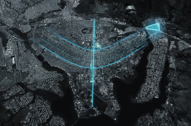
CRA - Carlo Ratti Associati has unveiled a major extension for Brazilia, reinterpreting “Lúcio Costa and Oscar Niemeyer’s modernist master plan for Biotic - a high-tech innovation district immersed in nature”. Developed in collaboration with Ernst&Young, the project that started in 2018 reimagines primarily the superblocks.


.jpg?1488209274&format=webp&width=640&height=580)


.jpg?1488209274 "© Jesús Granada")
.jpg?1488209274)


__by_Camille_Walala__in_White_City_Place__London_2020_Photography_Charles_Emerson_HighRes_004.jpg?1597595156 "Les Jumeaux. Image Courtesy of Camille Walala")

__by_Camille_Walala__in_White_City_Place__London_2020_Photography_Charles_Emerson_HighRes_002.jpg?1597595028 "Les Jumeaux. Image Courtesy of Camille Walala")