In a piece, originally published on Metropolis, author Lauren Gallow highlights an urban transformation in California, led by a group of local organizations and designers. The project "replaces a previously hazardous alley with play areas, public art, and native plantings", in order to reveal the untapped potential of the overlooked public realm.
The human scale spans both physical dimensions and sensory perception. Designers create spaces and objects like steps, doorways and chairs that are closely aligned to human measurement and how we see the world. But as we look beyond the human scale, new ideas and typologies emerge that help us rethink how we conceptualize architecture and build for the future.
Auckland in New Zealand has topped the ranking in the 2021 EIU's annual world's most liveable city survey. Classifying 140 cities across five categories including stability, healthcare, culture and environment, education, and infrastructure, this year’s edition of the review has been highly affected by the global pandemic. Australia, Japan, and New Zealand took leading positions, while European and Canadian cities fell down the ranking.
The City Prosperity Index, CPI, set by UN-Habitat, evaluates urban prosperity according to five parameters as productivity, infrastructure development, environmental sustainability, quality of life, and equity/social inclusion. To a greater or lesser extent, these five factors are represented in the street pattern of every city in the world. Streets have multiple functions as the mobility of people and goods, the supply of energy, water, and information, the collection of waste, the growth of trees, plants, insects or birds, the shadow and sun radiation, the bench where to sit, the place to salute and talk with your neighbors, a playground, or the access to the bakery where you buy the bread. In this sense, streets are public and vibrant spaces, which can perform multiple functions and activities.
Sagamihara, Japan. Drone photo by Rob Antill (@digitalanthill) and Ben Steensls (@randomoperator)
We live in a tangled web of flows – of capital, information, technology, images, structures, in constant momentum dominating all aspects of our lives. The large-scale road infrastructures shown here are products of this powerful desire for movement, which for many years was also synonymous with development, as portrayed by the famous Goethean character Faust in his endless quest for a (false) sense of progress.
From these tangles of concrete and steel, at multiple levels and in different directions, emerges a geometrically organized chaos that tears the urban fabrics in a relentless effort to prioritize the flows with the fewest obstacles and the highest capacity possible.
Urban infrastructures provide comfort to inhabitants and mitigate the risks of disasters such as flooding. Underground systems specifically conceal urban infrastructures from public view and are configured as real mazes under the streets. The distribution of drinking water, urban drainage, sewage, and even electrical wiring and fiber optics in some cases, pass under our feet without us noticing. To this end, the industry developed precast concrete parts for about 100 years that provided construction speed, adequate resistance to force, and durability against time. Concrete pipes with circular sections, in many diverse diameters, are perhaps the most used conduits and are ubiquitous around the world. But there are also those who use these apparently functional elements in creative architectural contexts as well.
I am a relative newcomer to the Midwest, and of all the things that have captured my enduring attention, one of them is water towers. In my adopted home state, Minnesota, they are everywhere. These top-heavy engineering marvels rise to well over 150 feet tall and assume all manner of shape and metallurgical prowess, from the pedesphere and fluted column structures, colloquially known as the “golf ball-on-a-tee” and “flashlight,” respectively, to the multicolumned spheroid and ellipsoid tanks that, as legend has it, were the targets of frantic gunfire during Orson Welles’ broadcast of “War of the Worlds.” I can attest that when the day’s twilight settles in, those multilegged towers—or, rather, their silhouettes—can appear otherworldly.
https://www.archdaily.com/952627/water-towers-iconic-infrastructure-underutilized-opportunityJustin R. Wolf
The world’s longest immersed road and rail tunnel design, the Fehmarnbelt link gets a go-ahead. The 18 km infrastructure, the longest of its kind, connecting Denmark’s Lolland Falster region with Germany’s Schleswig Holstein region across the Baltic Sea will shorten the journey between both countries to just 10 minutes by car and seven minutes by train.
Our cities, vulnerable by nature and design, have generated the biggest challenge that humankind has to face. With the vast majority of the population expected to settle in urban agglomerations, rapid urbanization is going to raise the issue of adaptability with future social, environmental, technological and economic transformations.
In fact, the main problematic of the decade questions how our cities will cope with fast-changing factors. It also looks into the main aspects to consider in order to ensure long-term growth. In this article, we highlight major points that help future-proof our cities and create a livable, inclusive and competitive fabric that adapts to any unexpected future transformation.
Space-saving fully automate parking solutions buy U-tron. 50% reduced parking footprint and superior user experience. Image Courtesy of U-tron Parking
As ride-sharing services grow and personal ownership of automobiles declines, office building owners and developers are re-thinking the value of parking structures, and their capacity and ability to convert. As part of the total transformation of One Post Office Square (OPOS), located in the heart of Boston's financial district and designed by Gensler, a new automated parking garage will optimize the use of valuable leasable space, enhance the user experience and create long term flexibility.
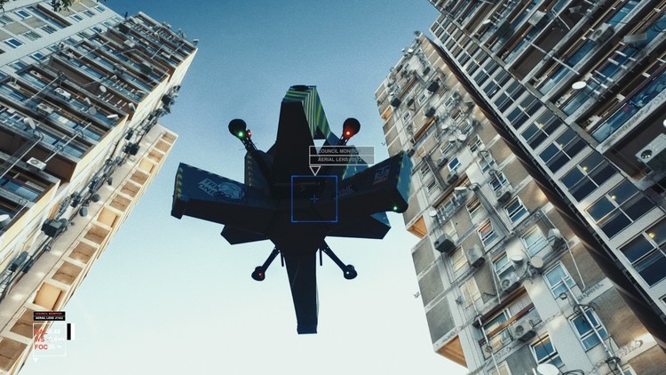
MVRDV in collaboration with Airbus, Bauhaus Luftfahrt, ETH Zurich, and Systra, is developing a plan for the future of Urban Air Mobility (UAM). The investigation tackles the integration of “flying vehicles” into our urban environments and envisions a comprehensive mobility concept.
The ‘interstitial volumes’ that lie beneath the central esplanade, interlocked with underground infrastructures.
Paris La Défense is seeking to vitalise the ‘interstitial volumes’ that lie beneath its central esplanade, interlocked with underground infrastructures. Located at the heart of La Défense, those spaces are very close to public transport and offer high potential due to their distinctive size and morphology. The aim is to use them to develop a new offering of activities accessible to the public – and see a lively and unusual destination emerge as a result. Paris La Défense, as the urban planner, developer and manager of the business district, is launching a competitive dialogue process. The purpose to this
The “Restricted Areas” photography set distills humanity’s strive to perfection through recording abandoned Soviet infrastructure. Traveling to now-deserted landscapes which once held great importance as centers of technological progress, Tkachenko captured images of “forgotten scientific triumphs, abandoned buildings of almost inhuman complexity” and a “technocratic future that never came.”


JannesLinders.jpg?1432094933)
JannesLinders.jpg?1432095050 "© Jannes Linders")
JannesLinders.jpg?1432094882 "© Jannes Linders")
JannesLinders.jpg?1432095109 "© Jannes Linders")
JannesLinders.jpg?1432094933 "© Jannes Linders")
JannesLinders.jpg?1432094933)


