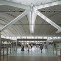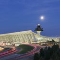
A public event will be held to kick off World Space Week at AIA Houston on the evening of Thursday, Oct 4 as part of the AERIAL FUTURES: The Next Frontier think tank taking place in Houston between Oct 4-5, 2018.
A public event will be held to kick off World Space Week at AIA Houston on the evening of Thursday, Oct 4 as part of the AERIAL FUTURES: The Next Frontier think tank taking place in Houston between Oct 4-5, 2018.
The AIANY + ASLANY Transportation + Infrastructure Design Excellence Awards recognize exceptional design by New York, New Jersey, Connecticut, and Pennsylvania AIA and ASLA members. The awards program is open to registered architects, landscape architects, and planners.
.jpg?1529322837&format=webp&width=640&height=580)
UNStudio has released images of its design for IJbaan, a green, future-proof cable car linking West and North Amsterdam. The result of a crowdfunding campaign started by founders Bas Dekker and Willem Wessels in 2015, the project is to be implemented by 2025, marking the city's 750th anniversary. The “all electric” transport scheme forms part of Amsterdam’s ambition to be a European center for urban innovation, integrating forward-thinking technology with existing public transport modalities.
Stretching over one mile (1.5 kilometers), the cable car links the two thriving residential districts of Amsterdam-West and Amsterdam-Noord through a system of three slender pylons and two stations. The cable car has been designed to accommodate a future third station depending on the pattern of growth for surrounding districts.

A Need for 21st Century Airport Design
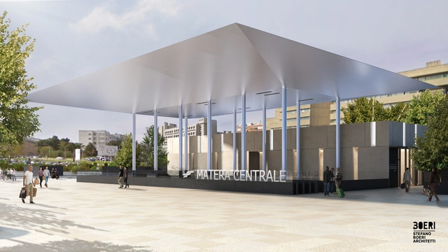
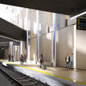
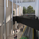
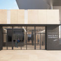
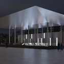
Stefano Boeri Architetti has released images of their proposed renovation of Matera Central Station in Southern Italy. Matera Central FAL railway station will be structurally altered through an “aesthetic and functional redevelopment together with technological upgrading of the railway itself.”
The proposal seeks to alter the existing hierarchy of space in the city by making the transport hub a genuine and significant urban landmark, rather than simply an infrastructural node. The scheme is therefore designed to incorporate a recognizable, pedestrianized public square, forming connections with the nearby historic city center.
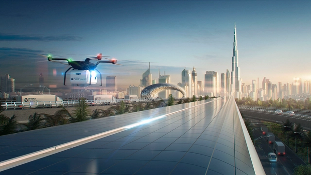
Foster + Partners has released a video depicting their vision for a future high-speed transportation infrastructure, taking advantage of recent advances in hyperloop technology. Designed for DP World Cargospeed, a collaboration between cargo giant DP World and Virgin Hyperloop One, Foster + Partners’ vision for an infrastructural network seeks to create a new ecosystem where urban centers and rural landscapes are interconnected, as are humans and nature.
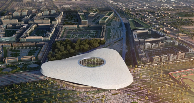
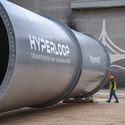
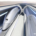
Hyperloop Transportation Technologies (HyperloopTT) has released details of their plan to create the world’s first commercial Hyperloop system in Abu Dhabi. Situated on the border between Abu Dhabi and Dubai, in close proximity to both the Al Maktoum International Airport and Expo 2020 Dubai site, the HyperloopTT will begin with the construction of six miles (ten kilometers) of infrastructure, with future development potentially creating a commercial Hyperloop network across the United Arab Emirates and beyond.
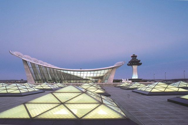
Airport design is both an art and a science: the best terminals are not only functional, but also beautiful and awe-inspiring spaces. Millions of people pass through these terminals every day, yet few understand their inner workings as well as Roger Duffy and Derek A.R. Moore—design leaders at SOM who have conceptualized some of the most ambitious aviation projects around the world, including Terminal 2 at Chhatrapati Shivaji International Airport in Mumbai. In this interview, Moore, a Director, and Duffy, a Design Partner, reflect on the complicated challenges of airport design, and how these constraints can fuel creative solutions.
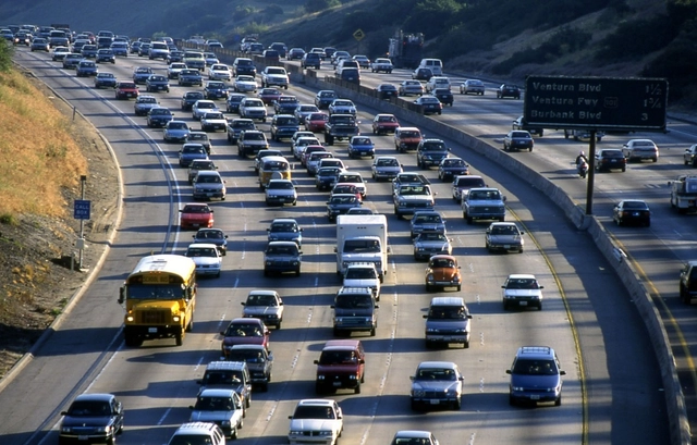
Despite being heralded as services that will reduce congestion on our streets, ride-hailing companies like Uber and Lyft actually are making traffic problems worse, a new study from Boston’s Northeastern University has revealed.
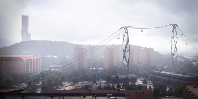
UNStudio has won a competition to design a new, 3-kilometer long cable car in the Swedish city of Gothenburg. The cable car's route, which will connect the old city on the south of the river with three locations to the north, will feature a total of six towers which have been designed around an adaptable, asymmetrical structural system intended to mimic the cranes in the city's shipyards. The expected opening date for the cable car is in 2021, with the new transportation system being inaugurated as part of the celebrations of Gothenburg's 400th anniversary.

Metro and subway maps can tell us a lot about cities. For example, by comparing metro maps from different cities, you might be able to understand those cities' relative size or level of development. Or, by comparing a metro map to an earlier version from the same city, you can learn about the pace of development being experienced in that city. What these "maps" rarely tell you with any reliability, though, is the actual geography of the city itself.
In a fascinating series of posts over at /r/dataisbeautiful earlier this year, Reddit users created GIFs comparing the official metro maps of cities around the world with the real geography those maps correspond to. The results show the incredible changes that cities are subjected to in the name of visual clarity: in cities such as London, Tokyo, and Berlin, transit maps expand the urban core, masking the density at these regions' centers; in other cities such as Washington DC, shortened lines hide the extent of the city's suburbs; while in some cities, entire neighborhoods are moved to the other side of the city to make the map layout more attractive (we're looking at you, Prague). Read on to see 11 of the best creations by Reddit users.
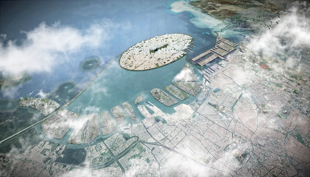
Due to rapid population and economic growth, Indonesia is facing issues such as land subsidence and rising sea levels. To combat these problems and more, SHAU Architects created a master plan for the Jakarta Jaya Foundation focused on large-scale land reclamation to integrate green space. By addressing impending challenges, SHAU Architects proposal, Jakarta Jaya: the Green Manhattan, won a Smart Cities prize at the World Architecture Festival 2017.
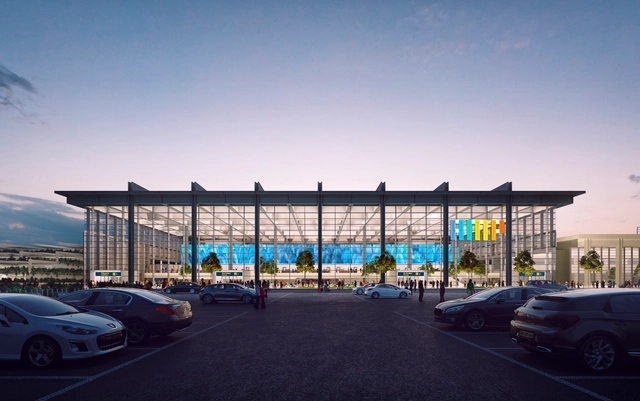
Foster + Partners has won the competition to design a new extension to Marseille Airport that will allow the building to process up to 12 million passengers a year. The 2-phase design will add a new central pavilion to the existing building—which comprises the original 1960s structure designed by Fernand Pouillon, and a 1992 extension by Richard Rogers—and a new pier to provide access to the planes.
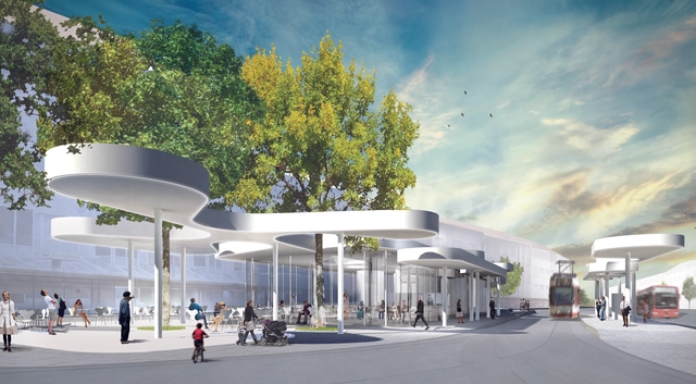
J. MAYER H., in partnership with Architekten, celebrated the groundbreaking ceremony for their competition-winning Pavillon am Ring Project in Freiburg, Germany. Located at the edge of Freiburg’s historic district, this new tram stop will feature a café and dynamic roof structure.

Aerial Futures: Leading Edge is lively, provocative and interdisciplinary symposium examining the architecture, technologies and cultures of the contemporary airport. Curated by PLANE—SITE and free to attend, this two-day event understands the airport as a choreographed topography of hypermobility, information and cultures, defining how we travel, trade and connect with each other. It marks the threshold between land and sky, as well as sovereign territories. The airport — what the philosopher Giorgio Agamben describes as a ‘zone of exception’ where the ordinary rules no longer apply — is where the definitive issues of the 21st century play out.
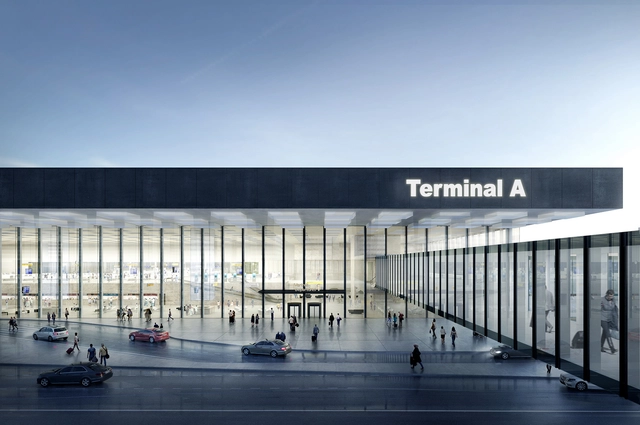
Netherlands-based architectural firm KAAN Architecten, in partnership with ABT, Estudio Lamela and Ineco has been selected to design the new Amsterdam Airport Schiphol Terminal, with the help of Arnout Meijer Studio, DGMR and Planeground. Soon to be located south of Schiphol Plaza, at Jan Dellaert Plein, the new 100,500-square-metre terminal will implement futuristic and sustainable design trends.
A new train station in Cambridge is getting a lot of attention from a surprising audience: mathematicians. Cambridge North Station is clad in aluminum panels with a geometrical cutout design. The architecture firm, Atkins, originally claimed that the pattern was derived from Cambridge alumnus John Conway’s “Game of Life,” but eagle-eyed mathematicians soon realized that was incorrect. As the above video points out, the design is in fact based on a mathematical rule studied by Stephen Wolfram, an Oxford alumnus, much to the dismay of rival university Cambridge. Though the firm’s website still references Conway, a Senior Architectural Designer at Atkins, Quintin Doyle, has since confirmed that it was, in fact, Wolfram’s Rule 30 that they used in the design.
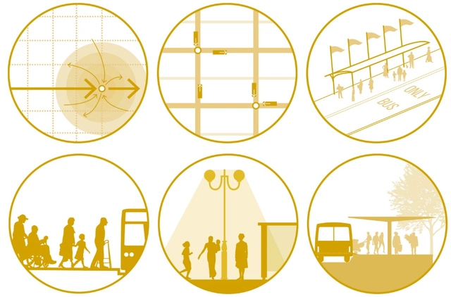
Designing urban spaces to improve mobility for all inhabitants is one of the main objectives of NACTO, the National Association of City Transportation Officials. Founded in 1996, this non-profit organization brings together more than 40 US and Canadian cities to share their advice and design practices seeking to raise the design standards in public policies for public spaces, mobility, and transportation.
They’ve developed a series of guides in which they propose design guidelines to make streets, cycle paths, intersections and other urban spaces more accessible and safe for all road users. One of the most recent is the "Transit Street Design Guide" in which they offer, among other things, 6 recommendations to take into account when designing bus stops. Find out what these recommendations are below.
.jpg?1529322827 "Courtesy of Plompmozes")
.jpg?1529322882 "Courtesy of Plompmozes")
.jpg?1529322837 "Courtesy of Plompmozes")
.jpg?1529322845 "Courtesy of Plompmozes")
.jpg?1529322837)