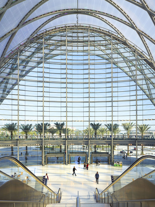
-
Architects: Nefa Architects
- Area: 22500 m²
- Year: 2015
-
Manufacturers: Holcim, Tacchini

The Burj Khalifa might get all the headlines today, but for nearly half a century before it was built, some of the tallest structures in the world were actually in North Dakota, in the form of TV masts. In this post originally published by re:form on Medium, Casey Tolan investigates the threatened industry that once gave the world some of its most heroic structures.
Name the tallest structures in the world. Maybe flashy skyscrapers in China or the Gulf States come to mind. Or maybe you’re thinking of U.S. icons like One World Trade Center in New York or the Willis Tower in Chicago.
You’re almost certainly not thinking of TV towers. But dozens of nearly anonymous towers around the United States, most in small rural communities, dwarf all but the tallest man-made structures in the world.

As the location of the world's largest single-purpose gathering of people, the 2013 Kumbh Mela obviously required a significant organizational effort from those charged with planning it - but what is less obvious is exactly how this need to plan can be squared with the nature of the Kumbh Mela itself. Located in the floodplain of the river Ganges, most of the 23.5-square-kilometer area of the festival (commonly referred to as the nagri) remains underwater until a few months before the festival, and organization is at every stage challenged by the uncertainty and ephemerality of the festival itself. In this excerpt from the recently published book, "Kumbh Mela, January 2013: Mapping the Ephemeral Mega City," Rahul Mehrotra, Chair of the Department of Urban Planning and Design at the Harvard GSD, and Felipe Vera, Co-director of the Center for Ecology, Landscape and Urbanism at UAI DesignLab, explain how infrastructure and street grids are deployed in a way that not only enables the Kumbh Mela festival itself, but enhances its ephemeral and democratic spirit.
Deployment Process
Standing at the Kumbh Mela at night looking towards an endless functioning city where the temporary construction of the nagri is fused with the city of Allahabad, there are two things that one cannot avoid asking: 1) How was this enormous city planned in terms of scale and complexity? 2) How is the city actually constructed? One of the most interesting elements about the construction process of the city is that unlike more static and permanent cities—where the whole is comprised of the aggregations of smaller parts, constructed in different moments that are tied together by pre-existing and connecting urban infrastructure—the city of the Kumbh Mela is planned and built all at once, as a unitary effort.
.jpg?1429623147&format=webp&width=640&height=580)
Among the many complex interactions between humans and water in the Ganges river basin, perhaps none is more awe-inspiring than the religious festival of Kumbh Mela, which every twelve years hosts the largest single-purpose gathering of people on the planet, with an estimated 2 million temporary residents and 100 million total visitors in 2013. In the following excerpt from his book "Ganges Water Machine: Designing New India's Ancient River," Anthony Acciavatti recounts the history of this spectacular event, as well as the smaller annual Magh Mela - and explains why even though it is temporary, the huge tent settlement that supports these festivals is not the "instant city" it is often described as, but instead a microcosm of settlement patterns across the whole Ganges.
Dangling at the tip of the Ganga-Jamuna Doab, where the Lower Ganges Canal system terminates, the city of Allahabad overlooks the confluence of the Ganges and Jamuna rivers. While the Jamuna, to the south of the city, runs deep and narrow, the Ganges, to the north and east of the city, runs shallow and wide. Where these two rivers meet (and a third mythical river, the Saraswati), is known as the Triveni or Sangam, the most sacred site within Hinduism.
Every twelfth year, the sleepy university city of Allahabad is transformed into a colossal tent city populated by millions of pilgrims for the Kumbh Mela (literally Pitcher Celebration). And it all seems to happen so fast. After the deluge of the southwest monsoon (June-August), the waters of the Ganges and Jamuna slowly start to recede. A city grid is tattooed into the banks and shoals of the Ganges. Tents and temples pop up in October. Pontoon bridges stretch from one bank of the river to the other and pilgrims begin to arrive in January. Then come reporters and camera crews from all over the world, who come to document the life of what must at first appear to be the world’s largest Instant-Mega-City: a temporary tent city with the major infrastructure of a metropolis.


C.F. Møller has unveiled designs for Denmark's largest sewage pumping station. Planned to be built on Copenhagen's Kløvermarken, the new building will serve as an independent counterpart to the site's historic 1901 pumping station, originally designed by city architect Ludvig Fenger.
According to the architects, the brick station aims to "set new standards for large-scale sustainable utilities in Danish cities," while "closely integrating itself into the dense urban context." It will be built as a circular structure - the optimal shape of an underground pumping well - and feature two rainwater harvesting green roofs, a distinctive set of 24 meter-tall pressure towers, and two recreational "gardens" for employees.

Few geographies in the world nurture such a rich and complex imaginary as the Ganges River Valley. The heart of Indian Culture, and home to over one quarter of India’s population, the Ganges is one of the most fertile and infrastructure-heavy river valleys in the planet. Its many physical, historical and spiritual natures defy a single interpretation: always in flux, source of life and destruction, and venerated as a Hindu Deity, the Ganges fully embodies the complexities and excesses of the Indian Civilization.
In “Ganges Water Machine: Designing New India’s Ancient River,” Anthony Acciavatti orchestrates a magnificent portrait of the Ganges River Basin, and its continuous reinvention as a test-bed for infrastructural innovation. Through the hybrid genre of the Atlas-Almanac-Travelogue, the book unfolds the many nested spatial and temporal scales that characterize this highly contested territory. Those captivated with the planetary urbanization of water will find in this book a timely and relevant volume of encyclopedic ambition and exquisite design.

As cities worldwide are plagued with increasingly congested streets, more people are turning to bicycles to ease their commute. To accommodate the trend, bike lanes have been popping up around cities, yet often in a disjointed manner. A series of maps compiled by the Washington Post illustrates this surprisingly sporadic cycle infrastructure in several US cities.
Cropping up as afterthoughts in the existing urban fabric, many US bicycle networks consist of fragmented stretches of bike lanes and “sharrows” (shared car and bike lanes) loosely bound together by their proximity. In the case of Washington D.C., most of these are under a mile in length. A lack of cohesion and continuity leads to commuter chaos, forcing cyclists onto unprotected shoulders or into traffic when their designated lanes pull a disappearing act. Take a look at the maps after the break.


Six years after the original announcement of the project, the first phase of Mecanoo's new Train Station and City Hall complex in Delft, The Netherlands, has been opened to the public. Within the new station hall an undulating 'vault', which has been designed to evoke an "unforgettable arrival experience", features a scaled 1877 map of the Dutch city rendered in blue and white. Columns wrapped in a mosaic of Delft-blue titles, also reminiscent of the colours of Delftware, one of the city's most famous global exports. The station platforms below ground have been designed by Benthem Crouwel, the Dutch practice behind Rotterdam Centraal Station.

Swiss firm HHF Architects have released images and drawings for "Parking & More," a mixed-use structure and public facility for Basel's Dreispitz quarter.
An addition to an existing steel parking complex, "Parking & More" combines a parking lot with eateries, sport facilities, and shops, "creating a vibrant and lively street and a partially covered urban plaza." The project is adjacent to BIG's Transitlager ad Herzog & de Meuron's 312 Helsinki Dreispitz, forming a triumvirate of new developments that reflect the area's rapid rates of densification and urbanisation. Read more about "Parking & More" and view selected images after the break.

Arup have released a new image of the proposed copper-nickel alloy cladding that will adorn Heatherwick Studio's Garden Bridge in London. According to a report by the Architects' Journal, the "concrete structure will be coated in 'cupro-nickel', from its feet on the riverbed up to the base of the balustrades on the bridge deck." The copper will be donated from Glencore, a multi-national mining company, forming "a protective skin to the carbon steel structure giving it a maintenance free 120-year life, protecting the bridge from river and environmental corrosion." More than 240 tonnes of the metal alloy, which often finds use in medical equipment and ship propellers, will be used.


.jpg?1428637575&format=webp&width=640&height=580)
.jpg?1428637461 "© João Soares")
.jpg?1428637315 "© João Soares")
.jpg?1428637847 "© João Soares")
.jpg?1428637649 "© João Soares")
.jpg?1428637575)