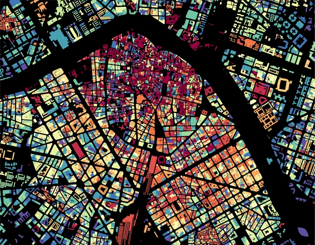


In the field of urban planning, data collection and management have ushered in a new era in the analysis of urban form, unlocking new resources to understand, evaluate, monitor, and manage the development and evolution of cities. Many countries offer open access to their catalogs and datasets with up-to-date information on their cities, allowing anyone in the world to access records with data on the built environment. Since visual culture has prevailed as a means of interpretation and communication in urban planning, translating this data into graphics and synthesizing the information into visual maps is a task that has been widely embraced by cartographers, urban planners, and architects.


















.gif?1621900204)











.jpg?1621796850&format=webp&width=640&height=580)
.jpg?1621796702 "Courtesy of Reutov Dmitry, Gerner Ekaterina")
.jpg?1621796703 "Courtesy of Reutov Dmitry, Gerner Ekaterina")
.jpg?1621796877 "Courtesy of Reutov Dmitry, Gerner Ekaterina")
.jpg?1621796840 "Courtesy of Reutov Dmitry, Gerner Ekaterina")
.jpg?1621796850)