Via macacovelho.com.br. ImageVilla 31, Buenos Aires - Argentina
It is said that the world is increasingly developed when in fact it is, undeniably, more technological and globalized. However, it seems risky to talk about development when the advances do not appear everywhere or for all inhabitants.
In such an uneven picture, a select few of the global population enjoy these advances, while a huge number live below the poverty line.
Such contrasts often go unnoticed in the city's daily life, however, are set forth on a diptych relationship with the urban layout, being, at the same time the cause and consequence of deep marks in city design. In Brazil, for example, we have the slums and poor communities that contrast with the buildings and upper-middle-class homes architecture, designed and built with all the necessary resources.
Ideasforward wants to give young creative people from around the world the opportunity to express their views on the future of societies through their innovative and visionary proposals. We are an experimental platform seeking progressive ideas that reflect on emerging themes.
Architecture, as both a profession and the built environment, currently finds itself at a crossroads in trying to adapt to a world in constant flux. Cities and its people face continuous socio-economic, political and environmental change on a daily basis, prompting a necessary rethink in the evolution of sustainableurbanization. With a focus on housing, society and cultural heritage, RIBA’s International Conference, Change in the City, aims to offer insight into the “New Urban Agenda” and how architects can play an interdisciplinary role in future urban development.
Speaking in an interview ahead of the conference, Norman Foster is a strong advocate for a careful consideration of what aspects of urban life need to be prioritized when designing cities of the future. For an increasingly global society, Foster stresses the need for architecture to surpass buildings and tackle its greatest obstacle – global warming, honing in on its roots and factors involved to create viable urban solutions.
https://www.archdaily.com/875169/norman-foster-stresses-the-importance-of-interdisciplinary-architecture-in-creating-future-citiesOsman Bari
“The world’s most sustainable eco-city,”Masdar City, is preparing for its next phase of development, as unveiled in the award-winning detailed master plan (DMP) by CBT. Depicted in a comprehensive masterplan by Foster + Partners, Masdar was originally envisioned as a carbon-neutral elevated city without cars, instead featuring pod-based transportation located below the podium. As the first phase was constructed, including the Masdar Institute of Technology, a new vision for the city began to emerge, eventually leading to CBT’s pedestrian-oriented innovation community plan for Phase 2.
Early in the 19th century, an invention arrived that would change the form and function of cities for generations.
Like all new technologies, it started out rudimentary, expensive, and nearly ineffectual. But it caught many imaginations and developed dramatically, eventually reaching the point of mass accessibility. Soon enough, it took aim at the public realm, with consequences that were indirect and unintended yet profound.
It reconfigured streets. It influenced the height of buildings. It altered foot traffic. It recast the relationship between buildings and streets. It changed how people felt about their cities and changed their points of reference. It turned cities into abstractions and, in some ways, turned city-dwellers against each other. Its influence nearly complete by the close of World War I, the invention has remained fundamentally unchanged, and is still universally celebrated, to this day.
For the past fifteen years, global headlines have depicted, through harrowing imagery, the effects of war on cities across the Middle East. An inevitable fracturing of law and order leads to an explosion of crime which we imagine could not be tolerated in a region at peace. However, when cities in war zones are set aside, an overwhelming yet underreported narrative emerges – 86% of the world’s most dangerous cities are in Latin America and the Caribbean.
Citymapper, which is just over five years old, has become the go-to mobility app for the majority of the world's major cities. It's strength lies in its accuracy and integration: the app parses local data and always seems to deliver the fastest route, even in comparison to its leviathan, data-rich competitors – Google Maps and Apple Maps. Having always focused their attention on public transport, as opposed to cars and taxis, Citymapper has become embedded into the way large amounts of urbanites navigate cities both familiar and foreign. As of today, they are building buses—and bus routes—of their own.
Though the idea of a vacation in Mexico usually brings to mind images of margaritas on white-sand beaches, it seems the country is slowly but surely gaining recognition in other aspects as well. Among the most populated urban cities in Latin America and the world – not to mention The New York Times' number one "Place to Go in 2016" – Mexico City offers a particular cultural diversity evident both in its traditions and in its architecture. Considering it's the main tourist, educational, cultural, economic and political center of Mexico, it makes sense that it's the perfect scenario for the social encounters of its multicultural inhabitants and tourists.
The sites of architectural interest alone are worth the visit, with prehispanic, classic, modern and contemporary examples ranging from Juan O'Gorman and Luis Barragán to Felix Candela and David Chipperfield. Add to that the fact that its gastronomic scene has garnered much praise and attention in recent years, and you've got a perfect combo. Below is a carefully curated list of 30 sites that every architect should know and visit.
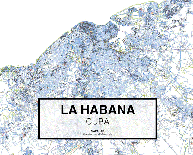
Mapacad is a website that offers downloads of .dwgs of dozens of cities. With 200 metropolises in their database, the founders have shared a set of their most-downloaded cities.
The files contain closed polyline layers for buildings, streets, highways, city limits, and geographical data--all ready for use in CAD programs like Autocad, Rhino, BricsCad and SketchUp.
The importance of public spaces in urban life is an issue that has been apparent since ancient Greece and is still with us today. Opportunities to meet and exchange ideas in these spaces are able to influence how the inhabitants participate in the development of their city, and occur in greater instances when public spaces are accessible to everyone.
However, in modern societies, the strategic role of these spaces has been limited. According to The City Fix, a blog on sustainable urban planning, one of the main reasons for this is the overabundance of automobiles. In fact, according to one study by the Brazilian Institute for Energy and the Environment, 70% of public spaces in urban centers are taken up by roadways and other spaces for cars, while car owners make up only around 20 to 40 percent of the city’s population.
How can public spaces be recovered to promote urban life? We discuss three important factors below.
Frank Lloyd Wright once described cities as both ‘our glory and our menace’. With more than half of the world’s population now living in cities, architects are becoming increasingly interested in their origins. Many fields of historical, geographical, and spatial research are devoted to exploring the evolution of cities, revealing a set of similarities across the globe. In a recent video, Wendover Productions described a common set of characteristics linking some of our largest cities, six of which we have outlined below.
Taking the six factors below into account, where is the perfect ‘world city’? Watch the video after the break:
https://www.archdaily.com/866821/the-origin-of-cities-six-reasons-for-their-locationNiall Patrick Walsh
The John S. and James L. Knight Foundation has announced the names of the 144 finalists in the 2017 edition of the Knight Cities Challenge, a nationwide call for innovative ideas aimed at transforming the organizations’ 26 member communities into more vibrant places to live and work. Open to innovators and designers from any field, the challenge requested submissions that responded to a simple prompt: What’s your best idea to make cities more successful?
Pedestrians, the most vulnerable users of road space, will now be more visible to drivers in the Netherlands with the inauguration of a new luminous pedestrian crossing this past November in Brummen, west of Amsterdam.
Designed by the Dutch firm Lighted Zebra Crossing, and installed free of charge for the municipality, this crossing makes pedestrians more visible at night or during bad weather. Each of the lines has two plates of lights that at night remain illuminated at all times and not only when there are people on them.
The latest publication of the National Association of City Transportation Officials, NACTO, is the "Transit Street Design Guide" in which tips and proposals are presented on how to improve streets through urban design.
The ideas are centered on prioritizing sustainable mobility so that both the member cities of the organization and those that have access to this document can improve their practices in relation to public spaces, mobility, and transportation.
Over the last few years, the way Americans move around has changed remarkably, especially among young people. Previously the automobile was people’s preferred, if not the only, option. Now they are choosing to walk, bike, or use public transport according to recent studies.
This difference in preferred transportation methods has generated many benefits not only for residents but also for cities, in both economic and social terms.
Building a highway in a city is often thought of as a solution to traffic congestion. However, the induced demand theory has shown that when drivers have more routes, they choose to continue using this medium instead of using public transport or a bicycle, and as a result, congestion doesn’t decrease.
As a result, some cities have chosen to remove spaces designated for cars and turn what was once a highway into urban parks and less congested streets.
Here we have six examples, some have already been completed, while a few are still under construction. To the surprise of some, most of the projects are in the US, which reflects that American designers are looking into further studying European transport policies.
Buenos Aires' contemporary urban landscape as we know it today provides a tempered mix of historical and recent construction projects. As one of the most beautiful cities in South America, it's wide boulevards and grand buildings, based on European models, have morphed to embrace the needs of a modern metropolis.
These images show just how profoundly time affects our cities (and how centuries-old foliage can powerfully transform spatial perception).
Browse the 20 interactive images of Buenos Aires before and after.
A recent article published in Nature makes a bold claim: we're analyzing our cities completely wrong. Professors David Wachsmuth, Aldana Cohen, and Hillary Angelo argue that, for too long, we have defined sustainability too narrowly, only looking at environmental impact on a neighborhood or city scale rather than a regional or global scale. As a result, we have measured our cities in ways that are inherently biased towards wealthy cities, and completely ignored the negative impacts our so-called "sustainable," post-industrial cities have on the rest of the world.Metropolis editor Vanessa Quirk spoke with Professor Wachsmuth to learn more about the unintended knock-on effects of going "green," the importance of consumption-based carbon counting, and why policy-makers should be more attentive to the effects of "environmental gentrification."


.jpg?1497550945 "Masdar City Phase 2. Image Courtesy of CBT")
.jpg?1497550961 "Masdar City Phase 2. Image Courtesy of CBT")