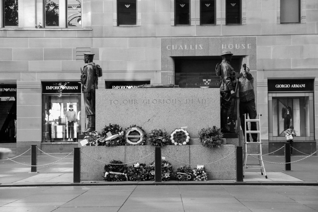
In October 2011, inspired by the Arab Spring revolutions, thousands of people in Australia and in many other cities in the world started to occupy public spaces. In Sydney, where I live, this occupation took place in Martin Place, appropriately enough right outside the Reserve Bank of Australia. This widely publicized protest was an attempt to promote a pro-democracy, civil liberty, social justice message, and to protest against corporate greed and economic inequality.
All of which begged a central question: Was it an occupation of our public space, or was it a reclamation of our public space from governmental and corporate dominance?
Chicago Mayor Lori Lightfoot and the Department of Assets, Information and Services (AIS) has announced that by 2025, all city-owned buildings and facilities in the city will be fully operated with clean, renewable energy. At the moment, Chicago is one of the largest cities in the United States to reduce the city’s carbon footprint at such a scale, and has already began the process of transitioning its transportation busses and cars to all-electric vehicles by 2035. The agreement demonstrates the city's plans to "drive high-impact climate action, build the clean energy workforce of the future, and equitably distribute meaningful benefits to foster the local clean energy economy for all.”
ICLEI Circulars has launched a new practical Equitable Transitions Guidebook to help cities make sure that their urban development projects are equitable for all groups of citizens. The guidebook is based on multiple case studies from cities worldwide under the Urban Transitions Alliance project. The guide’s purpose is to provide insights, recommendations, and tools for city practitioners to understand better and unpack what social equity means at the local level. The publication is free to download.
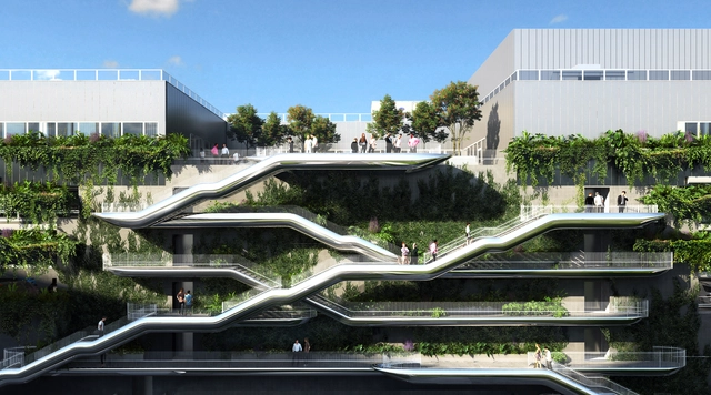
MAD Architects led by Ma Yansong, unveiled renderings of the MoLo, short for Mobility and Logistic hub, a new gateway situated along the western boundary of the Milano Innovation District (MIND). In collaboration with Architect Andrea Nonni, Open Project, and Progeca, the 28.5 meters high complex brings together several facilities across 68,700sqm of surfaces. Designed as an integration of nature and architecture, the MoLo “performs as a welcoming entrance and education space for issues related to mobility in which visitors can drop off their cars to explore the district on foot and see innovative transportation technology in person”.
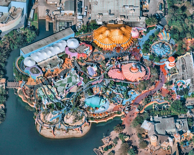
Throughout history, humans have always craved a sense of thrill and an affinity for different forms of entertainment and attraction at all different scales and sizes. Theme parks have continuously evolved, as society redefines what it means to be entertained, and have transformed from evening strolls into physics-defying twists and turns on state-of-the-art rollercoasters.
The urgency to reduce greenhouse gas emissions has never been greater, and getting there is going to require bold steps for buildings, infrastructure, and communities. Incremental reductions are not enough; we need to focus on full decarbonization, which means removing carbon emissions caused by our built environment.
These big changes in the way energy is generated and used will raise important questions about who benefits and who pays. Technology-focused incentive programs can wind up leaving our most vulnerable communities behind, exacerbating a legacy of underinvestment and health disparities, while also failing to reach the essential goals of a complete energy transition. Instead, we need holistic solutions that put disadvantaged communities first and transition buildings that would otherwise be left out, leading to bottom-up market transformation that benefits everyone.
As one of the first steps in the elaboration of an architectural project, the study of the current legislation on the ground is of paramount importance for the success of the proposal. Through calculations and restrictions, zoning laws present limits to be considered in projects that, consequently, instigate architects to think of intelligent solutions, dealing with such limitations in a practical and creative way.
These parameters are dictated by the government and aim to stop, maintain or accelerate urban growth in certain portions of cities. These are norms that establish guidelines for land occupation, delimiting the percentage of built-up area, setbacks, distances, permeability, among others.
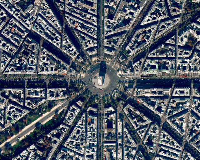
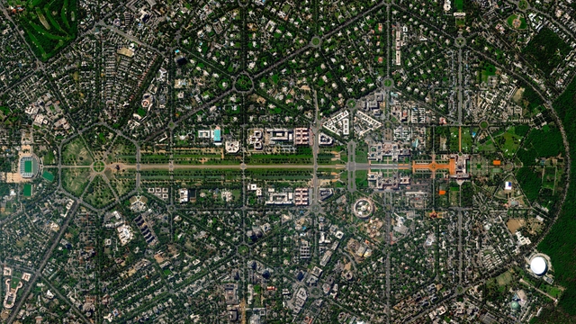
Arch of Triumph. Created by @benjaminrgrant, source imagery: @digitalglobe
In theory, urban planning is a process of elaborating solutions that aim both to improve or requalify an existing urban area, as well as to create a new urbanization in a given region. As a discipline and as a method of action, urban planning deals with the processes of production, structuring and appropriation of urban space. In this sense, its main objective is to point out what measures should be taken to improve the quality of life of the inhabitants, including matters such as transport, security, access opportunities and even interaction with the natural environment.
If you’re reading this right now, or have read an article on ArchDaily, it’s because you were in a place that enabled you to connect to the internet. Think about a time when you found yourself in a dead zone, where the internet was lagging and you were unable to connect your computer to WiFi to finish an assignment or even without the ability to connect your phone to quickly Google something. You likely dashed to the nearest coffee shop, or place where WiFi was more reliable, just to have the feeling of being online again. The internet, in an ideal world, is equally open to all providing access to knowledge and the ability to easily connect with others. But what happens when you don’t have internet? How is your life impacted if you’re on the wrong side of the digital divide and live in an area without broadband access?
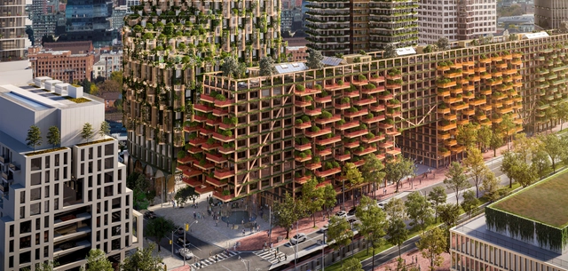
Alison Brooks Architects, Adjaye Associates, Henning Larsen and SLA to Develop Toronto's Waterfront. Image Courtesy of Waterfront Toronto
As more smart cities make their way across the globe, whether it being in countries of the Far East, Latin America, or the Middle East, Toronto is stepping back from the smart city bandwagon, and reassessing its substantial contribution to the community. The Canadian city, which ranked 15th on Global Finance's ranking of the world's best cities to live in for the year 2022, plans on "killing the smart city forever", especially after Quayside's controversial cancellation reasons, questioning its lack of privacy, necessity on an urban scale, and whether people truly want to live in a tech-driven environment.
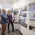
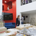
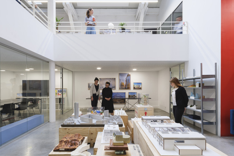
MVRDV and The Why Factory's have collaborated on an exhibition that explores the principles of "architecture and urbanism calls to action”. Titled "Agir", the exhibition is open to the public since June 9th, in the connected spaces of the ArchiLib Gallery and MVRDV’s Paris office. The exhibition takes its name from the French verb meaning “act”, and examines the activist works of MVRDV and The Why Factory, revealing its capacity to address a wide variety of environmental and social challenges.
Social responsibility and the desire to improve society has long been influenced by the built environment. Looking at city centers, architecture has contributed to the improvement of the urban fabric, whether it being through planning and zoning strategies, integration of public spaces, or small interventions. In some cases however, these interventions are in fact used as tools to keep the homeless off the streets, disguised as art or conceptual designs. Several public urban policies have all implicitly prohibited the homeless and other marginalized social groups from city centers, claiming that their presence and “irregular” use of public space could compromise the reputation, security, and desirability of the city.
An online search away from any computer are eye-level views of many of the world’s cities. This technology is powerful – allowing people to have an in-depth look at the cities they might one day visit, live in, or work in. It’s a useful tool for understanding buildings on a more comprehensive level than photographs. This technology is, of course, Google Street View – which recently turned fifteen years old.
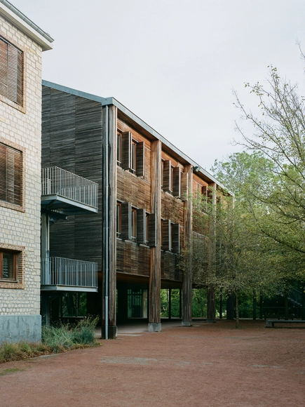
To wholly document a survey on the state of French forests, the wood industry, and forestry R&D, François Leclercq and Paul Laigle, from the architecture and urban planning practice Leclercq Associés, are in collaboration with architecture editor Michèle Leloup and photographer Cyrille Weiner.
The Wood That Makes Our Cities explores the environmental, economic, industrial, and technical challenges involved in the use of wood for large structures and urban architecture and assesses the future of wood construction. The book retraces the practice’s twenty years of experience with wood construction through five of its projects, featuring contributions by historians, researchers, manufacturers, timber producers, and forestry specialists.
Architecture, with all its practitioners, academics, and theorists, have long been exploring utopic ideas with hopes of turning them into something concrete for the sake of a better world. But as the world heads towards an even greater polarization than it currently has, the architecture practice found itself having to adapt to the current systems of the planet, constrained by its ever-growing conditions. Slowly, practitioners realized that utopia can not truly be seen as the ideal solution, and needed to be readapted or morphed with other concepts for it to actually work. DETAIL's latest monograph BIG. Architecture and Construction Details / BIG. Architektur und Baudetails, a rapport between BIG’s imaginative, unbuilt utopias and functional, built architecture, explores 20 projects from the firm's workshop.
We are still at the dawn of the Metaverse, the next wave of the Internet. The current “mainstream” Metaverse platforms serve as experimental containers to host the wildest dreams of virtual worlds where we are supposed to unleash the imagination. However, from a spatial design perspective, they have so far been lame and ordinary. Without the constraints in the physical world, how do we draft the urban blueprints in the metaverse? I believe metaverse planners can find inspiration from Italo Calvino’s Invisible Cities, in which he revealed a poetic and mathematical approach to “urban planning” in the imaginary worlds.
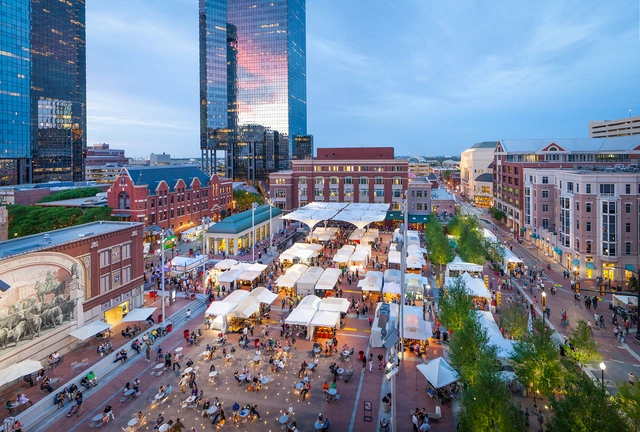
Sundance Square, a new central place for the city of Fort Worth, TX, USA. Image Courtesy of PPS
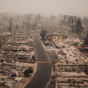
Public spaces play a significant role in organizing the life of every community but defining what differentiates them from other spaces within the city is not an easy task. Once these spaces start to settle into the collective memory of the local communities, they become key elements that concentrate the mental image of a city. While this process usually happens with urban spaces, monuments and isolated architectural elements can also become markers for the urban life of an area. So, what happens when dramatic events like fires, war, or even the pandemic alter that image?
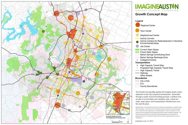
Imagine Austin Growth Concept Map / City of Austin. Image Courtesy of The Dirt
“The planning practices of the past are inadequate for today’s challenges,” said David Rouse, ASLA, a landscape architect and planner, at the American Planning Association‘s National Planning Conference in San Diego. Rapid technological change, socio-economic inequities, natural resource depletion, and climate change are forcing planning and design professionals to adapt. “How can the practice of planning evolve to be more sustainable and equitable?”
https://www.archdaily.com/982475/planners-must-now-anticipate-the-unanticipatedJared Green










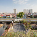
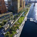

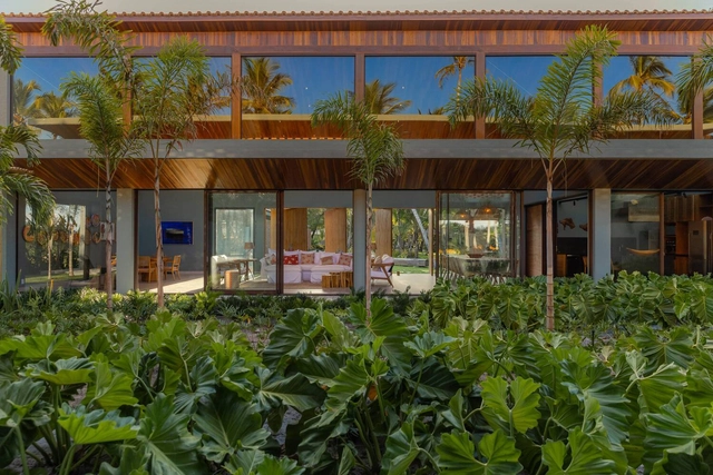











.jpg?1655725729 "© Juan Jerez")
.jpg?1655725498 "© Juan Jerez")
















._Image_by_Zupagrafika.jpg?1653259487 "Orła Białego prefab panel estate in Poznań (Brutal Poland). . Image © Zupagrafika")