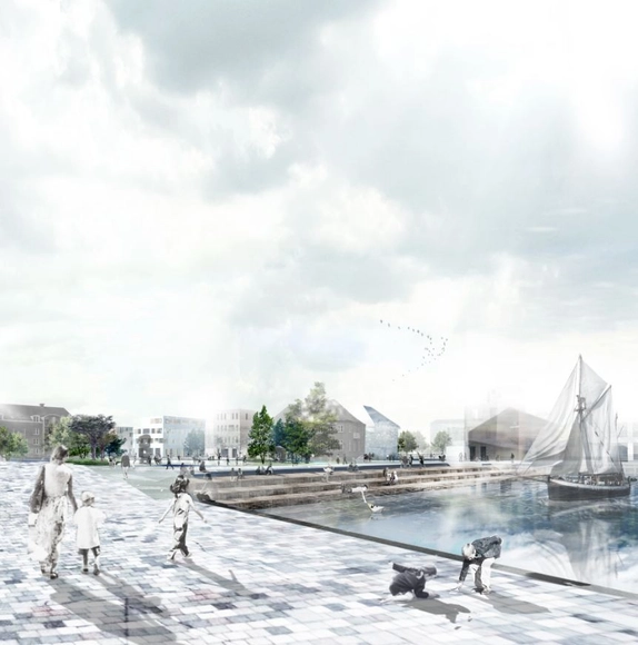
HOBRO – a city finds its lake, is the 1st prize winning proposal by Holscher Arkitekter, which aims to tie the historical center of Hobro to the harbor area. The philosophy behind the strategy is that the urban and landscape spaces are created first, then the streets and at last, the buildings. The architects wish to create a robust frame for a long lasting urban development. A strategy that allows the urban plan to exert itself and be experienced as completed in all phases of the development. More images and architects’ description after the break.
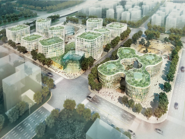
Upon recently winning the competition, MVRDV's design for the Hongqiao Business District recently started construction. The plan comprises ten office towers, an underground shopping center, cultural program, parking and a sunken plaza which will bring a more intimate form of urban life into an area currently dominated by large boulevards and urban expressway’s. Located near the fourth busiest airport in all of mainland China, the 4.5ha site is divided into a small northern plot of 8,409 m2 and a larger southern plot. More images and architects' description after the break.
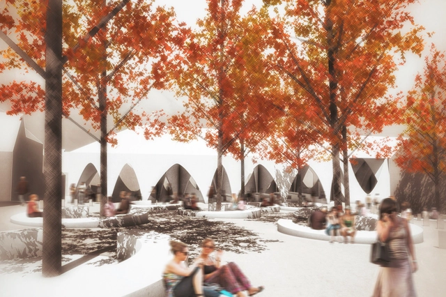
Situated in the very center of the historical town core, the Novo mesto central market feels somewhat removed today, being separated by its level and oriented towards the low-quality city space of Florjanov Square. Therefore, one of the basic guidelines for locating the new central market into the space must be to create the best possible entrance from the main square. Designed by Enota, the backbone of the new central market is formed by the covered Market Street, which lies on the level of main city square and connects the two spots closest to it on both access streets.
Most parking is free - but that doesn’t mean it doesn’t have a high cost. A recent podcast from Freakonomics Radio examined parking in US cities, investigating the “cost of parking not paid for by drivers” - a cost paid not just by the government, but by the environment - due to congestion and pollution caused by people searching for kerbside parking. For example, in a 15 block area of Los Angeles the distance traveled by drivers looking for parking is equivalent to one trip across the USA per day.
One potential solution which they discuss is a San Francisco project called SF Park, which makes use of sensor technology to measure the demand for parking in certain areas of the city and adjust price according to demand. In theory, this would create a small number of empty spaces on each block and dramatically reduce the time that many drivers spend cruising for parking spaces.
Though the idea is certainly an intelligent approach to the problem of kerbside parking, unsurprisingly all this talk of supply, demand and pricing sounds very much like an economist's answer to a problem. But what can designers do to help the situation?
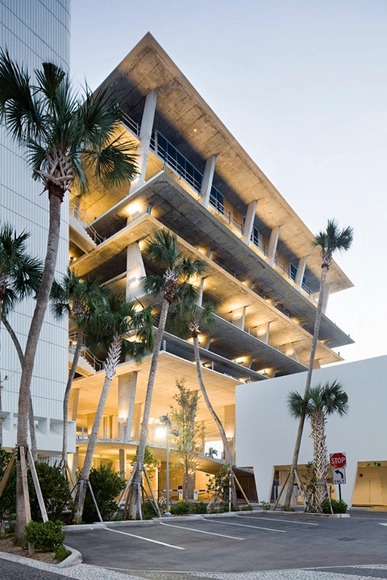
Perhaps, from the designer’s point of view, the real problem with kerbside parking and surface lots is that they are always seen as a provision “coupled with” a building or area of the city. There have been a number of attempts by architects – some successful and some tragically flawed – to make parking spaces less of a rupture in a city's fabric and more of a destination in themselves. Could these point to another way?
Read about 3 examples of parking’s past, and one of its potential future, after the break...
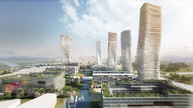
ATENASTUDIO, in collaboration with Archmaster studio, has developed a masterplan for a new district in Wuxi, China, which takes a 200,000 sqm buildable zoning lot to present two main keywords which are the base of all design choices and that can be defined as generator elements of all the project: landscape and waterscape. The intention is to emphasize to the maximum the presence of water making it become a diffuse system, introducing it inside the area and in every part of the project, and using it as if it was a “3D liquid material”. More images and architects' description after the break.
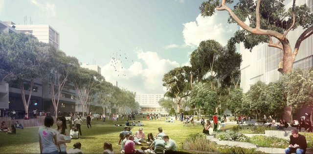
ASPECT Studios, in collaboration with Choi Ropiha Fighera, Barbara Flynn Grounds, ARUP, Deuce Design and People for Places and Spaces, was recently selected as one of five finalists by the University of New South Wales (UNSW) in a design competition for Alumni Park. In an effort to reconnect the University’s spatial hierarchy and movement patterns, the architects provide clearly articulated wayfinding and circulation routes with the new 2ha ‘Social Spine’. More images and architects' description after the break.
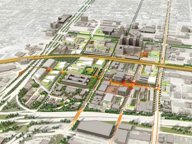
The TechTown District Plan by Sasaki Associates articulates an inspiring vision for the revitalization of the district. An emerging knowledge district in Midtown Detroit, this town is currently characterized by surface parking, vacant properties, and inward-facing, siloed hubs of activity. The architects' concept, however, aims to accelerate innovation, promote entrepreneurship, and build community around the generation of ideas in a vibrant, mixed-use setting. More images and architects' description after the break.
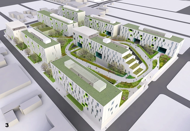
The proposal for Healthy Urbanism is a collaboration between a visionary client, a health scientist and ISA - Interface Studio Architects to investigate the potential for health outcomes to influence large-scale neighborhood and building design. The consulting team developed a conceptual tool in order to bring spatial design and health outcomes into communication with one another. “The Matrix” is a key proposal of the work which creates a bridge between health-related research and literature, factors, health impacts, program, and design parameters. More images and architects' description after the break.
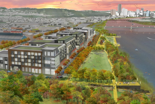
43rd St District View Back Towards Pittsburgh Courtesy of Sasaki Associates
With the advent of the High Line and the recent announcement about Chicago's Bloomingdale Trail, it's becoming clear that the 'parkway' is a powerful new force in urban planning, which has the potential to change the way cities around the world function. A new project in Pittsburgh seeks to harness these possibilities, as the city's history of industry has left its stamp upon the city in the form of a rusting industrial riverfront. A plan by Saski Associates envisages re-using this space to create a green belt, tying the city closer together. By adding pedestrian, cycling and light-rail transport routes, and creating plenty of green spaces, they hope to tap Pittsburgh's unrealized potential to be a river-front city, while encouraging geographical and social closeness amongst its communities.
More images and the architect’s description after the break…
In 2011, UN-HABITAT and Project for Public Spaces (PPS) signed a 5-year cooperative agreement to aspire to raise international awareness of the importance of public space in cities, to foster a lively exchange of ideas among partners and to educate a new generation of planners, designers, community activists and other civic leaders about the benefits of what they call the "Placemaking methodology." Their partnership is helping to advance the development of cities where people of all income groups, social classes and ages can live safely, happily and in economic security and in order to reach these ambitious goals, the duo recently released 10 informative steps that cities and communities can take to improve the quality of their public spaces.
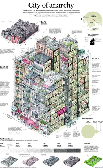
It has been twenty years since the demolition of the Kowloon Walled City. To mark this, the South China Morning Post has created an info-graphic that details the facts and figures of what life was like inside this architectural oddity.
Read more about the madness that was KWC after the break...
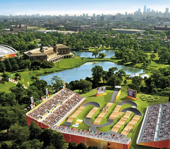
Via the Atlantic Cities "The would-be BMX track in Douglas Park, from Chicago's Bid Book."
In "How (Not) to Host the Olympics," I suggest that, when it comes to Olympic Planning, there is one Golden Rule: “The best thing to do if you’re bidding for the Olympics, Is to Not Get the Olympics.”
Badger follows up in Chicago, a city that bid - hard - for the 2016 Olympics (which will take place in Rio de Janeiro). As she puts it: "We often ask what Olympic cities really get in return for all the money, energy, and construction chaos invested in hosting the world's largest sporting event. But the story of cities that vie for but never win the Games raises a different question.
'What does putting together a bid that is unsuccessful leave you?'"
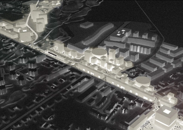
In order to accommodate the expansion of the local tram system, La Fabrique Métropolitaine de la Communauté Urbaine de Bordeaux has commissioned OMA to design a new major urban development in the southern district of Bordeaux, France. Over the next five years, the masterplan will regenerate the neighborhoods of Bègles and Villenave d'Ornon by forging new connections to Bordeaux's central station and unlocking the potential for both city development and public space.
This project is part of the new identity for the "Porte Sud de Bordeaux" (Bordeaux south gate) and continues OMA's intensive recent engagement in Bordeaux, as the office has been working since 2010 on the masterplan for 50,000 new housing units in the city.
More on OMA’s Bordeaux masterplan after the break...
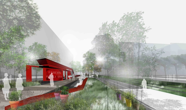
The proposal, ‘Athens PubliCity: an urban neuron for a new city center’, for the Re-Think Athens competition organizes a public space processing system which develops and expands like an “urban neuron”. Designed by Nikiforidis-Cuomo Architects, their concept becomes an entire living framework aiming to re-activate and revitalize the urban body. The system acts as a familiar, habitable and dynamic framework able to “contain” events and situations of both collective and individual actions. More images and architects’ description after the break.
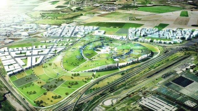
Danish architecture firm, BIG - led by Bjarke Ingels - has been announced as the winner of an international invited competition for the design of Europa City, a 800,000 square meter cultural, recreational and retail development in Triangle de Gonesse, France. Combining city development with an open landscape, Europa City creates a dynamic center of activity for visitors and residents, appealing to the variety of functions of city life. Europa City is situated along the route from Charles de Gaule Airport to Paris and has a wide range of programs that is part of a larger initiative to attract international tourism into the northern parts of Paris.
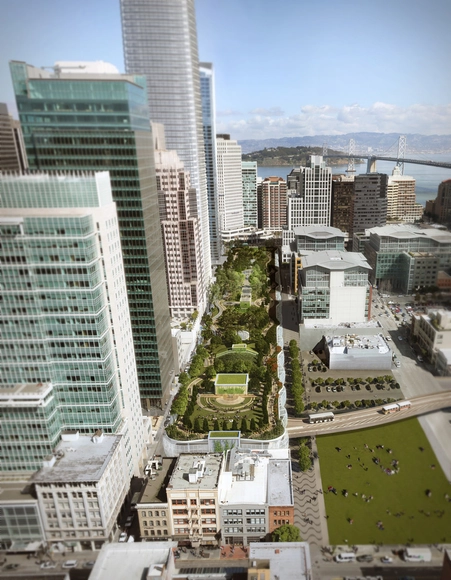
The revamped Transbay Transit Center in downtown San Francisco broke ground earlier this week, a project that will introduce a 1.5 million square foot development that will be part transportation hub, part public park and urban space, and part offices and retail establishments. The massive undertaking, designed by renowned architecture firm Pelli Clarke Pelli will bring together 11 systems of local and national transportation, serving 45 million people per year. In addition to securing access to myriad transit lines, the project will also provide downtown San Francisco with a 5.4-acre rooftop park, designed by PWP Landscape Architecture, along with numerous cultural programs. The project is budgeted at 4.2 billion dollars and is projected for completion in 2017. It is funded in part by the construction of a 1,070-foot tower that is adjacent to the Transbay Transity Center. It is also designed by Pelli Clarke Pelli and is slated to be the tallest tower in San Francisco. The tower will secure 60 stories of office space and jobs and will contribute to the projected $87 billion of revenue through 2030.
Join us after the break for more details on this project.