1. ArchDaily
  2. Geography

Geography: The Latest Architecture and News

The Main Problems in Landscape Design — And How to Avoid Them

Far beyond its decorative features, landscaping brings with it biological and cultural issues that need to be addressed in projects. However, what can be seen in most public, residential, condominium, commercial and business gardens is a series of approaches that distance landscaping from all its attributes, reducing it to a decorative layer in the construction. Next, we have put together strategies to avoid the main problems of landscape design, joining aesthetics with its environmental and cultural possibilities.

The Main Problems in Landscape Design — And How to Avoid Them - Image 1 of 4The Main Problems in Landscape Design — And How to Avoid Them - Image 2 of 4The Main Problems in Landscape Design — And How to Avoid Them - Image 3 of 4The Main Problems in Landscape Design — And How to Avoid Them - Image 4 of 4The Main Problems in Landscape Design — And How to Avoid Them - More Images+ 1

"The Future of Water" Is the Theme of the Portuguese Exhibition at the Venice Architecture Biennale 2023

The Portugal pavilion at the 18th International Architecture Exhibition - La Biennale di Venezia 2023 will present the Fertile Futures project, curated by Andreia Garcia and assistant curators Ana Neiva and Diogo Aguiar. The project aims to address water resources issues in seven Portuguese hydro geographies and encourage reflection on building a sustainable, equitable, and fertile future. The exhibition will take place at Palazzo Franchetti from May 20 to November 26, 2023.

"The Future of Water" Is the Theme of the Portuguese Exhibition at the Venice Architecture Biennale 2023 - Image 1 of 4"The Future of Water" Is the Theme of the Portuguese Exhibition at the Venice Architecture Biennale 2023 - Image 2 of 4"The Future of Water" Is the Theme of the Portuguese Exhibition at the Venice Architecture Biennale 2023 - Image 3 of 4"The Future of Water" Is the Theme of the Portuguese Exhibition at the Venice Architecture Biennale 2023 - Image 4 of 4The Future of Water Is the Theme of the Portuguese Exhibition at the Venice Architecture Biennale 2023 - More Images+ 3

The Different Cartographic Projections and What They Mean

Cartography consists of the flat, simplified and conventional geometric representation of the earth's surface, presented in the form of maps, charts or blueprints. Because it is a two-dimensional representation of something that is three-dimensional, all representations undergo some kind of deformation, so that the choice of a method takes into account not only technical aspects, but also political ones.

Colombia’s Pavilion at Expo 2020 Dubai: A Fusion of Geography, City and Culture

The Colombia Pavilion at Expo 2020 Dubai is thought of as an artefact with the ability to tell the past, present and future stories of the country's culture through its music. Supported by its geography and its cities, the pavilion designed by Pacheco Estudio de Arquitectura intersperses dense vegetation with water, representing the great biodiversity of its plant and animal world, and is composed of a reticular structure in three dimensions symbolising the urban centres that are constantly growing.

By proposing a route from the vegetable and aquatic floor to the open ceiling, the artefact is quickly identifiable from a distance and seeks to remain in the memory of those who visit it as a fresh, open space that reveals itself to all and finds itself in constant development.

Rural Landscapes: How Food Production Shapes the Land

Food cultivation is one of the great historical milestones of our society's development. The knowledge of agriculture was fundamental for the evolution of a nomadic society into a sedentary civilization. Centuries later, agricultural production has become one of the main contributors to the organization of the land. This phenomenon can be seen in the aerial images we have selected below.

Rural Landscapes: How Food Production Shapes the Land - Image 1 of 4Rural Landscapes: How Food Production Shapes the Land - Image 2 of 4Rural Landscapes: How Food Production Shapes the Land - Image 3 of 4Rural Landscapes: How Food Production Shapes the Land - Image 4 of 4Rural Landscapes: How Food Production Shapes the Land - More Images+ 8

GeoGuessr Game Uses Street View to Create a Geographical Puzzle

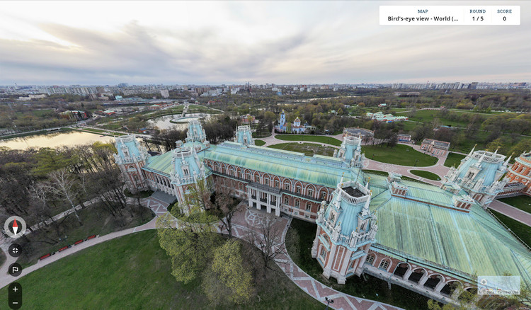
A geographic discovery game based on Google imagery, GeoGuessr requires players to guess various locations worldwide using only the clues provided by a Street view. Created in 2013, the game has taken on new relevance amidst the pandemic, as it provides a virtual travel experience. From desolate roads to famous sites, the game teases deductive reasoning, requiring players to make use of any clue, from signs, language, flags, landscape, to pinpoint their surroundings.

GeoGuessr Game Uses Street View to Create a Geographical Puzzle - Image 1 of 4GeoGuessr Game Uses Street View to Create a Geographical Puzzle - Image 2 of 4GeoGuessr Game Uses Street View to Create a Geographical Puzzle - Image 3 of 4GeoGuessr Game Uses Street View to Create a Geographical Puzzle - Image 4 of 4GeoGuessr Game Uses Street View to Create a Geographical Puzzle - More Images+ 5

Global Watersheds and Waterways Captured in Vibrant Colorized Maps

GIS analyst and Hungarian cartographer Robert Szucs has shared an impressive collection of maps that bring together all the drainage basins of the world in vibrant colors. Titled Grasshopper Geography, the maps showcase the rivers and watercourses of the world, featuring the basins of selected regions, countries and continents.

Global Watersheds and Waterways Captured in Vibrant Colorized Maps - Image 1 of 4Global Watersheds and Waterways Captured in Vibrant Colorized Maps - Image 2 of 4Global Watersheds and Waterways Captured in Vibrant Colorized Maps - Image 3 of 4Global Watersheds and Waterways Captured in Vibrant Colorized Maps - Image 4 of 4Global Watersheds and Waterways Captured in Vibrant Colorized Maps - More Images+ 9

Vantage

The first monograph of photographer Ryan Koopmans, an award winning Canadian/Dutch photographer whose work is exhibited and published across the world, Vantage explores the earth’s manmade structures, surreal architecture and megacities, evoking the insight and intrigue experienced from a travelling photographer’s perspective. Koopmans’ compelling photographs are presented alongside conversations with political leaders, business tycoons and local residents, providing a timeless vision of our world that is both contemporary and creative.

Marvin Heiferman, an independent curator and writer who originates projects about the impact of photographic images on art, visual culture and science, offers an insightful foreword.

With photographs shot on location in

ELEMENTAL Proposes Pedestrian Path To Connect Districts of Santiago

ELEMENTAL has given us details on a proposed 14.5 km pedestrian and bike path within Santiago, Chile that will run along the base of San Cristobal Hill and connect the city's many distinct communities. According to ELEMENTAL, the proposal - named "Metropolitan Promenade" - seeks to facilitate the use and quality of the city's public spaces.

The total project will cost about $16 million USD and will be constructed in two stages. The first is expected for March 2015 and will deal with 7.2 kilometers in the western sector of the park. The second stage, which should be ready in September 2015, will complete the following 7.3 kilometers in the eastern sector of the park.

Read the full architect's description, after the break.

ELEMENTAL Proposes Pedestrian Path To Connect Districts of Santiago - Image 2 of 4ELEMENTAL Proposes Pedestrian Path To Connect Districts of Santiago - Image 3 of 4ELEMENTAL Proposes Pedestrian Path To Connect Districts of Santiago - Image 4 of 4ELEMENTAL Proposes Pedestrian Path To Connect Districts of Santiago - Image 5 of 4ELEMENTAL Proposes Pedestrian Path To Connect Districts of Santiago - More Images+ 7