1. ArchDaily
  2. subways

subways: The Latest Architecture and News

Consider the 15 mph City

This article was originally published on Common Edge.

When San Francisco’s MUNI spent big money on a “central subway” to Chinatown, I was doubtful. One recent Saturday, though, I revived the gallery-hopping I did before the pandemic, taking the train from Berkeley into the city, walking to one gallery near Embarcadero Station, then taking a tram past the ballpark to the CalTrain Station, where I switched to another tram to head south to Minnesota Street’s Dogpatch cluster of galleries and artists’ studios.

These GIFs Compare Cities' Metro Maps to Their Real Life Geography

Metro and subway maps can tell us a lot about cities. For example, by comparing metro maps from different cities, you might be able to understand those cities' relative size or level of development. Or, by comparing a metro map to an earlier version from the same city, you can learn about the pace of development being experienced in that city. What these "maps" rarely tell you with any reliability, though, is the actual geography of the city itself.

In a fascinating series of posts over at /r/dataisbeautiful earlier this year, Reddit users created GIFs comparing the official metro maps of cities around the world with the real geography those maps correspond to. The results show the incredible changes that cities are subjected to in the name of visual clarity: in cities such as London, Tokyo, and Berlin, transit maps expand the urban core, masking the density at these regions' centers; in other cities such as Washington DC, shortened lines hide the extent of the city's suburbs; while in some cities, entire neighborhoods are moved to the other side of the city to make the map layout more attractive (we're looking at you, Prague). Read on to see 11 of the best creations by Reddit users.

The Breakneck Evolution of Chinese Metro Systems

In 1990, China, then a country with a population of just over 1.1 billion inhabitants, had only three metro systems—located in Beijing, Hong Kong and Tianjin. Fast forward a mere 27 years later and the number of urban transit systems has grown more than ten-fold.

Reconnecting the Subway with the Sky

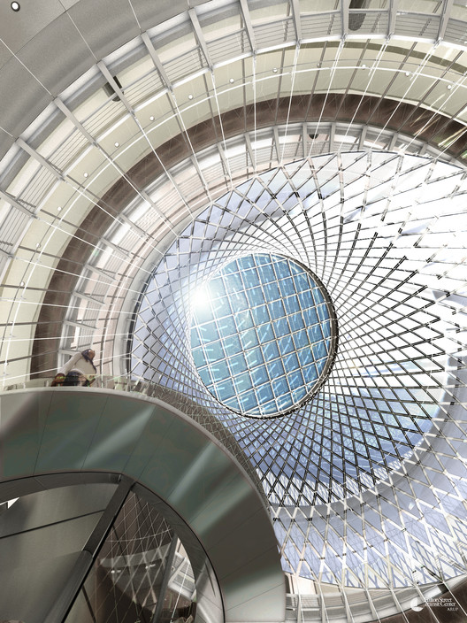
In the early years of the New York City subway system, natural light played a dominant role in the illumination of subterranean spaces. The architecture emphasized a connection to the sky, often through skylights planted in the median of city avenues above — lenses in the concrete sidewalks.

However, it proved extremely difficult to keep the skylights clean, and light eventually stopped passing through. Subway authorities moved toward an almost exclusive reliance on electric lighting. While this allowed for greater flexibility in station design, permitting construction at any location and depth, it also created a sense of disorientation and alienation for some passengers.

For the design of Lower Manhattan's Fulton Center, Arup, in conjunction with design architect Grimshaw sought to reconnect the century-old subway system with the world above.

Read more about this "enlightening" subway station, after the break...

Reconnecting the Subway with the Sky - Image 1 of 4Reconnecting the Subway with the Sky - Image 2 of 4Reconnecting the Subway with the Sky - Image 3 of 4Reconnecting the Subway with the Sky - Image 4 of 4Reconnecting the Subway with the Sky - More Images+ 11