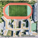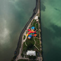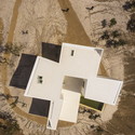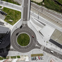
What is the draw of the aerial view? Whereas architects and designers often find solace in this particular spatial perspective there is a more inclusive, universal appeal to this way of seeing. The ease of access to online mapping services has increased our collective reliance on understanding our world from above.
Maps condense the planet into a little world inside our pocket, the commodification of which has universalised the ‘plan-view’ photograph. The question of whether or not their ubiquitous availability, having now been assimilated into our collective consciousness, is a positive step for the status of the plan is a discussion ongoing. Yet, in the face of this dilemma, architectural photographers are pushing the boundaries of drone technology in order to find new meaning.
Articulating space through plan has long been an accepted convention for spatial designers. It is, more than anything, a way of thinking, understanding, and representing complex architectural and urban compositions. Orthographic projections (plan, section, elevation) provide a view of a place which is both artificial and unattainable, defined by a degree of precision and purity of space that is impossible to replicate in real-world situations.
_01-12_cropped.jpg?1422267099)
It works on any scale: from Giambattista Nolli’s seminal ichnographic map of Rome (1748) to the geometrical perfection of the Dutch fortress of Coevorden (1647). In 20th and 21st century domestic architecture, the plan has come to symbolise a universally recognised method of orchestrating space around square feet/metres in residential buildings across the world.

However fundamental the plan is in allowing architects to understand a project, it is stylistically limited - and this is where the top-down photograph comes into its own. Unlike a drawing, aerial photographs capture perfect shadows, unexpected patterns of weather, worn ground surfaces and roofscapes, as well as the traces of people, animals and vehicles that elevate architectural scenes into ‘reality’. Most importantly, they provide glimpses into extended urban settings and powerful natural conditions which are not idealised or inflated as part of a designer’s vision, thereby splicing the gap between the tangible and intangible.


It is the marriage of photography’s innate authenticity, coupled with the 'purity' of orthographic projection, that drone technology makes possible. These photographs are not plans; rather, the gentle perspective and natural realism that is characteristic of these shots gently remind us that we are looking at a frame captured not through ink but through a lens. Designers cannot accurately predict the ways in which people inhabit and adapt their built visions. As such, they are imbued with genuine character: vehicular turning circles can be seen etched onto dusty landscapes, while trampolines and children’s play-sets are peppered across manicured lawns.
Perhaps the honeymoon period is now over and footage taken using drones flying over the site for this year's Milan Expo, or through New York City's Hearst Tower at the will of the architect, is no longer exciting nor unique. Some architectural photographers are actively embracing this technology to create quieter, more composed architectural stills. The work of Joao Morgado and Fernando Guerra - among others - demonstrates that drones can be harnessed to capture astonishingly potent photographs of buildings and their surrounding landscapes. In their stillness they reveal just how compelling the aerial view continues to be.


Contemplating Humanity's Effect On Planet Earth, From Above
The Three-Dimensional City: How Drones Will Impact the Future Urban Landscape


