Diverse, green and dynamic, in this video Singapore is shown through a new kind of lens, one that exists above the city, pans down it, rolls over it and offers a view of its architecture from an alternative angle. André Eckhardt's drone hyperlapse video takes us onto the street, up in the air, and down by the sea as the weather shifts and changes, and as people go about their day to day lives. Using clever speed adjustments, Eckhardt switches between the fast-paced movements of the city up-close and moments of pause as he takes us up over it. Picking out architectural works including the iconic Bayside projects of Moshe Safdie, PARKROYAL on Pickering and the Oasia Hotel by WOHA, the Gardens by the Bay, and the Helix Bridge, Eckhardt brings Singapore's colorful skyline to life.
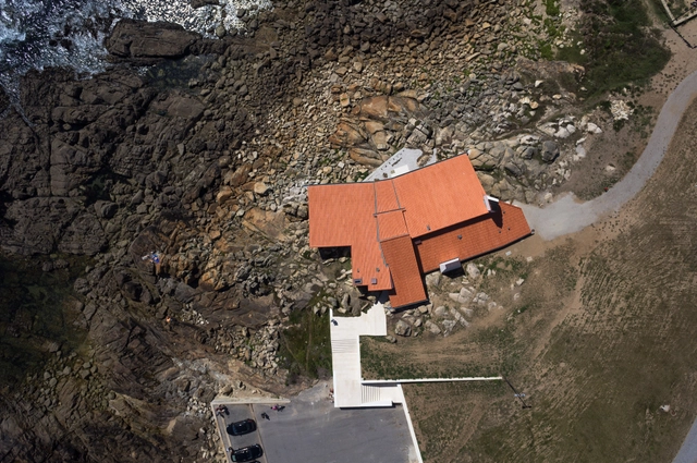
Drone Photography: The Latest Architecture and News
Drone Video Shows Off Singapore's Stunning Architectural Sights
This Drone Video Captures the Mesmerizing Geometries of The World's Most Vertical City
The immense scales and geometric intricacies of Hong Kong have long held the fascination of the public consciousness, and has been further reinforced in recent years by mind-bending photography series such as Michael Wolf’s “Architecture of Density.”
In this new film from architect Mariana Bisti, this phenomenon is explored for the first time through drone videography. Not limited to vantage points accessible to humans, the video zooms and pans deliberately over, across and into the city’s enormous residential blocks, the cinematography bringing to mind that of Charles and Ray Eames’ seminal production, “Powers of Ten.” Special care to detail has been taken to align each composition to the Cartesian plane, resulting in mesmerizing experience that never breaks your attention.
Soar Through BIG's Twisting Miami Towers, the Grove at Grand Bay, in This Drone Video
In this video, drone Videographer Azeez Bakare takes us through BIG's recently-completed Grove at Grand Bay, a residential complex in South Miami featuring two twisting 20-story towers and a lush tropical landscape terrace designed by landscape architect Raymond Jungles.
Commissioned for the project by BIG, the video shows how the building transforms throughout the day: standing out as stark white sculptures during the day before turning an orange glow as the glass balconies reflect back the setting sun, and finally, lit up at night against the Miami skyline.
A 6000-Year Old Unplanned Community Photographed From Above
Photo of the Day: Ghadames, Libya http://t.co/MpRCAemGuy #pod #photography
— National Geographic (@NatGeo) March 27, 2013
Since time immemorial, and more recently, humans have wondered what the world looks like from above. This fascination has historically manifested in the plan drawing and aerial photography. In this vein, and using a motorized paraglider, National Geographic photographer George Steinmetz has captured a stunning bird’s-eye view of the ancient city of Ghadames, in Libya.
This Drone Video of Los Angeles Highlights the City’s Many Murals
In this wide-ranging video, drone videographer Ian Wood captures the diversity of the built environment in Los Angeles, featuring architectural gems on equal footing with freeways and freight trains. The buildings and locations featured in the video span over a century of architectural history in LA, and cover the region’s vast geography, including such icons as Frank Lloyd Wright’s Hollyhock House, Cesar Pelli’s Pacific Design Center, Eric Owen Moss’ Stealth building, and Morphosis’ recently completed Emerson College Los Angeles.
But what truly sets this video apart is how it highlights the many murals spread throughout the city. Often utilizing otherwise blank facades facing parking lots and alleys, these murals are nonetheless an integral part of LA’s urban fabric, as illustrated in this video. Sadly though, as Wood notes on the video description, there were many more murals that vanished before he was able to get them on video.
These Drone Photographs Reveal the Hidden Geometries of Late Soviet Modernism

Though the ahistorical dogma of modernism would seem a perfect fit for the Soviet Union’s mandated break with traditions, the architectural history of the USSR was somewhat more complex. Stalin’s neoclassically-inflected socialist realism superseded the constructivist heyday of the early Soviet Union, only to be replaced by a return to modernism under Khrushchev, facilitated by an opening to the West. Architectural photographers Denis Esakov and Dmitry Vasilenko recently used a drone to capture photographs of several landmark structures of the Khrushchev-era return to modernism, focusing on how these aerial views reinforce their rational geometries and regimented forms. Until the recent advent of satellite imagery and commercially available drones, these were views that were only ever seen by the architects, and the officials who reviewed the plans. Even so, the photographer notes that these methodical forms must have been very attractive to the state officers tasked with implementing Khrushchev’s mandated aesthetic.
The photographs, taken in and around Moscow, include works by several prominent Soviet architects. Leonid Pavlov’s long career spanned the full spectrum of state-sponsored architectural styles, starting as a constructivist, and moving into more historicist designs under Stalin, before emerging as one of the Soviet Union’s most prominent post-war modernists. Similarly, Yuri Platonov’s work received extensive state recognition, earning him the title of “People’s architect of the USSR,” as well as awards such the Silver Medal of the Arts Academy of the USSR, the USSR State Prize, and the State Prize of Russia.


Video: Bird's Eye View of Brasília's Tesourinhas
Drone Brasília has shared with us a brief video filmed by a drone that gives a bird’s eye view of a signature feature of Brasília -- the “tesourinhas,” the so-called cloverleaf interchange that the city’s highways form.
In just thirty seconds the video shows the scale of the space, marked by cars traveling through the wide avenues, which themselves are projected onto an expansive green plane.
12 Stunning Aerial Photos Taken with a Drone

Photographer Amos Chapple has traveled the world, capturing well-known landmarks and cities from the perspective of a drone. From the Katshi Pillar in Georgia to New Delhi’s Lotus Temple and the star fort in Bourtange, the Netherlands, Chapple carried out “as much aerial work as weather and local laws allow.”
See 12 of his most impressive photos after the break.


Contemplating Humanity's Effect On Planet Earth, From Above

Earthrise, a photograph taken on Christmas Eve of 1968 by astronauts of the Apollo 8 mission, was a defining moment for our collective understanding of the world in which we live on. For the very first time it dramatically pulled into focus the simultaneous magnificence, intricacy, and terrifying fragility of the planet we inhabit. Since that time the advent, acceleration, and accessibility of satellite imagery has made one thing abundantly clear: that humankind has had a considerable effect on Earth, for better or for worse. Daily Overview's self-defined mission is to "consider the places where man has left his mark and then conduct the necessary research to identify locations to convey that idea." They do so with incredible effect.


The Power Of The Plan: Drones And Architectural Photography
What is the draw of the aerial view? Whereas architects and designers often find solace in this particular spatial perspective there is a more inclusive, universal appeal to this way of seeing. The ease of access to online mapping services has increased our collective reliance on understanding our world from above.
Maps condense the planet into a little world inside our pocket, the commodification of which has universalised the ‘plan-view’ photograph. The question of whether or not their ubiquitous availability, having now been assimilated into our collective consciousness, is a positive step for the status of the plan is a discussion ongoing. Yet, in the face of this dilemma, architectural photographers are pushing the boundaries of drone technology in order to find new meaning.


Light Matters: Smart Flying Pixels Create a Floating Glow
Imagine luminaires that could fly and visualise new buildings or individually guide you through space. What would happen if you could even interact with these flying pixels? These concepts could be realised in the near future as the first prototypes and experiments are being introduced. Software-driven LED pixels combined with drone swarm technology provide extraordinary possibilities for inducing new forms of spatial experience. These luminous pixel clouds emerge as digital patterns, but at the same time they emanate a romantic quality with their unique star formations twinkling in the night sky. The first projects have shared a playful note, but laboratories such as MIT's SENSEable City Lab, ARES Lab and Ars Electronica Futurelab have shown an intriguing future in urban design for guidance systems or envisioning real estate developments, as advances in battery technology and wireless control have opened new perspectives for a life with smart flying pixels.