1. ArchDaily
  2. Urban Planning

Urban Planning: The Latest Architecture and News

Winners selected for round two of the Moscow City Agglomeration Competition

Subscriber Access | 
Winners selected for round two of the Moscow City Agglomeration Competition - Featured Image
Photo Credit: RIA Novosti

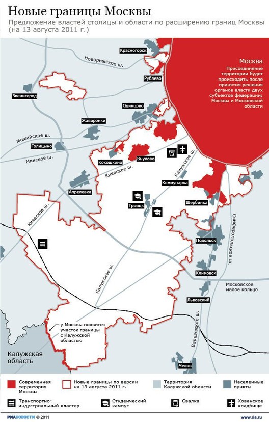
The international team, lead by well-known Russian urbanist Andrey Chernikhov, and including McAdam Architects, Tower 151, Georgi Stanishev and Ginsburg Architects placed first in round two of the Moscow City Agglomeration Development Concept competition. The winning consortium sparked debate by suggesting Moscow officials should consider redeveloping the abundant brown field sites and other available infill spaces within the existing city boundaries before proposing new development. They highlighted vast areas occupied by goods railways and disused industrial sites from Soviet times as prime areas for regeneration and expansion, as well as a re-thinking of transport networks to alleviate pressure on existing systems.

Continue after the break to learn more.

What Can Architecture Do for Your Health?

Subscriber Access | 
What Can Architecture Do for Your Health? - Image 9 of 4
© NYC DDC

In an effort to make New York City’s built environment “more livable and hospitable” the Department of Design and Construction (DDC), Health and Mental Hygiene, Transportation (DOT), and City Planning have developed the Active Design Guidelines: Promoting Physical Activity and Health in Design to be referenced in conjunction with the DOT’s Street Design Manual and other guidelines produced by NYC. The guidelines are written for urban planners, designers and architects and are driven by the need to address health concerns such as obesity and diabetes through intelligent design. Our built environments give us cues as to how to inhabit them and have tremendous effects, sometimes subconscious, on our lifestyles. Do you walk, drive, or bike to work? Do you take the stairs or the elevator? We make these types of decisions, which are largely based on comfort, on a daily basis. But the guidelines established in this manual are intended to give designers the tools to encourage healthy lifestyle choices to address the social concerns of NYC. So, what can planners, architects and designers do to create an active and healthy city? Find out after the break.

The Green Building Council of Australia Launches Community Ratings for Sustainable Practices

Subscriber Access | 
The Green Building Council of Australia Launches Community Ratings for Sustainable Practices - Image 1 of 4
Courtesy of Athanasios Polyzoidis & Katerina Petsiou

The Green Building Council of Australia has released Green Star – a new comprehensive rating system that can assess the degree to which communities, as a whole, succeed in creating livable and sustainable environments. This is a new and dynamic way to look at the culture of sustainability. “Green building” is not only reflected in individual buildings; it is the accumulation of the buildings, the infrastructure, the urban planning and design, the amenities of the community and the lifestyles that communities live. Projects such as DIY Urbanism in the Netherlands by MVRDV and “e_co_llectiva” by Athanasios Polyzoidis & Katerina Petsiou have this kind of regard for the development of holistic community.

Read on for more after the break.

A Bright Future for Willets Point - Redevelopment on an Environmentally Marred Peninsula

Subscriber Access | 
A Bright Future for Willets Point - Redevelopment on an Environmentally Marred Peninsula - Image 1 of 4
© NYC EDC

The New York Economic Development Corporation and Mayor Bloomberg of NYC announced the completion of the final plan for Willets Point - a peninsula on the Flushing River in Northern Queens, New York. The development of Willets Point is part of the urban renewal project associated with Citi Field – the Mets’ new stadium. Nicknamed the Iron Triangle, the project will include housing for mixed incomes, retail and entertainment amenities, a hotel, a convention center, office space, parks and open space, and a new public school, all of which falls under the umbrella of LEED-certified buildings and infrastructure. As with every redevelopment plan, there are positives and negatives to restructuring the community.

Read on for more after the break.

Atlantic City Tourism District Master Plan / The Jerde Partnership

Subscriber Access | 
Atlantic City Tourism District Master Plan / The Jerde Partnership - Image 10 of 4
Courtesy of The Jerde Partnership

Well known for their visionary architecture that people love to visit and go back to time and again, The Jerde Partnership has set out to attract more people through a realistic framework by transforming Atlantic City into the preferred coastal resort destination of the Northeastern United States. By creating a clean, green, safe city that pays homage to its storied history and takes advantage of its unique island setting, the new Atlantic City Tourism District master plan will offer a wide range of attractions and experiences for all ages. By promoting a strategy for redevelopment, phasing, and district-wide improvements, the master plan will serve as a catalyst for Atlantic City’s economic and social uplift. More images and architects’ description after the break.

Central Tirana Masterplan / Grimshaw Architects

Subscriber Access | 
Central Tirana Masterplan / Grimshaw Architects - Image 1 of 4
Courtesy of Grimshaw Architects

Grimshaw Architects recently announced that they have been selected to masterplan a large expansion to Albania’s capital city, Tirana. Grimshaw proposed a robust sequence of public spaces threaded along the boulevard that responded geometrically to existing patterns of land ownership. Tirana is a Mediterranean city with an outdoor culture. Each space or ‘living room’ was presented with a different use and character; a new ‘symphony of squares’. More images and architects’ description after the break.

Urban Agriculture Part I: What Cuba Can Teach Us

Subscriber Access | 
Urban Agriculture Part I: What Cuba Can Teach Us - Image 3 of 4
Havana Cuba. CC Flickr User weaver. Used under Creative Commons

Everyday, in the city of London, 30 million meals are served. That’s millions of trucks arriving to millions of stores and restaurants in a complex, tightly scheduled orchestration of production, transportation, and distribution.

We take it for granted that this system will never fail. But what would happen if these trucks were stopped? As unrealistic as it sounds, it’s happened – and not so long ago.

In 1989, over 57% of Cuba’s caloric intake was imported from the Soviet Union. When it collapsed, Cuba became, virtually overnight, solely responsible for feeding its population – including the 2.2 million in the city of Havana. [1] What happened next is an incredible story of resilience and innovation.

As our world becomes increasingly urbanized, our farms increasingly endangered, and our reliance upon fossil fuels increasingly undesirable, the question of how we will feed billions of future city dwellers is no mere thought experiment – it’s an urgent reality.

The story of Cuba offers us an interesting question: What would our cities look like if we began to place food production/distribution as the primary focus of urban design? And what will it take to make this vision a reality?

More on how Food can shape our cities, after the break…

Christopher Hawthorne takes on the Boulevards

Subscriber Access | 
Christopher Hawthorne takes on the Boulevards - Featured Image
Screenshot via Los Angeles Times; "Atlantic on the Move" by Christopher Hawthorne

Christopher Hawthorne’s article “Atlantic on the Move“, published in the Los Angeles Times, covers the transitions taking place along LA’s boulevards and one in particular: the 5600 block of Atlantic Avenue. Hawthorne reveals the changes taking place that are “reversing decades of neglect” among LA’s roadways. Among those that have promoted a cultural association with Los Angeles: traffic, congestion and miles of roadways. The article covers the small steps that take place over time via minor interventions that combine to change the face of the boulevards to more pedestrian and bike-friendly spaces for alternative modes of transportation.

Read on for more after the break.

Masterplan for National Creative Cluster / Sasaki Associates

Subscriber Access | 
Masterplan for National Creative Cluster / Sasaki Associates - Image 15 of 4
Courtesy of Sasaki Associates

The masterplan for the National Creative Cluster by Sasaki Associates integrates the urban form with the surrounding landscape by creating a series of green wedges, interspersed within the urban clusters and forming a series of community parks. Located near Songzhuang, a quiet village on the outskirts of Beijing, the success of the district is tied to its openness, where people can interact in both structured and spontaneous ways to exchange ideas and have constructive dialogue. More images and architects’ description after the break.

Masterplan for the Honghe Project / AECOM

Subscriber Access | 
Masterplan for the Honghe Project / AECOM - Image 4 of 4
Courtesy of AECOM

Commissioned by the Golden Harbor Group, the design for the masterplan for the Honghe project by AECOM is aimed to help Longgang, an emerging area of Shenzhen, to function positively on the city’s renovation and upgrading. Located in a new rising area, the project covers the south area of the main venue for last year’s University Games. Their design will not only become the complex of services in east Shenzhen, but will lead the development of sports and mice industries, which will also be important for Shenzhen to become the base radiation to the development of east Guangdong Province. More images and architects’ description after the break.

Superbowl Project / Supermachine Studio

Subscriber Access | 
Superbowl Project / Supermachine Studio - Image 19 of 4
Courtesy of Supermachine Studio

The Superbow Project, designed by Supermachine Studio, is a proposal for a sustainable city of its own. Using Nakornsawan, Thailand as a location to implement their vision of a giant hydraulic tool in the network, they place a new ‘Water’ city in between the two rivers to slowly generate a new way of living for Nakornsawan’s people. The city, located by 2 rivers Ping and Nan, is usually flooded every year, but in 2011 the water broke the protecting levee into the city’s center. The whole town of Nakornsawan sank into one meter plus deep water. Therefore, this project aims to build a massive hydraulic tool that is habitable as an extension of the city or as a new city itself that all of people in the old city can move into. More images and architects’ description after the break.

Europa City / Manuelle Gautrand Architecture

Europa City / Manuelle Gautrand Architecture - Urban Planning Europa City / Manuelle Gautrand Architecture - Urban Planning , FacadeEuropa City / Manuelle Gautrand Architecture - Urban Planning , TableEuropa City / Manuelle Gautrand Architecture - Urban Planning , FacadeEuropa City / Manuelle Gautrand Architecture - More Images

Qingdao Master Plan / HAO + Archiland

Subscriber Access | 
Qingdao Master Plan / HAO + Archiland - Image 12 of 4
Courtesy of HAO + Archiland

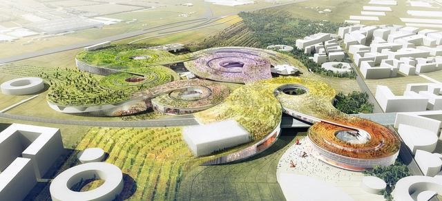
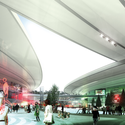
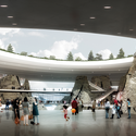
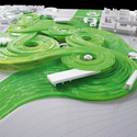
The design for the Qingdao Master Plan, designed by HAO/Holm Architecture Office + Archiland, seeks to further develop and expand the existing elements of the city. Situated within the city of Qingdao and conveniently located five minutes from the airport, the site is divided into three main areas. To take advantage of this, the design takes its starting point around a sunken cultural path that leads visitors through the entire programmatic experience of the new master plan. More images and architects’ description after the break.

Reimagining the Waterfront Ideas Competition

Subscriber Access | 
Reimagining the Waterfront Ideas Competition - Image 2 of 4
First Place / Joseph Wood; Courtesy of Civitas - Reimagining the Waterfront

CIVITAS, the organizer of the Reimagining the Waterfront, has announced the winners of the ideas competition for the design of the East River Esplanade between 60th and 125th in New York City bound by the East River to the East and the FDR Drive to the west. Joseph Wood of New Jersey, USA; Takuma Ono and Darina Zlateva of New York City, USA and Matteo Rossetti of Italy claimed first, second and third prize respectively. The competition aspires to bring to new and fresh ideas to the conversation about this waterfront, which over the years has had many issues of disrepair. Anyone who has attempted to bike down this path can appeal to just how unpleasant it can be – massive potholes that take up the whole path, traffic rushing by just a foot away just beyond a shoulder (which is not provided everywhere) and cobbled paths that create a bumpy ride. The proximity to the East River, and the views of Randall’s Island, Queens, Roosevelt Island and the Queensboro Bridge are its saving grace.

There have already been many talks about the state of the East River Esplanade, particularly that it stops abruptly at East 53rd street at the foot of the Queensboro Bridge and starts up again around East 38th street. Last summer MAS, an organization in NYC that advocates for intelligent urban planning, design and preservation, hosted a day-long charette to design an esplanade along the ConEd piers located between East 38th and East 41st Streets. MAS appealed to the community for ideas for “The Next Great NYC Waterfront” and worked alongside W Architecture and Landscape Architecture to produce a report, which can be found here. With CIVITAS’s competition, the issues are again acknowledged to continue brainstorming the future of the waterfront.

The Architect’s Newspaper reviewed the competition winners in an article by Tom Stoelker, which are imaginative and considered. The proposals of the winners and honorable mentions will be exhibited at the Museum of the City of New York between June 6th and September 2012 which will give the public access to some possibilities for the future of the East River Esplanade.

Join us after the break for more on the proposals.

Railway area "Baricentrale" / Massimiliano & Doriana Fuksas

Projects like the High Line, Bloomingdale Trail, and Allegheny Green Boulevard illustrate that disused, industrial infrastructure is rife with re-use potential and often can create new ways for a city to connect. However, what opportunities can this infrastructure present when it is still in use?

Read about the problem facing Bari and how it might be resolved after the break...

Finalists for the Masterplan of Tirana, Albania / Grimshaw Architects

Subscriber Access | 
Finalists for the Masterplan of Tirana, Albania / Grimshaw Architects - Featured Image
Courtesy of Grimshaw Architects

Grimshaw Architects is one of two finalists selected in a competition for the master plan of central Tirana, Albania. The competition brief called for a comprehensive strategy that built upon the international identity of the city – particularly its waterways and the major boulevard running between them. It also called for an integration of transportation links – a city-wide transformation to streamline the infrastructure and bring vitality into the experience of the city.

Read on for more on Grimshaw’s strategy to enrich Tirana.

New York City's Green Infrastructure Plan

Subscriber Access | 
New York City's Green Infrastructure Plan - Featured Image
Skokie Public Library Green Roof © Skokie Public Library

As Larry Levine and Ben Chou discuss in their NRDC blog post ”New York and Pennsylvania: Among the Best at Planning for the Inconvenient Truths of Climate Change”, we have already seen what the progress of climate change has done to the most recent weather patterns and the harm it has caused to our infrastructure. Rising temperature throws off climate balances making some areas wetter and others drier, complicating water supplies, farmland and infrastructure. In the post, they point out the specific affects on densely populated urban areas and outdated infrastructure that cannot support heavy rains and increased runoff, which inevitably ends up in our waterways: New York City, Albany, Buffalo, Philadelphia and Pittsburgh. While many parts of the country lack a comprehensive strategy to respond to these mounting threats, nine states have created detailed reactionary and preventative measures to deal with climate change (see the NRDC report).

However, public policies, regulations and reports are not always in sync with what people choose to construct or what actually gets built. New York’s 2012 Green Infrastructure Grant Program is promising in that respect; it is a step towards bridging that gap that exists between building purely for utility versus building to keep cities livable, functional and safe. The program focuses on storm water management, giving private enterprises the incentive to make responsible decisions that will alleviate the burden on the NYC sewer system. The grant has set aside $4 million for green infrastructure projects, which include green roofs, blue roofs, combined roofs, bioswales, permeable pavers and perforated piping. This money is open only for use on private properties and businesses, or along streets that abut privately owned properties and are located on sites that drain into a combined sewer. The full report is outlined here.

Follow us after the break for more.

2012 President’s Medal / Amanda Burden

Subscriber Access | 
2012 President’s Medal / Amanda Burden   - Image 4 of 4

Amanda Burden has been making a big impact on the City. As Chair of the New York City Planning Commission and Director of the Department of City Planning, Ms. Burden’s efforts to revitalize New York have resulted in the preservation of the High Line, the creation of the East River Waterfront Esplanade, and the future development of Freshkills Park – a former landfill in Staten Island, to name a few. Both on an architectural and urban level, and also from a sustainability policy viewpoint, Ms. Burden’s years as Chair has effectively “raised the quality of design in our city and our expectations about design and city life.”

This week, Ms. Burden has been recognized by the Architectural League of New York and has been awarded their highest honor, the President’s Medal. Such an award is rightly deserved as Ms Burden’s impact on architecture and planning initiatives has shaped the public spaces that have grown to define New York. The President’s Medal is an honor that is awarded by peers from an organization that is independent of any professional or policy agenda, and with this recognition, Ms. Burden joins recent recipients such as Massimo and Lella Vignelli, Hugh Hardy, Richard Meier, Ada Louise Huxtable, Robert A.M. Stern, Kenneth Frampton, Tod Williams and Billie Tsien, and Robert Venturi and Denise Scott Brown.

More about the award after the break.