Case Studies in Coastal Vulnerability: Boston, Seoul, Hamburg, Bangladesh & New York

This article originally appeared in the latest issue of ArchitectureBoston as “Troubled Waters."

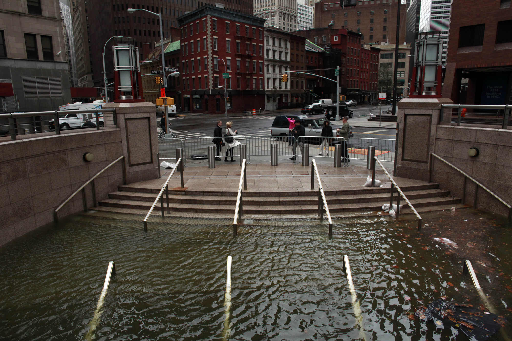
The challenges of sea-level rise cross boundaries of all sorts: geographic, political, social, economic. Proposed mitigation strategies will also necessarily shift and overlap. Here, we present five case studies from across the globe that offer intriguing ways—some operational, some philosophical—to address the threats associated with climate change. Drawing on a research initiative focused on vulnerabilities in Boston, a team at Sasaki Associates developed these additional design-strategy icons to illustrate the layered approaches. They are adaptable, the better to meet the unique demands of each coastal community.

Case Studies in Coastal Vulnerability: Boston, Seoul, Hamburg, Bangladesh & New York - More Images+ 6


Boston: Beware nostalgia

Boston Harbor. Photo by http://www.flickr.com/photos/rodzvilla/. Used under Creative Commons

by Steven G. Cecil AIA ASLA

The anticipated onslaught of rising seas and severe storm surges has grabbed media attention, spawning dramatic narratives about the urban disasters ahead. The science-based predictions are grim, raising specters of an additional 4 feet of storm-driven seawater flooding coastal cities by the end of the century.

In the recent past, we have formed urban-design and regulatory models around nostalgic visions of waterfronts as bustling civic and maritime edges, where an unspoiled environment meets the architecture of the city. But these approaches can become barriers to necessary innovation in the face of climate change.

Key state and federal regulations limit alterations of shorelines and piers, as though they were ideal configurations. We use the scale of 19th-century waterfront buildings as the standard of measure. We set aside some areas for waterborne commerce that has practically vanished. We reward development of high-value uses that draw people along the water’s edge in areas of high risk.

Many current policy discussions call for barrier strategies to save the city waterfront so that the future looks like this imagined past. But we need some historic perspective and design-based optimism before we take this defensive view too far. Urban waterfronts — Boston’s harbor is a prime case in point — have been remarkably successful over the centuries precisely because of bold design and engineering. We have redesigned and rebuilt urban harborfronts time and again to adapt to changes in economic, transportation, and civic priorities.

Pull out any of those great books with maps and drawings showing Boston Harbor’s evolution, such as Mapping Boston (Krieger, Cobb, Turner) or Gaining Ground: A History of Landmaking in Boston (Seasholes). They illustrate astonishing time-lapse leaps of urban change.

Look at the earliest views of the harbor. Boston was not, in fact, a great deepwater port at the start; mudflats dominated the water’s edge, and large ships sat on their hulls in the muck at low tide. The pattern of deepwater docks and finger piers around the harbor emerged only by knocking down hills and filling those flats. East Boston’s edge bloomed with clipper-ship construction during an era of sail that lasted scarcely two decades. The shipyards vanished, replaced by gigantic new piers hosting the Cunard Line, a gateway for immigration. Hundreds of acres of mudflats were transformed into the South Boston industrial waterfront, with its Fan Piers fed by rail spurs.

By midcentury, the shipping was nearly gone, piers rotted, and most marine-dependent businesses disappeared. Highways and parking lots filled in the deteriorating gaps. Those were the bad old days.

Since then, we have shifted course entirely. But we must realize that we did not “rediscover” a waterfront that was long lost. Rather, we scrubbed up the mess with unprecedented environmental standards and then recolonized the waterfront with uses corresponding to the strengths of our economy. We now have residences, offices, hotels, restaurants, and parks perhaps unimaginable to our predecessors.

A few years back, the South Boston waterfront was branded as our Seaport District. Revised branding is underway — the Seaport is now Boston’s Innovation District, successfully attracting science-based enterprises. We should think of all of our urban waterfronts as innovation districts, but from an even broader perspective: We need to reinvent the harbor and its borders through imaginative planning, architecture, and engineering based on emerging science and geared to the future.

Steven G. Cecil AIA ASLA has planned and designed waterfronts, ferry terminals, and harbor parks in Boston and throughout the country.

Seoul: Flood the zone

The Cheonggyecheon River, 2008. Photo: Michael Sotnikov.

by Chris Reed ASLA

Water needs more space in the city. For many centuries, rivers, floodplains, and protective wetlands have been filled in or moved to make room for urban growth. This work was done with a mindset that once the water is taken away — often engineered out of sight — it would not come back.

But we know better now. Superstorm Sandy’s impacts on the metropolitan New York coast, Hurricane Irene’s severe flooding of inland rivers in Vermont, and the 1996 storm that pushed Boston’s Muddy River into the Green Line tunnels (flooding Kenmore Station to 20 feet) all testify to this fact. Unfortunately, the engineering strategies used to control the water only aggravated the impact of these storms.

In giving back space to water, I don’t mean to fully displace urban and social uses. In fact, reintroducing natural systems can and must bring new life and richness into the public realm. Fish parks, bobbing buildings, water plazas, canal streets: all can be designed to recognize both civic and hydrologic functions, while giving a nod to their watery origins. We can transform vacant land into new wetlands — whether within the city or at the edge. Stormwater detention basins, small-scale rain gardens, and seawalls can now be rethought and expanded into large-scale ecological parks that bring value to adjacent neighborhoods.

Perhaps we can go further, integrating water into the fabric of the city itself. Public plazas, waterways, and boulevards can be designed as floodable green infrastructures, creating new open-space connections that could also work as elevated escape routes in the event of an emergency. My core landscape studio at Harvard’s Graduate School of Design takes these issues head-on, asking landscape architecture students to develop fully fledged urban strategies for a vulnerable coastal site that are finely tuned to the ecological and hydrologic dynamics in play, including the effects of storm surge and sea-level rise.

The Cheonggyecheon River in Seoul, South Korea, is a great example of this change in approach. Once covered by layers of roadway and highway, the Cheonggyecheon was uncovered beginning in 2003 and renovated as a new central riverfront in downtown Seoul. It is set below street level, in order to carry intense floodwaters during the rainy season. But it was designed primarily as a public space, with water plazas, riverwalks, and civic rooms all along it. It has become the heart of life in the downtown area, and it has catalyzed redevelopment of adjacent properties along its length, thereby further enhancing the urban fabric.

The project cleverly uses water constantly being pumped out from the city’s subway tunnels, and it is set up to accept the treated effluent from a nearby sewage plant to maintain water flow throughout the year. City folks have flocked to it, but it is also great new habitat for all sorts of invertebrates and birds and fish — including carp up to 2 feet in length!

These are examples of how existing cities can be renovated to better live with water, while creating vibrant public spaces. Importantly, these strategies require a shift in thinking: We need to adopt an amphibious mindset. And they point to new coordinated, interdisciplinary, and collaborative roles that our public agencies can play in remaking the city.

Chris Reed ASLA is principal of Stoss Landscape Urbanism and associate professor in practice of landscape architecture at the Harvard Graduate School of Design. His work focuses on water-based planning strategies and design projects from Milwaukee to Shanghai.

Hamburg: Raise the city

Tiered development along the Elbe River, 2013. Photo: ELBE&FLUT. Courtesy HafenCity Hamburg GmbH.

by Donna Denio

We’ve all heard that Germany is light-years ahead of the United States in responding to climate change. Is it true, and, if it is, are there practices that can inspire our own choices?

I recently joined a delegation of 13 women leaders on a trade mission to Hamburg to find ideas and insights that can help Boston become more climate-resilient. Seven in our delegation knew one another through the organization New England Women in Real Estate, and we included four architects, an engineer, several planners, and two who craft or influence policy. We chose Hamburg because this harbor city has a raised environmental consciousness, and for good reason: The North Sea flood of 1962 destroyed 60,000 homes and took 315 lives.

The newest neighborhood in Hamburg — and currently the largest urban-planning project in Europe — is HafenCity, a 385-acre development with 6,000 residential units along with retail, tourism, and business uses that will replace a declining neighborhood along the Elbe River. Jürgen Bruns-Berentelg, CEO of HafenCity Hamburg GmbH, the master developer, described his team’s priorities. “Each public tender has focused on social innovation and creative ground-floor uses because, in Hamburg, the social obligation of ownership is a foundational idea of society. If all you have to offer is a pot of money, go home and sleep.”

In the early 1990s, with the harbor’s prominence in decline, civic leaders began reimagining the sparsely populated urban dock area a half-mile from city hall. A visionary masterplan by a Dutch-German team, led by Kees Christiaanse/ASTOC, set the stage. The plan mandated that the entire area have the same level of flood protection as areas of Hamburg next to the dike, between 24 and 28 feet above mean sea level, depending on distance from the water’s edge.

So HafenCity is tiered with a 30-foot difference in elevation. The lowest levels, closest to the water’s edge, are designed to flood and are for pedestrians and bikes. The next level is for sealed storage space and underground parking, and the highest level — 28 feet above mean sea level — is for buildings and major roadways for cars and emergency vehicles.

During seasonal peak-water conditions, plazas fill with water and become reflecting pools. Changes in paving material mark crosswalks and paths designated for pedestrians and bicycles. Benches and community spaces are cast into the backs and sides of ramps and steps, permanent structures that will not wash away.

The liveliness of the area is enhanced by the planning mandate that the ground floor of every building be community space. The parks adjacent to the waterfront are designed to attract people 24/7. People walk, bike, sit, spoon, read, feed the fish, and soak their feet in the water. This is no fortified city where the river acts as a moat.

Now about 50 percent complete, HafenCity has been nominated for the 2013 Urban Land Institute Global Award for Excellence. New York City is already embracing the HafenCity model. As reported in the December 2012 Architectural Record, planning guidelines for flood-prone Willets Point, in Queens, call for raising the entire site 14 feet above mean sea level, incorporating terraced public space at the water’s edge.

Which waterfront areas in Boston could benefit from a tiered planning approach? Or will it take a flood?

Donna Denio is a communication specialist and team-builder who believes the collective power of design leadership, especially by women, will change the world for the better.

Bangladesh: Honor simplicity

Villages after Cyclone Gorky, 1991. Photo: Staff Sergeant Val Gempis.

by Jennifer Leaning MD

As sea levels rise a predicted 3 to 6 feet by the end of the century, coastal and island populations in low-lying areas will bear the greatest brunt: more violent storms and the gradual inundation of agricultural and settlement areas. Among the most vulnerable places on the planet is Bangladesh, where half the population of 150 million lives in lowlands athwart the Bay of Bengal.

Tropical cyclones strike the Bangladeshi coastline routinely; very powerful ones strike at least every 15 or 20 years. In the last 40 years, faced with three extremely strong cyclones and massive population growth in the at-risk areas, the country can claim a somewhat heartening — albeit grim — record of declining storm-related deaths.

When Cyclone Bhola raged up the Bay of Bengal in 1970, with winds at 125 miles per hour pushing a storm surge of 27 feet inland for miles, it drowned an estimated 500,000 people. That was a different South Asian world in terms of technology (warnings only from ships at sea); governance (Bangladesh was then East Pakistan); and disaster planning (minimal attention, except to epidemic disease).

But the 1970 cyclone became blurred in public memory as citizens and leaders struggled to overcome the brutal 1971–72 civil war that created independent Bangladesh and forge a viable state. By 1991, the population had almost doubled, and the new generation, largely ignorant of 1970, paid little heed to the sparse and late warnings that Cyclone Gorky was upon them. Of similar strength and trajectory, Gorky resulted in an estimated 150,000 deaths.

Then the country galvanized its resources to put a stop to this cycle of heavy disaster mortality. It undertook small but thoughtful population studies that yielded important findings: Women died in much greater proportions than men because they could not run as fast to get out of the way; because they did not know how to swim; because their saris and long hair got caught in the debris; because their upper arms lacked comparative strength to hold on to branches; because they were also trying to hold on to their children. The elderly and children had very high death rates for many of these same reasons. People did not want to leave their homes and belongings — particularly those who were most poor. The shelters were too far away and degraded by animal and human waste.

Armed with this information and spurred by public grief, the government invested heavily, building improved and more numerous shelters inland and acquiring the best technology for early storm warnings. Local nongovernmental organizations began to teach families and women self-salvage tactics (tie your hair up in your sari; pay close attention to the warning signals). In 2007 Cyclone Sidr struck with very similar force and created similarly strong storm surges; yet this time, the storm-related deaths numbered 5,000.

As in Bangladesh, local adaptation linked to concerted government planning may prove a strong pillar in the world’s response to impending sea-level rise. Yet more profound adjustments, such as out-migration, may be necessary for some islands and coastal flood plains. What makes Bangladesh special is that for decades the entire society has focused on how to mitigate its ever-present danger from the sea.

Jennifer Leaning MD is the director of the François-Xavier Bagnoud Center for Health and Human Rights at Harvard University.

New York: Think coastal, plan local

New York after Hurricane Sandy. Photo by André-Pierre du Plessis – http://www.flickr.com/photos/andrepierre/. Used under Creative Commons

by Jane Amidon

Cities and coasts are like peanut butter and jelly, like Sonny and Cher — partnerships that were mutually beneficial in the beginning but have become ripe for reinvention. Peanut allergies and acrimonious divorces happen; extreme storms and floodwaters rise. For vulnerable urban waterfront zones, locations that once made great sense economically now present formidable questions. How much is at risk? What needs to change? How long will it take?

According to a study by the Organization for Economic Cooperation and Development, the top five global cities economically exposed to coastal flooding — Miami; New York–Newark, New Jersey; Kolkata, India; Guangzhou, China; and Shanghai — are forecast to have more than $12 trillion in combined coastal assets at risk by 2070. The imperative of climate-change adaptation calls for not just protection and remediation but a wholesale redefinition of the land-water interface.

In response, several coastal cities have shifted gears from what should be planning modes to a data-driven process of understanding what might be. Alternatives-based scenario building is gaining ground on masterplanning, particularly in the uncertain terrain of urban waterfront districts. As with the strategic shift in the healthcare industry from treatment to prevention, urban coastal management is moving from top-down prescription and hard infrastructure toward the bottom-up potential of multipronged resiliency models.

One such model is New York’s PlaNYC 2030 and its related initiatives, such as the Stronger, More Resilient New York strategic framework, released in June 2013 after Superstorm Sandy. Much of this work involves rearranging the city’s relationship to water. Aimed at diverse players, from politicians to designers to the general public, these tools offer hyperlocal and flexible goals, practices, and parameters instead of hard metrics. They respond to regionally specific conditions rather than conveying universal rules of thumb. Indeed, a fascinating and frightening lesson from Sandy was the varied impact on the coastline wrought by seemingly minor differences in orientation, wind direction, tidal cycle, soil type, and degrees of urbanization.

Since Sandy, a growing body of science, advocacy, and funding in so-called coupled human and natural systems (CHNS) is encouraging municipalities to approach coastal resiliency at the neighborhood level, couched within systems-scale research and analysis. The Stronger, More Resilient New York report, for example, reveals that while some aspects of the superstorm were long predicted, such as flooded subway tunnels, officials did not anticipate the devastating intersection of multiple systems failures: rail, road, electricity, food, and fuel supplies.

In lower Manhattan, investigators learned that despite current development patterns, flooding of roads, parks, and more than 130 million residential and commercial square feet followed historic inland topography; water seeks its level, and these floodwaters sought long-disappeared rivers, canals, and marshes. As a result, the framework outlines first-phase coastal protections such as multipurpose levees integrated with development and transit improvements, passive flood walls with coastal edge-conservation measures, and building code and insurance amendments.

All of this points to the city/region as the locus of innovation in response to sea-level rise and powerful storms. Recognizing the coastal metabolism in coupled human and natural systems will allow other waterfront cities to develop comprehensive “user’s manuals” such as PlaNYC. Although it is no longer possible for Sonny and Cher to reunite, this generation’s cities are clearly re-embracing their waterfronts, and cities such as Boston should continue to rediscover their intrinsic coastal attributes as an engine for managing environmental vulnerability and economic vitalization.

Jane Amidon is a professor and director of the urban landscape program at Northeastern University. She lectures and writes on modern and contemporary landscape and urbanism.

About this author
Cite: ArchitectureBoston. "Case Studies in Coastal Vulnerability: Boston, Seoul, Hamburg, Bangladesh & New York" 04 Feb 2014. ArchDaily. Accessed . <https://www.archdaily.com/473188/case-studies-in-coastal-vulnerability-boston-seoul-hamburg-bangladesh-and-new-york> ISSN 0719-8884

You've started following your first account!

Did you know?

You'll now receive updates based on what you follow! Personalize your stream and start following your favorite authors, offices and users.