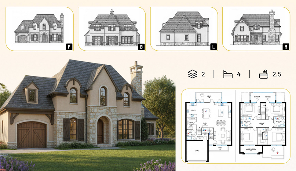
This guide covers a workflow that moves from project parameters to generated floor plans, 3D perspective views, exterior design exploration, and site context visualization, using AI tools in place of preliminary CAD and rendering work.
This guide covers a workflow that moves from project parameters to generated floor plans, 3D perspective views, exterior design exploration, and site context visualization, using AI tools in place of preliminary CAD and rendering work.
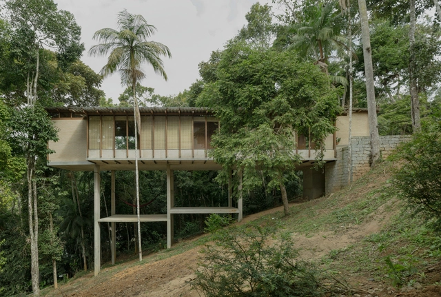
A cada ano, a equipe de Curadoria de Projetos do ArchDaily rememora a vasta gama de obras publicadas ao longo desse período, apresentando retrospectivas que permitem não apenas identificar tendências e variações na produção arquitetônica, mas também reconhecer de que forma impactam a nossa audiência. No ArchDaily Brasil, a seleção anual de melhores casas – que ano após ano, segue permanecendo como nossa categoria de projeto mais popular – representa uma amostra das variadas soluções, estratégias, técnicas e materiais encontrados na arquitetura residencial dos países de língua portuguesa.
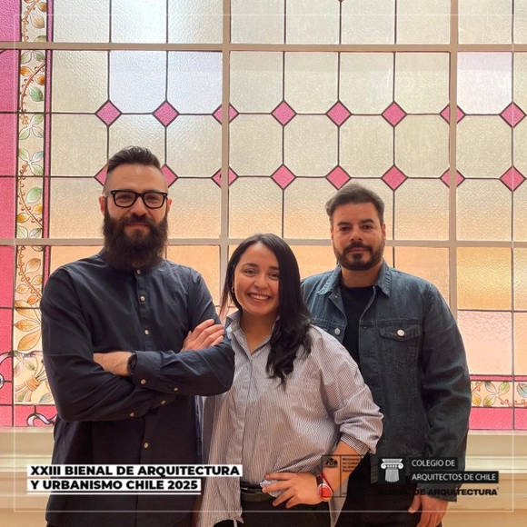
The Architects Association of Chile and the Ministry of Cultures announced the results of the competition for the XXIII Chilean Biennial of Architecture and Urbanism. The winning proposal, "Double Exposure: reprogram, revitalize, rebuild", by Sebastián López, Ángela Carvajal, and Óscar Aceves, addresses interventions in disused heritage spaces, merging old and new works. In addition, awards were presented to "Urban Amusements" and "Weaving Territories". The event reflects on historical architecture and its revitalization.
The curatorial team for the XXIII Chilean Biennial of Architecture comprises Sebastián López Jeldes, Ángela Carvajal Fernández, and Óscar Aceves Álvarez, and the jury is composed of Fernando Pérez Oyarzún, Amarí Peliowski, Cristián Izquierdo, Macarena Cortés, Pablo Rojas, Beatriz Buccicardi, Fernando Miranda, Martín Urrutia, and Vicente Burgos.
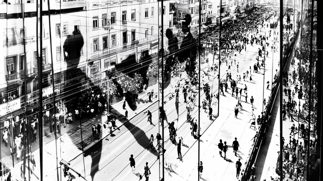
Seeking to reflect on the contemporary city invariably runs up against the limitations imposed by the methods of the Modern Movement. Classical sciences and their deterministic methods, which guided—and still guide—the urban planning of this era, describe world phenomena through strict causal relationships and, consequently, define them by reductive universal laws that exclude contradictions and uncertainties. The frequent result of these perspectives is an idealized, mechanistic world that denies the complex, actual nature of phenomena such as cities.
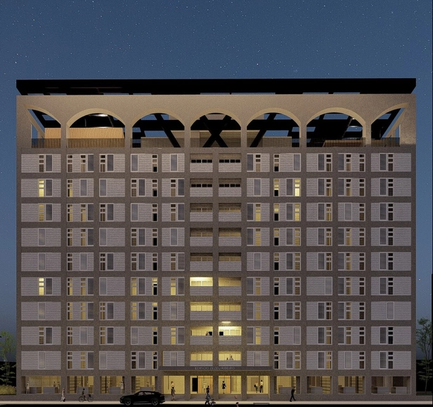
The Council for Architecture and Urbanism of Amazonas (CAU/AM) announced the winners of the ATHIS Ideas Competition - Arquiteto e Urbanista Zezéu Ribeiro Award, which sought to promote technical assistance projects for social housing (ATHIS). The initiative's main goal is to address the housing challenges of vulnerable communities in the state through affordable, innovative, and socially responsible architectural solutions.
The winning projects stood out for their sensitive and contextualized approach to local needs, incorporating principles of sustainability, community participation, and the efficient use of resources. Focusing on housing improvements, land tenure regularization, and the upgrading of urban spaces, the proposals align with the objectives of the ATHIS program, established by Federal Law 11,888/2008, which guarantees free technical assistance to low-income families.
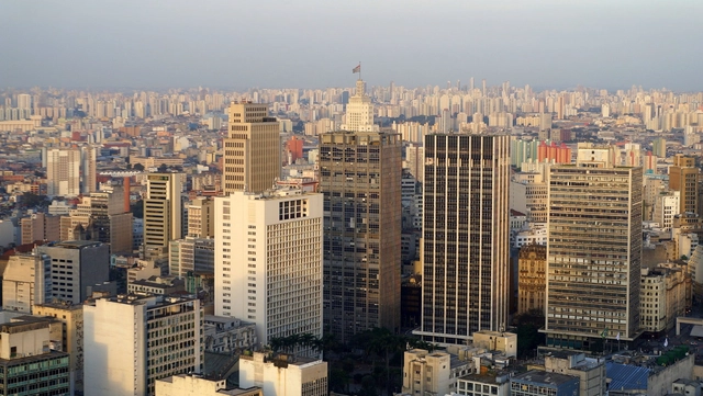
Real estate speculation is undoubtedly the greatest villain singled out by those who study, inhabit, or are simply interested in cities today. It gets blamed for practically every urban problem: whether a city is too dense or too sprawling, choked with traffic or prohibitively expensive; whether local politics are corrupt or the poor are marginalized to the periphery; whether corporations profit from public investments or public infrastructure lies idle; whether historic heritage is destroyed, new buildings alter the cityscape, or informal settlements are burned down. The list is endless.
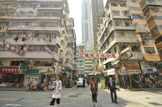
Many authors address the importance of the street to vitality in urban space. Streets are public open spaces, typically bordered by the buildings that shape them. We rarely realize it, but it is through this open space that we appropriate the city, and where the experience of walking takes place.

Casa Lacerda, one of the main architectural heritage sites in the Lapa region (Paraná), will soon be revitalized. Currently operating as a museum and Heritage House—with rooms styled to recreate the home of a traditional local family—the space will be expanded with the construction of an annex. On Wednesday (18), the National Historic and Artistic Heritage Institute (Iphan) and the Paraná Department of the Institute of Architects of Brazil (IAB-PR) announced the winning proposals of the national design competition for the new building.
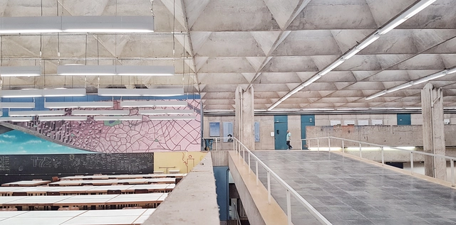
The School of Architecture and Urbanism at the University of São Paulo (FAU USP), one of the most prestigious architecture schools in Latin America, recently launched its YouTube channel—an initiative that continues efforts to highlight its community's work and democratize knowledge. Featuring student projects, lectures, documentaries, and expert perspectives on a wide range of topics, the channel offers diverse and relevant content.
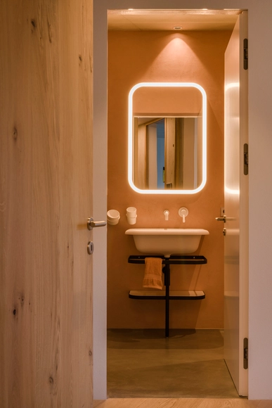
A successful interior design must be paired with a proper lighting design. It is responsible for ensuring that the quantity and wattage of the bulbs are suited to the space based on its dimensions and use.
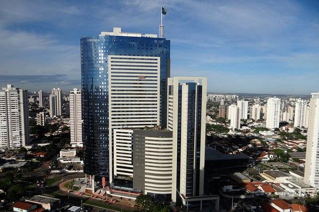
On flat terrain, where the horizon is visible in every direction, buildings with over forty stories rise across different areas of the city. Recently, a fifty-story building was completed; at 191 meters (626 feet) high, it is the tallest in the country. While some criticize this development model for its impact on the landscape, in a capital with rapid population growth, one would expect the cost of housing to rise steadily, along with the housing deficit. This, however, is not the case in Goiânia.

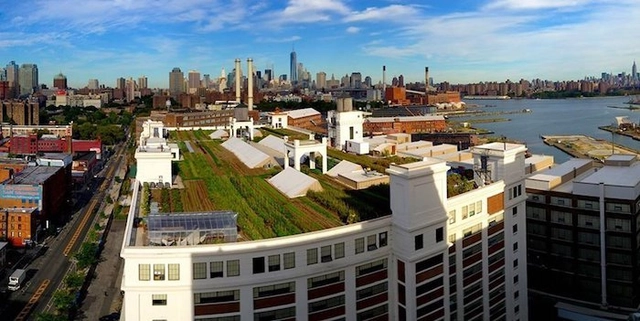
More than 36 tons of organic vegetables are grown on New York City rooftops every year. Beyond providing food, these green roofs also prevent pollutants from reaching the city's rivers.
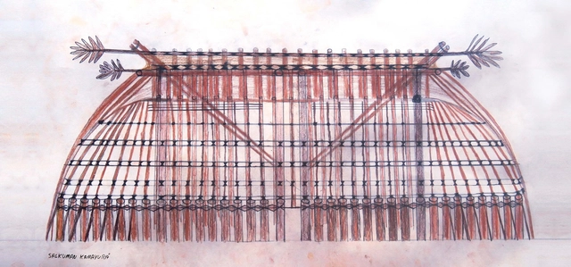
In July 2019, the habita-cidade Platform [1] organized the "Ways of Dwelling: Traditional Architectures" Travel-Workshop, which brought students and professors to the Ypawu Village in Kamayurá territory, in the Upper Xingu. The general objective of the "Ways of Dwelling" Travel-Workshops is to foster constructive reflection on the diverse forms of human habitat across the planet. This year, responding to a request from Kamayurá master builders to produce a manual on local architecture, the Travel-Workshop was designed so that the visiting group could support this important endeavor. The idea for the Kamayurá Architecture Manual was first proposed by Kanawayuri L. Marcello Kamaiurá (a local leader) to architect Clarissa Morgenroth (a graduate of Escola da Cidade) and theater director Cibele Forjaz. Escola da Cidade was then invited to join the project, which was taken on by the habita-cidade Platform, an initiative linked to the *lato sensu* postgraduate program "Housing and City."


The Master Plan is the basic instrument for defining a municipality's development model. It establishes guidelines and strategies for executing plans, programs, and projects, seeking to emphasize public participation as well as economic, social, and environmental sustainability. Yet, its influence on the city goes far beyond what is commonly imagined: it ultimately dictates the volume and form of every new building.
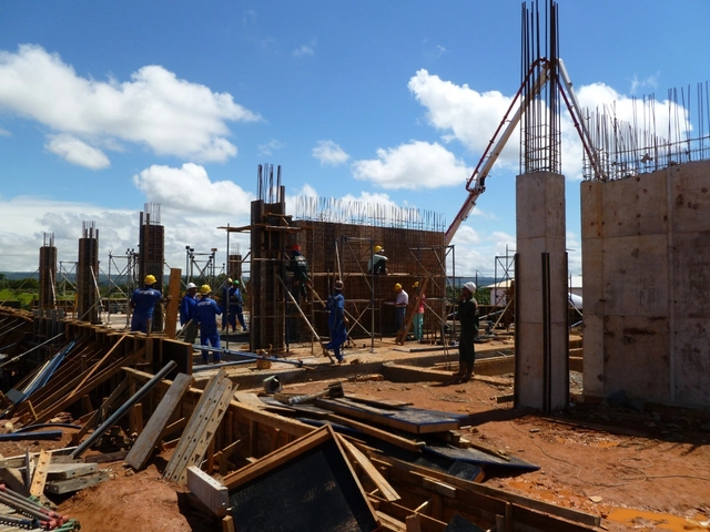
Growing concern over the use of natural resources in architecture has drawn increasing attention from professionals and researchers, pointing toward a future where architects must not only design but also facilitate the decommissioning and recycling of buildings. Against this backdrop, raising awareness about water waste on construction sites has become a major priority—an issue addressed in a recently launched guide by the São Paulo State Construction Industry Association (SindusCon-SP), Caixa Econômica Federal, and the United Nations Development Programme (UNDP).

The city of São Paulo is the first in South America to freely release laser-scanned data covering its entire territory. The files are available for download on the GeoSampa Portal. The technology, known as LiDAR (Light Detection and Ranging), goes beyond standard satellite imagery or aerial photography to provide a high-resolution geometric representation of a city. Consequently, it offers a much more accurate and detailed model of the mapped area.
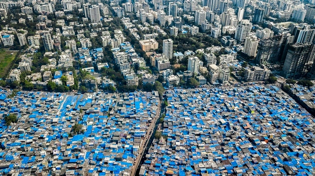
Imagine Lagos, Nigeria, a city of 22 million people. What was once a small coastal town just a few decades ago has exploded into a sprawling megacity stretching over more than 1,170 square kilometers. This rapid growth has strained municipal services to their limit: less than 10% of people live in homes connected to sewer networks, and less than 20% have access to running water. Many homes are in slums or informal settlements on the city’s periphery.
Now imagine Lagos twice as large.
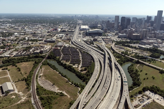
While conventional American urbanism is known to drive excessive sprawl, it is worth remembering that, ultimately, the true extent of a city's horizontal expansion lies far beyond the reach of urban planning controls.

From revitalizing degraded green spaces to hosting collaborative games, events, and workshops, there are numerous volunteer initiatives capable of transforming a city's landscape and the lives of its residents.
In addition to serving as vital forms of social participation, community collectives and volunteer-driven initiatives facilitate dialogue between public authorities and local communities. This collaboration yields numerous benefits, particularly in reshaping how we interact with our cities.
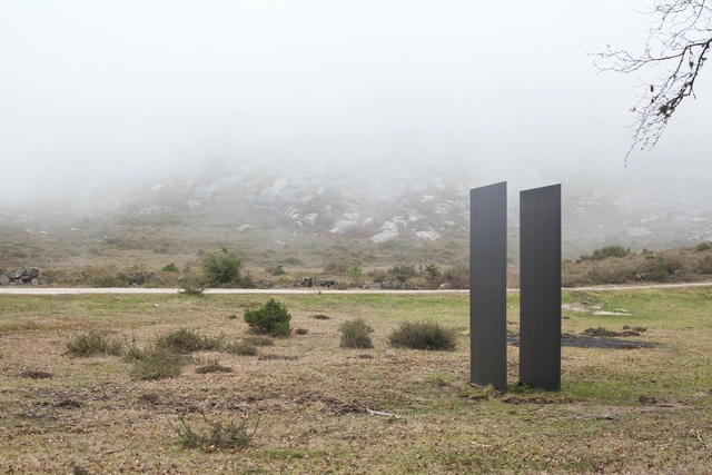
The Alto Minho region in northern Portugal had its landscape transformed by a series of site-specific artistic interventions that were part of the DESENCAMINHARTE program. The initiative aimed to promote artistic creation in the region through a collaborative network designed to foster recognition of its local identity.
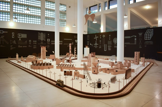
The exhibition Victims: A Work by John Hejduk materializes the unbuilt work of the New York architect, presented here for the first time by the Leopoldo Rother Architecture Museum at the National University of Colombia. Alongside the scale model of the project, the 67 figures are accompanied by narratives, illustrations, and a short film titled Structures of a Wound.
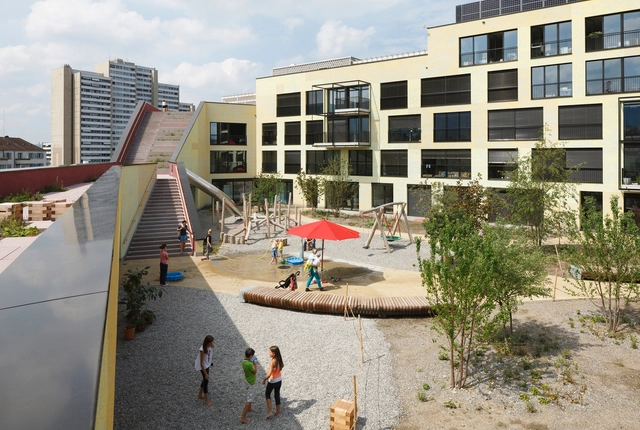
The magazine Solidarity Housing Production: An International Overview was launched on Monday, November 25, at the opening of the National Seminar on Technical Assistance for Social Interest Housing. The publication compiles the main contributions from the event of the same name, held in July 2018. Organized by architects and urban planners Luciana Ximenes and Thais Velasco, the magazine was produced by CAU/RJ and the Observatório das Metrópoles (Ippur/UFRJ).
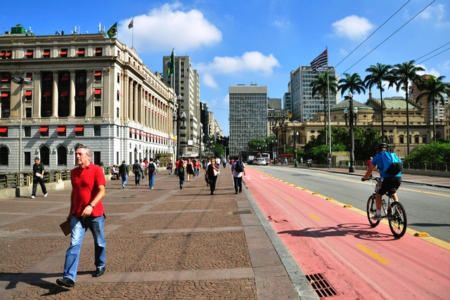
Five Brazilians die in traffic accidents every hour. While highly critical statistics like this can spark positive reactions, they are not always enough to change reality on their own. However, knowing that in the city of São Paulo intersections concentrate more accidents per kilometer, and that these rose by 5% from 2017 to 2018, provides decision-makers with the concrete data needed to implement measures to reduce these numbers. Acting on the most dangerous intersections will save lives.

A quality public transit system does not depend on buses alone: its overall quality is also directly linked to adjacent elements—such as bus stops. In all cities participating in the QualiÔnibus Benchmarking Group, bus stops were identified by the public as one of the most problematic components. But what can cities do to improve them?
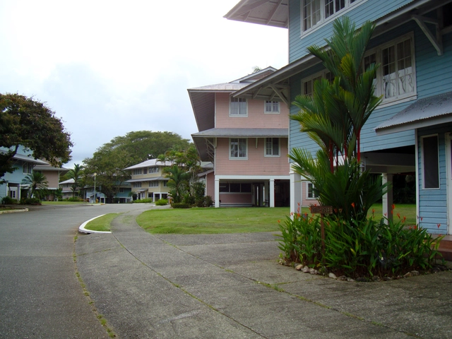
The book Sustainable Tropical Cities, published by the Institute of Tropical Architecture (San José, Costa Rica) in 2006, gathers the conclusions its authors compiled over years of observation and study. Bruno Stagno and Jimena Ugarte, both architects and immigrants enamored with the tropics, aimed to demonstrate the specific characteristics that cities located in the tropical belt possess—or should possess—while introducing an unprecedented topic.