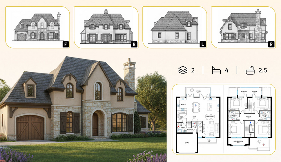
This guide covers a workflow that moves from project parameters to generated floor plans, 3D perspective views, exterior design exploration, and site context visualization, using AI tools in place of preliminary CAD and rendering work.
This guide covers a workflow that moves from project parameters to generated floor plans, 3D perspective views, exterior design exploration, and site context visualization, using AI tools in place of preliminary CAD and rendering work.
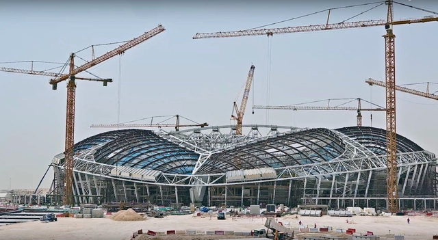

The year is 2010. As the first Arab country selected to host the 2022 FIFA World Cup, Qatar is already ramping up its preparations to host this highly anticipated and costly event 12 years down the line. Extensive construction and reconstruction efforts are being launched, targeting not only the facilities directly demanded by FIFA, but also, more broadly, the urban infrastructure systems of the country's major cities.

When driving alongside a bike lane, it is hard to escape comments like “it’s always empty,” “it takes away space from cars,” or “businesses lose customers.” But is there any truth to these claims? Here are some of the most common myths about bike lanes – and the reality behind them.

“Writing is like a city, for which words are a thousand gates.”
- Walter Benjamin
No roads or maps lead to them. Yet, many of the cities imagined in literature feel more tangible than real ones, capturing the human imagination with their fantastical sparks. The rich geographical, cultural, and social detail of cities like the famous Macondo, from One Hundred Years of Solitude, frequently places a magnifying glass over the relationship between territory and its inhabitants.
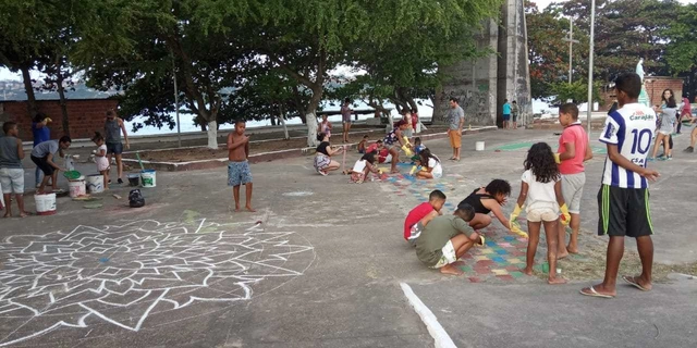
As a result of three months of training in local engagement within the pioneering COURB Ambassadors Program, mobilizers from various Brazilian cities promoted actions in their territories. Aiming for the collaborative construction of inclusive cities, the Articulation Journey—a highly collaborative effort—took place between August and September and featured three types of actions: roundtables, territorial interventions, and collective proposals. The ambassadors mapped and engaged more than 150 institutions in the program, including city halls, universities, collectives, businesses, and organizations.
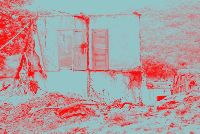
Economic and urban processes are known to drive major modifications in the urban structure. In light of the events of January 25, 2019, with the collapse of the Brumadinho dam, it is clear that environmental negligence by major mining corporations also has the power to produce profound consequences and alter the ways in which people inhabit and utilize the territory.

Metropolis is a word derived from the Greek metropolis, a combination of meter (mother or womb) and polis (city). Thus, the metropolis is the mother city, the most important within a context where several interconnected cities depend on one another to fully function. In most cases, metropolises feature conurbations of multiple urban clusters.
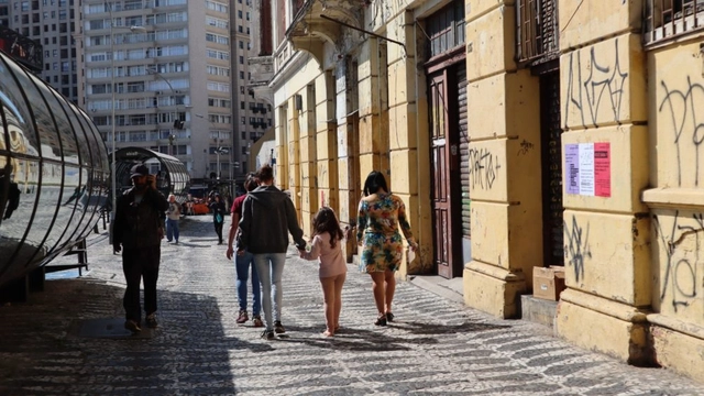
Have you already crossed the street out of fear today? As a woman, what is your greatest fear when walking down the street? How would you feel safer? With the goal of reflecting on how we can plan more egalitarian cities for everyone, the firm amb ateliê, in partnership with architects Fernanda Linero and Beatriz Teixeira, launched this initiative across various neighborhoods in Curitiba. The project ci.da.de; substantivo feminino (city; feminine noun) is part of the 3rd Biennial Architecture Exhibition for Curitiba.
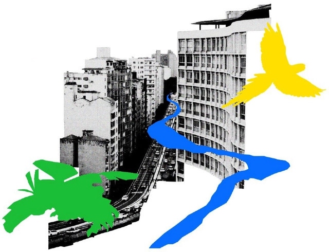
In May of this year, *The Guardian* recommended in its style guide that journalists and contributors heighten their language when discussing climate change or global warming. Now, the British newspaper announced, it is a climate crisis, emergency, or climate breakdown.
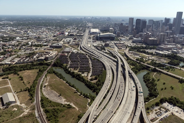
While conventional American urbanism is known to drive excessive sprawl, it is worth remembering that, ultimately, the true extent of a city's horizontal expansion lies far beyond the reach of urban planning controls.
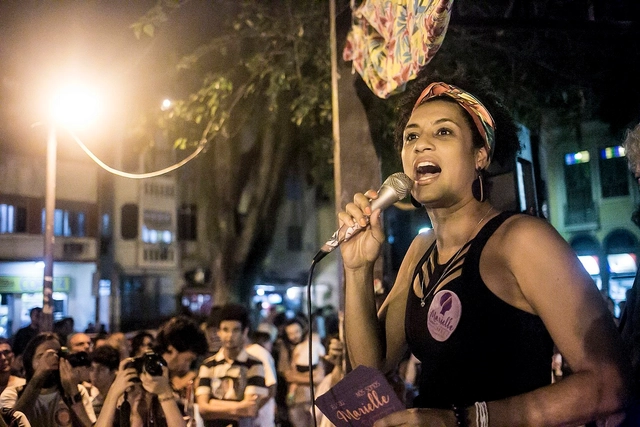
Today marks one year since the brutal assassination of Rio de Janeiro sociologist and city councilwoman Marielle Franco. The week before her death, Marielle took part in a series of debates organized by CAU/RJ called "Architecture - Feminine Noun," aimed at strengthening mobilizations for International Women's Day.
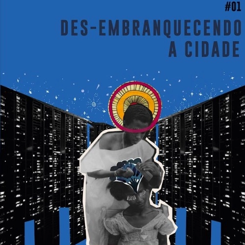
The “De-whitening the City” Podcast is a space invented from the desire of five Black women residing in Salvador, São Paulo, Rio de Janeiro, and Belo Horizonte to circumvent geographic distance in order to foster and celebrate connection. Emmily Leandro, Gabriela Gaia, Luciana Mayrink, Malu de Barros, and Natalia Alves make up the Terra Preta collective, giving shape and voice to this exercise in creating a shared virtual territory—both a political and aesthetic commitment—now made public for the first time.
_(Custom).jpg?1559915700&format=webp&width=640&height=580)
C40 Cities, a global coalition of cities, launched a competition to select the best solutions for transforming underutilized urban spaces into resilient, carbon-neutral developments. Named Reinventing Cities, the competition selected 15 innovative ideas poised to "reinvent" the future of cities.
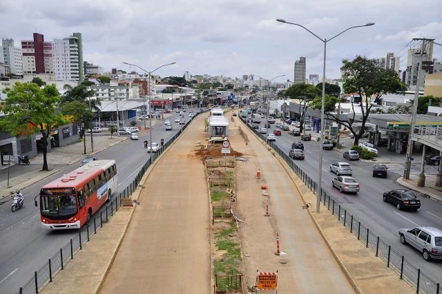
Improving public transit requires close attention not only to vehicles and routes, but to how people access and exit them. All too often, urban planning fails to account for the diverse needs of all individuals and how they navigate a transit system.

From revitalizing degraded green spaces to hosting collaborative games, events, and workshops, there are numerous volunteer initiatives capable of transforming a city's landscape and the lives of its residents.
In addition to serving as vital forms of social participation, community collectives and volunteer-driven initiatives facilitate dialogue between public authorities and local communities. This collaboration yields numerous benefits, particularly in reshaping how we interact with our cities.

The research project Aurelio Martinez Flores: The Work of the Mexican Architect in Brazil (1960-2015) investigates the life and architectural career of Mexican architect Aurelio Martinez Flores (1929–2015) from 1960 to 2015, aligning with Latin American architectural history and the growing interest in recovering architects whose careers ran parallel to the mainstream movements in Brazil over the last several decades. Although little known, his work exerts a significant influence on one of the most successful currents of contemporary Brazilian architecture.
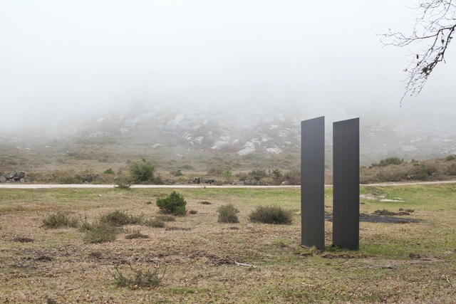
The Alto Minho region in northern Portugal had its landscape transformed by a series of site-specific artistic interventions that were part of the DESENCAMINHARTE program. The initiative aimed to promote artistic creation in the region through a collaborative network designed to foster recognition of its local identity.
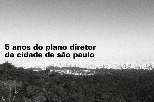
Five years ago, São Paulo approved its Master Plan, a social pact to transform the city by 2029. While a significant portion of the planned actions have been carried out or are currently underway, just as many remain on paper. Assessing this period is essential to achieving the ultimate goal of this entire process: improving the quality of life for its residents, especially those who need it most.

At least two major avenues (23 de Maio and 9 de Julho) mark the footprint of the 1932 Constitutionalist Revolution in the city. Yet, across the capital's landscape, numerous other sites evoke the memory of an armed conflict that became the defining myth of São Paulo's history, commemorated as a state holiday since 1997.


"I Saw a Brazil on TV" was the theme of the debate that, on November 8, 2018, brought together a group of architects participating in the exhibition "Infinite Span - 90 Years of Brazilian Architecture" at the Instituto Moreira Salles in São Paulo.

The formal configuration of open space systems in Brazilian cities—whether qualified or not—derives a significant contribution from private developments, since public urban planning and design have historically been the exception.
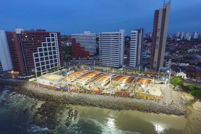
Architects and urban planners evaluated the services offered by CAU/BR and the state-level CAU/UFs. Out of nine services analyzed by the professionals, seven received an average score above 7 on a scale of zero to 10. These and other findings are part of the CAU Evaluation Survey conducted by the Datafolha Institute in May. The study interviewed 1,500 architects and urban planners and 500 architecture and urban planning firms by telephone to assess the effectiveness of the Council's communication channels with professionals and society, as well as to gather information to support initiatives ensuring access to the entity's information.
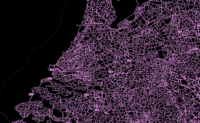
For some time now, cycling infrastructure planning has become a priority for several countries around the world seeking to seriously mitigate the challenges of rapid urbanization. In this regard, it is worth looking at which countries are expanding their cycling networks and understanding the development patterns established for each of them. OpenCycleMap is a project that makes it possible to clearly identify these countries and analyze their networks in great detail.
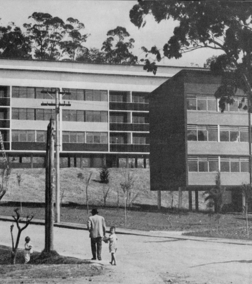
After studying civil engineering at the Escola de Minas de Ouro Preto, Carlos Frederico Ferreira returned to his native city of Rio de Janeiro and enrolled in the Escola Nacional de Belas Artes, graduating in architecture in 1935. In 1939, he was hired by the IAPI as an engineer-architect and soon rose to the position of head of the institute's Engineering Department. By 1943, having overseen the partial completion of the first major housing development, the Conjunto Residencial Operário in Realengo, he was able to begin expanding the model to other locations. The designs for Vila Guiomar in Santo André and Piratininga in Osasco, as well as the apartment building and IAPI Regional Office headquarters in Recife—all designed by him—demonstrate how, through his position, he sought to shape the direction of the institute's future developments.
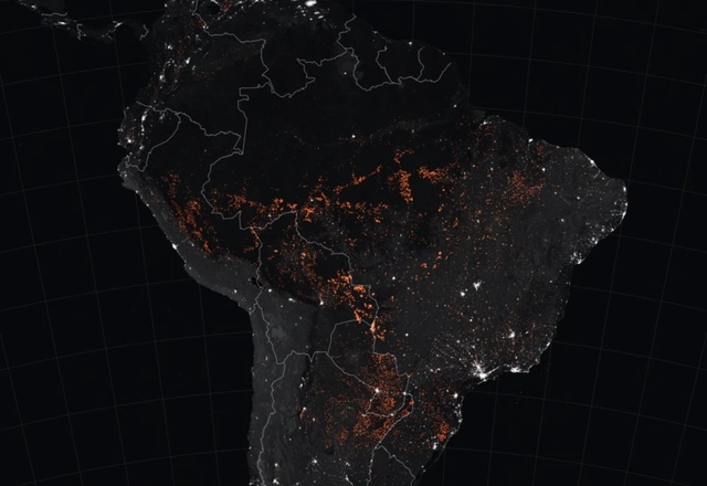
Over the past week, thousands of active fires in the Brazilian Amazon captured global attention in the press and on social media, where the hashtag #PrayForAmazonia was mentioned more than 150,000 times in a single day. But what can satellite data tell us about what is actually happening in Brazil's forests?