How to Use a Drone to Create a Detailed 3D Context Model

Subscriber Access

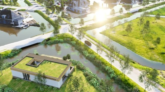
While working in 3D-visualization software such as Lumion, features such as OpenStreetMap (OSM) and satellite ground planes can provide some context for your design. They are suitable options for quickly building urban or rural environments relevant to your project’s location, but they’re also limited. For instance, OSM only provides rough building shapes, rendered white, and the satellite maps are flat, often outdated, and the resolution is too low for client visualization.

NYC skyline with context provided by OpenStreetMap, rendered in Lumion 8.3. Image Courtesy of Lumion
Content Loader

Image gallery

See allShow less
About this author
Cite: Pjotr van Schothorst, Lumion. "How to Use a Drone to Create a Detailed 3D Context Model" 23 Aug 2018. ArchDaily. Accessed . <https://www.archdaily.com/899196/how-to-use-a-drone-to-create-a-detailed-3d-context-model> ISSN 0719-8884

You've started following your first account!

Did you know?

You'll now receive updates based on what you follow! Personalize your stream and start following your favorite authors, offices and users.