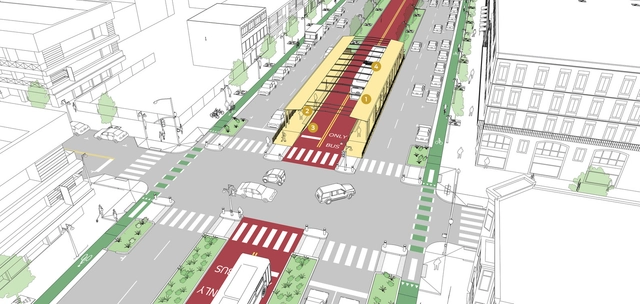
The latest publication of the National Association of City Transportation Officials, NACTO, is the "Transit Street Design Guide" in which tips and proposals are presented on how to improve streets through urban design.
The ideas are centered on prioritizing sustainable mobility so that both the member cities of the organization and those that have access to this document can improve their practices in relation to public spaces, mobility, and transportation.
Over the last few years, the way Americans move around has changed remarkably, especially among young people. Previously the automobile was people’s preferred, if not the only, option. Now they are choosing to walk, bike, or use public transport according to recent studies.
This difference in preferred transportation methods has generated many benefits not only for residents but also for cities, in both economic and social terms.
Building a highway in a city is often thought of as a solution to traffic congestion. However, the induced demand theory has shown that when drivers have more routes, they choose to continue using this medium instead of using public transport or a bicycle, and as a result, congestion doesn’t decrease.
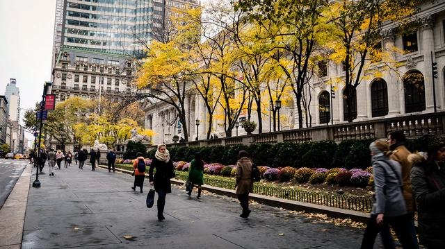
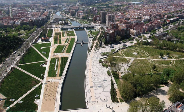
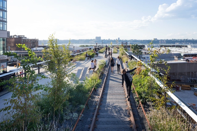
As a result, some cities have chosen to remove spaces designated for cars and turn what was once a highway into urban parks and less congested streets.
Here we have six examples, some have already been completed, while a few are still under construction. To the surprise of some, most of the projects are in the US, which reflects that American designers are looking into further studying European transport policies.
Buenos Aires' contemporary urban landscape as we know it today provides a tempered mix of historical and recent construction projects. As one of the most beautiful cities in South America, it's wide boulevards and grand buildings, based on European models, have morphed to embrace the needs of a modern metropolis.
These images show just how profoundly time affects our cities (and how centuries-old foliage can powerfully transform spatial perception).
Browse the 20 interactive images of Buenos Aires before and after.
A recent article published in Nature makes a bold claim: we're analyzing our cities completely wrong. Professors David Wachsmuth, Aldana Cohen, and Hillary Angelo argue that, for too long, we have defined sustainability too narrowly, only looking at environmental impact on a neighborhood or city scale rather than a regional or global scale. As a result, we have measured our cities in ways that are inherently biased towards wealthy cities, and completely ignored the negative impacts our so-called "sustainable," post-industrial cities have on the rest of the world.Metropolis editor Vanessa Quirk spoke with Professor Wachsmuth to learn more about the unintended knock-on effects of going "green," the importance of consumption-based carbon counting, and why policy-makers should be more attentive to the effects of "environmental gentrification."
From the Cradle of Civilization in ancient Mesopotamia to the modern urban explosion in China, cities are among the most obvious and dramatic evidence of human existence. In a recent paper published in Scientific Data, a team led by Yale University researcher Meredith Reba mapped the emergence of cities between 3,700 BC and 2,000 AD based on when their populations were first recorded in historical accounts.
Taking the data from this study, Max Galka of Metrocosm has produced this fascinating animation showing the history of cities worldwide. "Most datasets available go back only a few years or decades at most. This is the first one I've seen that covers 6 millennia," Galka told CityLab. "I'm a big fan of history, so after reading the study, I thought it would be interesting to visualize the data and see if it offers some perspective." The steady flow of time may seem a little slow at first, but stick with it through the early BC years and the shifts in urban development start to get intriguing. And—spoiler alert—buckle up as you approach the 20th century.
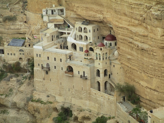
Jericho, Palestinian Territories, 9,000 BC. Image Courtesy of Wikimedia User: Dr. Avishai Teicher Pikiwiki Israel licensed under CC BY 3.0
Have you ever wondered which are humanity's oldest cities? Matador Network has compiled a list of the world's ancient metropolises, and perhaps unsurprisingly, nearly all of them are within or adjacent to the Fertile Crescent, a moon-shaped region running from the Persian Gulf through what is today the south of Iraq, Syria, Lebanon, Jordan, Israel, and the Nile River Delta in Egypt. With settings that range from hamlets on the road less traveled, like Susa, Iran, and Sidon, Lebanon, to cities that hold international renown as trade and migratory crossroads, like Beirut and Damascus, these places share an ability to endure through the highs and lows of fortune and conflict. This factor of longevity is all the more remarkable considering that the youngest locales date from 3,000 BC and others extend back another 6,000 years.
Urban95 Challenge: Designing Cities that support Healthy Child Development
Do you have an idea to improve the lives of young children in cities? How would you organise neighbourhoods, public space, green areas, housing, services and transportation? What else would you change or improve? The Bernard van Leer Foundation will invest in promising small projects that benefit young children in cities from the prenatal period up to the age of five. Applications are open to all organisations and individuals, from any country.
Many technological advancements have changed the way we design in the past 150 years, but perhaps none has had a greater impact than the invention of the passenger elevator. Prior to Elisha Otis’ design for the elevator safety brake in 1853, buildings rarely reached 7 stories. Since then, buildings have only been growing taller and taller. In 2009, the world’s tallest building, the Burj Khalifa, maxed out at 163 floors (serviced by Otis elevators). Though a century and half separates those milestones, in that time elevator technology has actually changed relatively little - until recently.
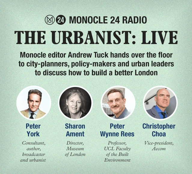
Join us for this special live episode of The Urbanist at our Marylebone HQ, where Monocle editor Andrew Tuck hands over the floor to city-planners, policy-makers and urban leaders to discuss how to build a better London. How would you fix the capital? We’ll look at transport, culture, housing, business, the night-time economy and much more. Be part of the debate following the election of the city’s new mayor.
Can architects have a truly active role in pressing social problems? Malkit Shoshan, the curator of the Dutch Pavilion at the 2016 Venice Biennale, thinks so. Her career is evidence of this: advocating for the incorporation of a fourth 'D' in the criteria of the UN (Defence, Diplomacy and Development) in its peacekeeping missions around the world, Shoshan has sat at the same table as military engineers and policy makers to analyze the urban impact peacekeepers have left around the world.
For the Dutch Pavilion, Shoshan has focused on the case of the joint mission of the Netherlands and the UN in Gao (Mali). In 2012, Gao was declared capital of the Independent State of Azawad, a nation not recognized by the international authorities, following Mali's Tuareg rebellion. "Although [these peacekeeping missions] occupy large plots of land in hundreds of different cities around the world, it is rarely discussed or addressed by our profession," says Soshan in the following interview.
We spoke with the curator of the Dutch pavilion after her recent visit to Mali to discuss the principles of the Netherlands in the next Venice Biennale; the impact of military drones in public spaces and why, according Shoshan, there is a close relationship between architecture, public policy and ideology. "[With design,] we can make resources available to communities that are exhausted by militarized conflicts, long periods of drought, famine and disease," she says.
The city has been explored as a theme in movies since the early days of cinema, appearing as both a setting and a protagonist in films by renowned directors like Fritz Lang, Jean-Luc Godard, François Truffaut, Roberto Rossellini and Quentin Tarantino. In one of the first films ever made, Arrival of a Train at La Ciotat (1925), the Lumière brothers already show the modern urban environment as an important element and part of the contextualization.
Yet the cinema and the city have an extensive relationship, each influencing one another. The influence of architecture (especially modern) in the settings and cities of films can be seen in movies like Jacques Tati’s My Uncle (1958) and Ridley Scott’s Blade Runner (1982), while the influence of cinema in architecture and buildings can be seen in the work of architects like Rem Koolhaas, Jean Nouvel and Bernard Tschumi.
We have compiled a list of 10 films in which the city plays a much more important role than just the mere setting, acting as a true protagonist of the plot.
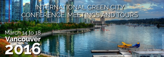
AIPH and Canadian Nursery Landscape Association (CNLA) invites all those with an interest in making our cities healthier and happier to join them in Vancouver, Canada on 16-18 March 2016 for the AIPH International Green City Conference, sponsored by TD Canada. The event will be held in conjunction with the AIPH Spring Meetings, the ELCA Board Meetings and the Landscape Canada Summit. The conference will give delegates a chance to see innovations in urban green infrastructure and planning on a global scale.
Australia to host landmark gathering of architects from Asia Pacific. As the Asia Pacific experiences unprecedented urban growth, architects will play a critical role in shaping the future of cities across the region. The diversity of its people and countries will be explored in the Asia Pacific Architecture Forum, taking place in Brisbane from 1 to 14 March 2016.
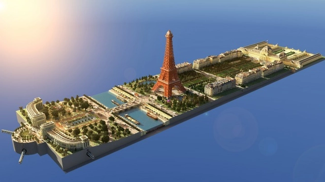
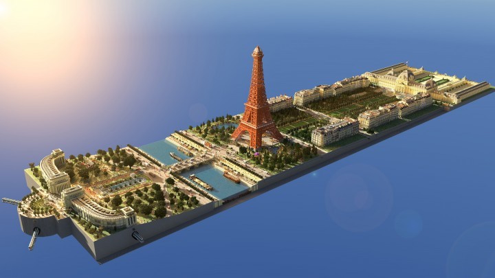
Model of the Eiffel Tower in Minecraft. Image via LanguageCraft
With more than 70 million copies sold worldwide, it would be unfair to refer to Minecraft as just a simple game of textured boxes in a pixelated 3D world. After acquiring the makers of the game (Mojang) in 2014, Microsoft announced on Tuesday, January 19 that it also acquired MinecraftEdu, the official educational version of Minecraft, which is used as a creative tool in more than 10,000 classrooms in 45 countries around the world.
The infinite possibilities that the game offers have led millions of people around the world to make and share their greatest creations: cities, buildings and even the reinterpretation of historical structures. Minecraft's impact was recognized in 2015 when the Centre Pompidou dedicated an exhibition to its creative potential for children and adolescents.
We've rounded up 15 of the best models created on the platform. And if you use Minecraft, you can download most of them (via an external link provided by the creator) to add to your own account.
Since time immemorial, and more recently, humans have wondered what the world looks like from above. This fascination has historically manifested in the plan drawing and aerial photography. In this vein, and using a motorized paraglider, National Geographic photographer George Steinmetz has captured a stunning bird’s-eye view of the ancient city of Ghadames, in Libya.
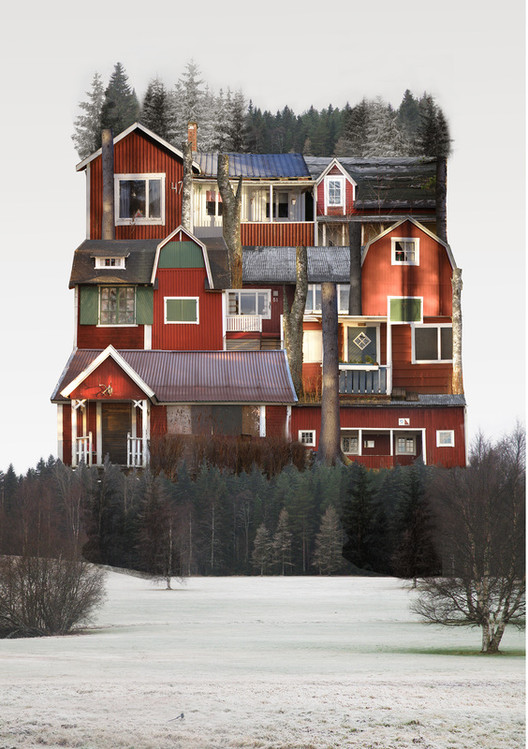
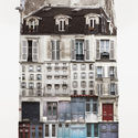
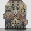
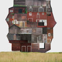
Sweden based visual artist, Anastasia Savinova, has created a series of collages that seek to capture the spirit of cities. Titled “Genius Loci,” her collages form a big house that is composed of many buildings characteristic of each city, visualizing the way of life, the atmosphere, and the feeling of each place. Photographs of architecture are the foundational components of her art work, representing the feeling as a whole.




.jpg?1460846971&format=webp&width=640&height=580)