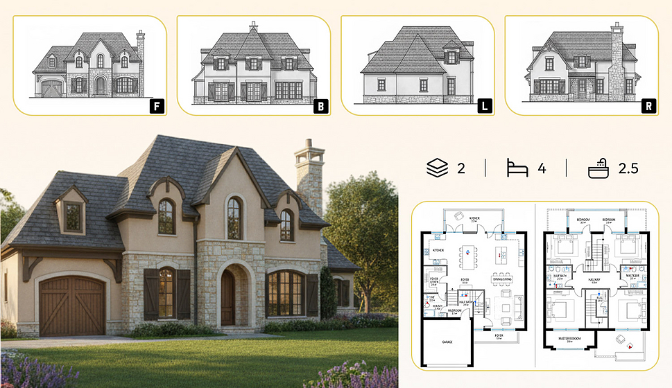
This guide covers a workflow that moves from project parameters to generated floor plans, 3D perspective views, exterior design exploration, and site context visualization, using AI tools in place of preliminary CAD and rendering work.
This guide covers a workflow that moves from project parameters to generated floor plans, 3D perspective views, exterior design exploration, and site context visualization, using AI tools in place of preliminary CAD and rendering work.
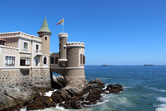
Wulff Castle in Viña del Mar is a renowned landmark, celebrated for its appearance and architectural style inspired by Liechtenstein Castle in Germany. The structure features German and French design elements, along with medieval characteristics—qualities that captivate both locals and the thousands of tourists who visit it.
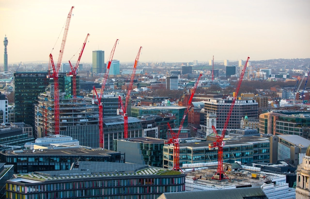
Every day, governments, financial institutions, and corporations face a critical decision: continue investing in physical assets that emit greenhouse gases and degrade nature, or prioritize developing green solutions that foster a stable, resilient, and equitable economy. As communities bear the brunt of severe climate impacts, the imperative to build a sustainable future becomes increasingly clear.

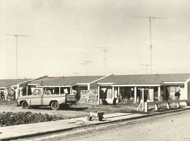
The city of Federación, located in the northeast of the province of Entre Ríos, was structured, like most Argentine cities, around “the classic block-by-block grid layout bequeathed by the Laws of the Indies,” taking shape alongside the development of its various economic roles. The evolution of economic functions and the actions of different social forces gradually shaped a unique organization of urban space, in which distinct “neighborhoods” or urban districts clearly reflected the inequalities of the local socioeconomic structure.
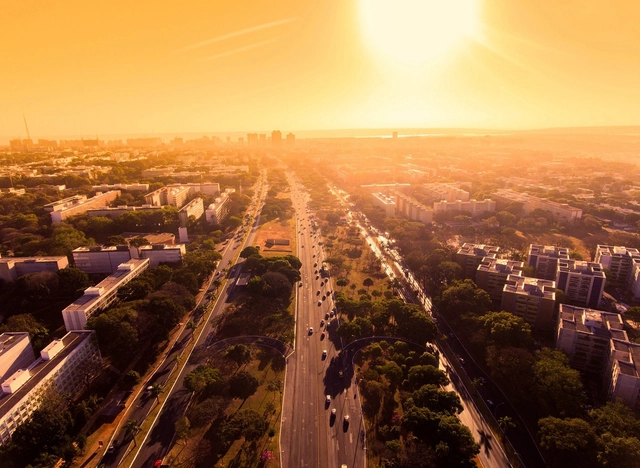
The capacity of trees to naturally cool cities is one of the key benefits of promoting urban planting. In the Federal District, urban afforestation has been studied to guide public policies toward the sustainable use of natural resources. Architecture and Urbanism student Júlia Almeida, from the University Center of Brasília (CEUB), measured the microclimatic influences of vegetation at the residential scale in Brasília, proving the power of greenery to improve quality of life.
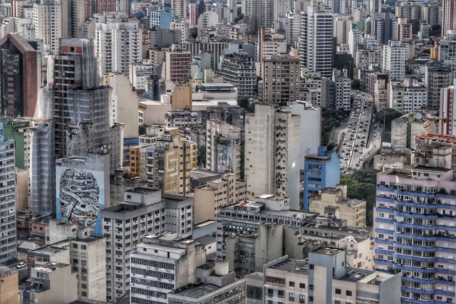
Many cities around the world face severe housing affordability issues. One of the primary reasons is highly restrictive zoning regulations. Zoning—the rules that dictate what can be built on any given lot—was originally designed to manage urban issues such as congestion, pollution, and shadow impacts.
Over time, however, planners aligned with property owners to tighten these rules. Planners disliked urban density and were more than happy to reduce it. Homeowners realized that stricter codes could preserve their property values and exclude low-income residents and minorities from their neighborhoods.
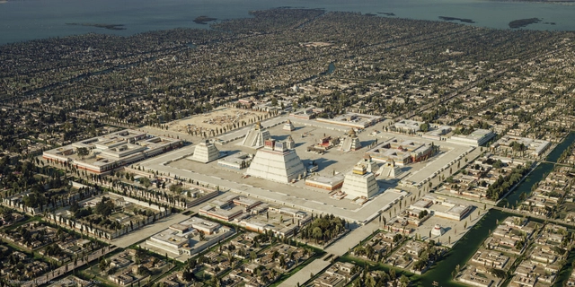
As part of a project led by Dutch artist Thomas Kole, a website titled "Portrait of Tenochtitlan: A 3D reconstruction of the Mexica capital" has been launched, presenting a variety of images of what Tenochtitlan once was. This reconstruction is based on historical and archaeological sources, as well as the collective knowledge that yields these images today to continue studying our history. The site offers navigation in three languages: Nahuatlahtolli, Spanish, and English, featuring an overlay of contemporary images where users can compare before and after simply by sliding the cursor across the screen. It was created using open-source software: Blender, Gimp, and Darktable.
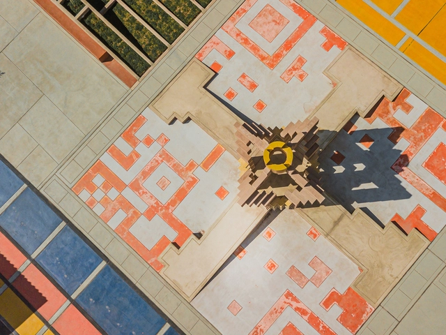
The Time Portal, designed by Longhi Architects, is an architectural project commissioned by the company "Los Portales" to create an identity landmark in the plaza of a modern residential development in the city of Juliaca, Peru.
The project merges fundamental characteristics of Inca culture and landscape design with elements of contemporary globalization, represented by the recognizable QR code icon.
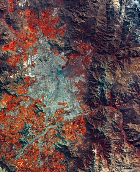
Paola Jirón is the newly appointed president of Chile's new National Council for Territorial Development (CNDT), a recently established entity that merges the National Council for Urban Development (CNDU) and the National Council for Rural Development (CNDR). She takes on the challenge of promoting planning that accounts for the specific characteristics of each region, while facilitating dialogue to develop solutions for pressing spatial issues, such as the growing population in informal settlements, urban development in disaster-prone areas, and the increasing subdivision of rural land.
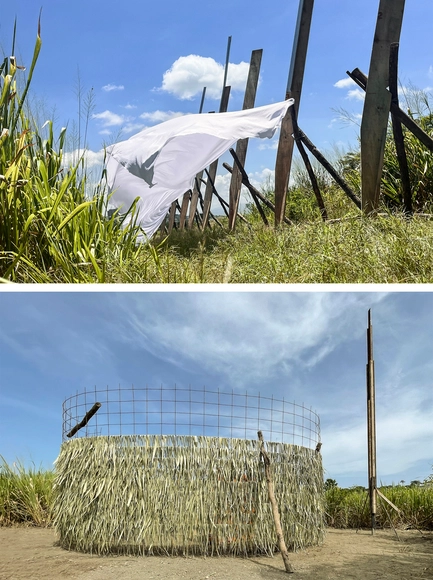
For five days, we ventured into the Turbio River of Barquisimeto, its valley, and its banks to experience fieldwork that culminated in the construction of landscape interventions. We were 70 students and 30 professors, guests, and collaborators, taking part in a Summer School organized by Dislocal alongside the Faculty of Architecture and Urbanism of the Universidad Central de Venezuela and its Extramural Teaching Unit in the city of Barquisimeto.

While high expectations build up during the development of an architectural project—which often represents the realization of a professional dream or a new home for a family—and even though, despite careful planning, countless unforeseen issues and headaches can arise during construction, after weathering endless estimates, schedules, and delays, once construction is complete and the property is occupied, it usually feels as though the journey has finally come to an end.
However, even with the work seemingly finished and a sense of accomplishment, architects and clients will likely still need to align on certain points or address issues that crop up along the way. In light of this, what are the architect's responsibilities once the owners occupy the property?
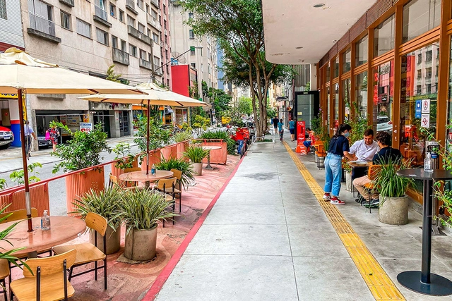
Twenty-one years after the passage of the federal City Statute (Estatuto da Cidade)—which regulated the “Urban Policy” chapter of the Brazilian Constitution, leading to the formulation of several master plans for 21st-century cities with more than 20,000 inhabitants and, now, the opportunity to revise many of them—it seems timely to tune our radars to a highly relevant topic for all cities, and one we have consistently struggled to address: our sidewalks!
I am referring to various aspects of their use and purpose, their regulatory mechanisms, their maintenance, and their design... Let us look at them.
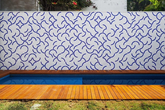
The word "deck" originated in the English language to refer to a ship's deck. Today, the term is used to describe outdoor surfaces made of wooden planks that may or may not surround pools, hot tubs, and soaking tubs. These design options can be highly diverse—so much so that a new approach has emerged in the market as a growing trend: the wet deck.






The municipality of Rio do Antônio, located about 700 kilometers from the capital of the state of Bahia, still retains remnants from the era of slavery in Brazil. This period left deep marks that remain visible in the town's daily reality, including its architecture.

The podcast "Lápiz femenino en el aula de arquitectura" was created by Layla Jorquera Sepúlveda, an architect from the Universidad de Chile, to bring visibility to women from different architecture institutions who have completed the Design Studio course, which carries the highest number of academic crédits.

Even though one-third of all trips in Brazilian cities are made on foot, citizens who walk or use wheelchairs are not treated as a priority. In fact, the words "pedestrian" and "sidewalk" do not even appear in Law 12,587/2012, which establishes the guidelines for the National Urban Mobility Policy—a clear sign of legal inconsistency at both federal and municipal levels.
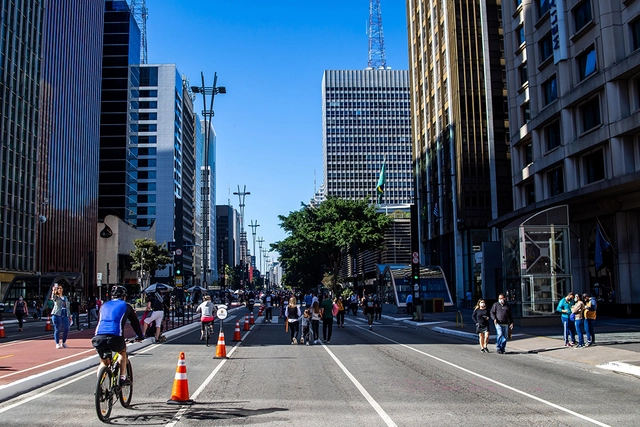
Urban public space is, and must remain, a platform for social, cultural, and political expression. Studies such as those by UN-Habitat recognize that accessible, safe, and inclusive public spaces are vital tools for mitigating urban inequality.
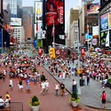
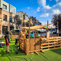
Moreover, when conceiving these spaces as a "living room," they should ideally be functional and welcoming to everyone, ensuring users feel "invited" to linger, use, and care for them. Over the past two decades, open public spaces (streets, intersections, squares, plazas, parks, etc.) have increasingly become the focus of strategic and tactical activations and experiments.
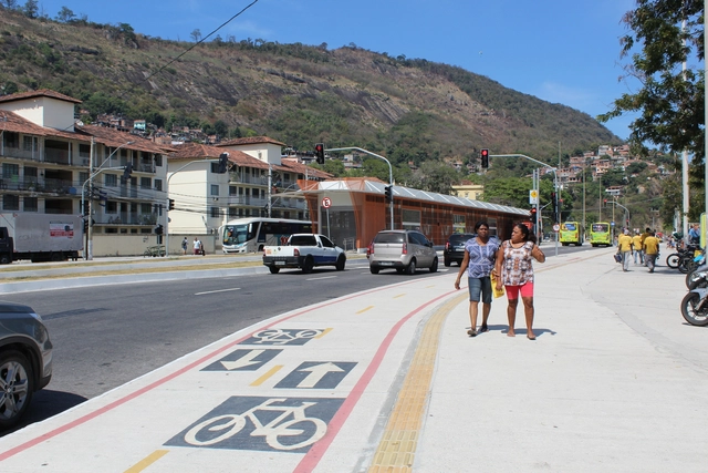
With the rapid acceleration of the climate emergency and the consolidation of an urbanized planet, the challenge of transforming cities and metropolitan areas into more inclusive and sustainable environments depends on reducing the negative impacts of transportation. Shortening the distances traveled by residents, bringing homes closer to work and opportunities, promoting the shift from private motorized transport to active or public transit modes, and creating more plural and democratic territories are the outcomes of policies aligned with addressing 21st-century global challenges. Implementing the necessary transformations across urban territories on a global scale, while also considering local particularities, is an even greater challenge—yet a vital one for a more sustainable future.
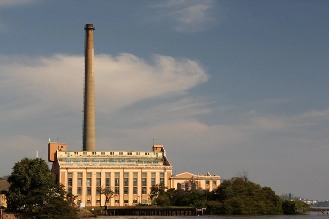
The update to Porto Alegre's Master Plan is currently underway. Much has been said about the city's future, but what can we learn from the past to foster greater dynamism, walkability, and quality of life for its citizens? After all, a more inviting city retains and attracts talent, driving innovation and wealth. In this article, I look back at the most significant moments in Porto Alegre's urban evolution, dividing them into four major periods.
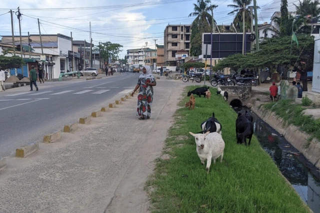
In the hyper-tech twenty-first century, urban North America is largely a service economy. New York City, for example, is currently dominated by a mix of high-end financial services, technology, and other specialized professions, while lower-skilled work is concentrated in tourism, food delivery, and other service-sector jobs. Manufacturing jobs, where they exist, persist as a legacy of strictly industrial zoning. Agrarian land uses, such as "urban agriculture," are almost non-existent—an esoteric hobby for foodies.

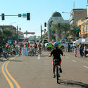
Discouraging the use of private cars is a crucial step in addressing climate change, improving air quality, and reducing traffic collisions. Cities must find ways to curb traffic and prioritize human well-being, while also considering the environmental and social impacts of automobile use by offering transportation options that generate lower carbon emissions.
Recently, low-emission zones (LEZs) have become a popular strategy in several cities worldwide. The measures implemented in these areas effectively reduce car dependency by offering cleaner, more affordable, and accessible transportation alternatives.
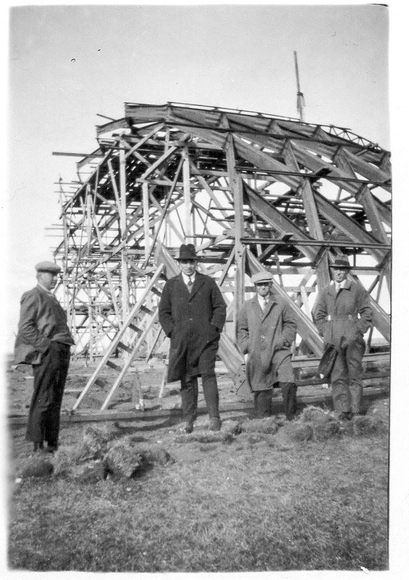
Chiloé as a starting point. From here, translocal phenomena, driven primarily by sea, served as the catalyst for sculpting the southern Patagonian cone—across both Chile and Argentina—by Chilote hands during colonial times. A hybrid people of Indigenous and European descent, whose geographic and political-administrative isolation forced them to rely on the self-construction of their settlements, the cultivation and gathering of their own food, and the making of their own clothing—all from the resources available within their archipelago. Out of this emerged the unquestionable Chilote ingenuity—a skill set highly sought after in territories that, during the colonial period, were being forged under the Chilean state. Consequently, it is easy to recognize the creative hand of the Chilote people in the architecture of the southernmost towns.
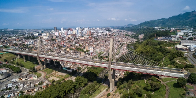
The 38th Colombian Congress of Architecture and Urbanism opened virtually on Monday, October 16, and will host its in-person sessions starting October 19 in the city of Pereira, Risaralda, Colombia. The event will run until October 21 at the Expofuturo Convention Center.
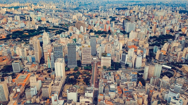
From a natural perspective, agglomerations represent a nucleation similar to the "gravitational model," in which flows of energy and matter are "optimized" through proximity and articulation—the urban center. Etymologically, as we know, polis, from the Greek, indicates the collective and political character of the formation of urban space.
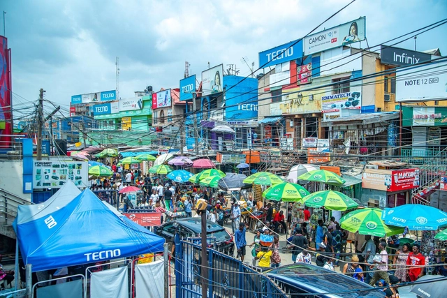
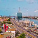
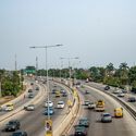
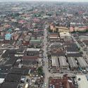
From its historical origins as a fishing village and the site of a pepper farm to today's bustling metropolis, Lagos, Nigeria, has evolved into a complex agglomeration of people, settlements, and vested interests.
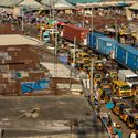
As the economic powerhouse of Nigeria and West Africa, Lagos is projected to become the most populous city in Africa over the next 50 years, growing from its current 15 million to a population of 100 million. If recent migration waves are any indication—comprising those seeking economic opportunity or fleeing climate crises and conflicts in other parts of Nigeria—these projections may well be underestimates.