1. ArchDaily
  2. Aerial Photography

Aerial Photography: The Latest Architecture and News

In Celebration of Earth Day, 5 Overviews of Our Planet

In celebration of Earth Day, we invited Benjamin Grant—founder of the Daily Overview—to select the five "overviews" which he considers to be among the most inspiring that his platform has shared. The image above, taken on Christmas Eve in 1968 by astronauts of NASA's Apollo 8 mission is, according to Grant, "believed by many to be the first "overview" of our planet, captured by astronaut Bill Anders." This photograph dramatically pulled into focus the simultaneous magnificence, intricacy, and terrifying fragility of the planet we inhabit. Since that moment the advent, acceleration, and accessibility of satellite imagery has made one thing abundantly clear: that humankind has had a considerable effect on Earth, for better or for worse.

Civilization in Perspective: Capturing the World From Above

As recently as a century ago the idea of viewing the world from above was little more than a fantasy: the airplane was still in its infancy, with rocketry and satellites still decades into the future. Those who could not take to the air had no recourse but drawing in order to represent their world from an aerial perspective. This limitation is difficult to imagine today when access to plan photography is never further than the nearest Internet connection. Anyone with a smartphone has, in essence, the entire world in their pocket.

A 6000-Year Old Unplanned Community Photographed From Above

Since time immemorial, and more recently, humans have wondered what the world looks like from above. This fascination has historically manifested in the plan drawing and aerial photography. In this vein, and using a motorized paraglider, National Geographic photographer George Steinmetz has captured a stunning bird’s-eye view of the ancient city of Ghadames, in Libya.

The Power of Photography: How Images Continue to Shape the Built Environment

In a culture dominated by smartphones and Instagram, with estimates that over one trillion photographs will be taken this year alone, it might seem impossible for photographs to make and shape issues in the ways they once did. Despite this, images still steer debates with shocking resiliency and, with luck, become iconic in their own right. As architecture is synonymous with placemaking and cultural memory, it is only logical that images of the built environment can have lasting effects on the issues of architecture and urbanism. It's never been easier for photographs to gain exposure than they can today, and with social media and civilian journalism, debates have never started more quickly.

12 Stunning Aerial Photos Taken with a Drone

12 Stunning Aerial Photos Taken with a Drone - Featured Image
The star fort in Bourtange, the Netherlands. Image © Amos Chapple

Photographer Amos Chapple has traveled the world, capturing well-known landmarks and cities from the perspective of a drone. From the Katshi Pillar in Georgia to New Delhi’s Lotus Temple and the star fort in Bourtange, the Netherlands, Chapple carried out “as much aerial work as weather and local laws allow.”

See 12 of his most impressive photos after the break. 

12 Stunning Aerial Photos Taken with a Drone - Image 1 of 412 Stunning Aerial Photos Taken with a Drone - Image 2 of 412 Stunning Aerial Photos Taken with a Drone - Image 3 of 412 Stunning Aerial Photos Taken with a Drone - Image 4 of 412 Stunning Aerial Photos Taken with a Drone - More Images+ 7

Las Vegas vs The Landscape: Photographer Michael Light Exposes the Terraforming of the American Dream

Las Vegas vs The Landscape: Photographer Michael Light Exposes the Terraforming of the American Dream - Image 5 of 4
“Barcelona” Homes and the Edge of Lake Mead Recreation Area, Lake Las Vegas, Henderson, NV; 2011. Image © Michael Light, Lake Las Vegas/Black Mountain

“Nestled into the desert landscape that defines Nevada’s visage,
Ascaya feels as if it were shaped by the elements.
[...]
Where stone rises up to meet the sky, there is a place called Ascaya.”
- The Ascaya promotional website

Not quite, according to Michael Light’s soon-to-be released book, Lake Las Vegas/Black Mountain. Covering the advance of suburban Nevada into the desert, this two-part book looks at Lake Las Vegas, a then-abandoned victim of the 2008 real estate crash which has since emerged from the other side of bankruptcy, and nearby Ascaya, a high end housing estate that is still in the process of being carved into Black Mountain. Light’s photography doesn’t so much question the developers’ summary as it does, say, blast it, scar it, terrace it and then build a large housing development on the remains. Featuring beautifully composed aerial shots of the construction sites and golf courses covering the desert, the book is a clear condemnation of the destructive and unsustainable development in Nevada. Much more than that, though, Light is highlighting a wider philosophy behind developments like Ascaya and Lake Las Vegas that fundamentally fail to connect American society with the American landscape in a non-destructive way.

Las Vegas vs The Landscape: Photographer Michael Light Exposes the Terraforming of the American Dream - Image 1 of 4Las Vegas vs The Landscape: Photographer Michael Light Exposes the Terraforming of the American Dream - Image 2 of 4Las Vegas vs The Landscape: Photographer Michael Light Exposes the Terraforming of the American Dream - Image 3 of 4Las Vegas vs The Landscape: Photographer Michael Light Exposes the Terraforming of the American Dream - Image 4 of 4Las Vegas vs The Landscape: Photographer Michael Light Exposes the Terraforming of the American Dream - More Images+ 8

Contemplating Humanity's Effect On Planet Earth, From Above

Earthrise, a photograph taken on Christmas Eve of 1968 by astronauts of the Apollo 8 mission, was a defining moment for our collective understanding of the world in which we live on. For the very first time it dramatically pulled into focus the simultaneous magnificence, intricacy, and terrifying fragility of the planet we inhabit. Since that time the advent, acceleration, and accessibility of satellite imagery has made one thing abundantly clear: that humankind has had a considerable effect on Earth, for better or for worse. Daily Overview's self-defined mission is to "consider the places where man has left his mark and then conduct the necessary research to identify locations to convey that idea." They do so with incredible effect.

Contemplating Humanity's Effect On Planet Earth, From Above - Image 1 of 4Contemplating Humanity's Effect On Planet Earth, From Above - Image 2 of 4Contemplating Humanity's Effect On Planet Earth, From Above - Image 3 of 4Contemplating Humanity's Effect On Planet Earth, From Above - Image 4 of 4Contemplating Humanity's Effect On Planet Earth, From Above - More Images+ 20

The Power Of The Plan: Drones And Architectural Photography

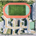
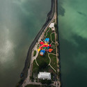
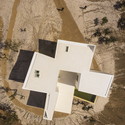
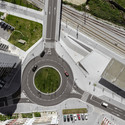
What is the draw of the aerial view? Whereas architects and designers often find solace in this particular spatial perspective there is a more inclusive, universal appeal to this way of seeing. The ease of access to online mapping services has increased our collective reliance on understanding our world from above.

Maps condense the planet into a little world inside our pocket, the commodification of which has universalised the ‘plan-view’ photograph. The question of whether or not their ubiquitous availability, having now been assimilated into our collective consciousness, is a positive step for the status of the plan is a discussion ongoing. Yet, in the face of this dilemma, architectural photographers are pushing the boundaries of drone technology in order to find new meaning.

The Power Of The Plan: Drones And Architectural Photography - Image 1 of 4The Power Of The Plan: Drones And Architectural Photography - Image 2 of 4The Power Of The Plan: Drones And Architectural Photography - Image 3 of 4The Power Of The Plan: Drones And Architectural Photography - Image 4 of 4The Power Of The Plan: Drones And Architectural Photography - More Images+ 8