1. ArchDaily
  2. streets

streets: The Latest Architecture and News

The Barcelona Model: Public Space as a Synonym for Urban Adaptation

CityMakers, The Global Community of Architects Who Learn from Exemplary Cities and Their Makers, is working with Archdaily to publish a series of articles about Barcelona, Medellin, and Rotterdam. The authors are the architects, urban planners, and/or strategists behind the projects that have transformed these three cities and are studied in the "Schools of Cities" and "Documentary Courses" made by CityMakers. On this occasion, Jaume Barnada, coordinator of the award-winning Climate Shelters project in Barcelona schools and speaker at the "Schools of Cities", presents his article "Barcelona, the public place as a synonym for the adaptation of the built city."

Cities are dense, built spaces in which pavements have been efficiently imposed on the natural soil. Cities like Barcelona have almost 75% of the land paved and waterproof. Without a doubt, it is an excess to reverse at a time of climate emergency, where we must reconnect with nature. Oriol Bohigas [1] told us that good urbanization had paved the squares of Mediterranean cities and that no one wanted to live in a mudhole. I'm sure he was right. Also, he taught us that the green and, consequently, the natural soil had to have dimension and especially an urban position. Squares are squares and parks are parks, and each space has a type of project. Today, concepts are too frequently confused when urbanizing public places and consequently, we find projects that blur the model.

The Barcelona Model: Public Space as a Synonym for Urban Adaptation - Image 1 of 4The Barcelona Model: Public Space as a Synonym for Urban Adaptation - Image 2 of 4The Barcelona Model: Public Space as a Synonym for Urban Adaptation - Image 3 of 4The Barcelona Model: Public Space as a Synonym for Urban Adaptation - Image 4 of 4The Barcelona Model: Public Space as a Synonym for Urban Adaptation - More Images+ 3

Learning From Europe: Beyond Symbolic Dark Landmarks to Save Energy at Night

When capital cities like Paris and Berlin resolved to switch off lighting for public buildings and landmarks in July 2022 in order to save energy in the context of the Russian invasion of Ukraine, the cities created a ripple effect throughout central Europe. Images of dark iconic landmarks swept through the media and allowed politicians a momentary act of environmental demonstration. However, designers have started to question the sustainability of this ad hoc step. Seen from a broader perspective the impression arises that this alleged radical action has been part of a rather media-savvy campaign with small effect in cities at night. Further steps are necessary to reassess urban lighting that may have a major impact on energy saving and sustainability.

How Tactical Urbanism Helped Conquer the Streets of Jersey City

This article was originally published on Common Edge.

Covid has been particularly hard on cities: downtown business districts are still struggling due to the shift to remote work; some cities have seen population declines; and crime has spiked virtually everywhere. In addition, the pandemic pushed more people into cars, setting back the safe streets movement. After years of progress, cities like New York City saw big increases in pedestrian deaths. This is a nationwide problem—with one notable exception: Jersey City recently announced that no one died on its city streets in 2022, meeting its Vision Zero plan for the city. The milestone was the result of years of work by the city and its collaborator, Street Plans, a planning firm founded by Mike Lydon and Anthony Garcia. Lydon, a DPZ alum and co-author of the 2015 book Tactical Urbanism (currently being updated), began working with Jersey City on a whole raft of initiatives six years ago. I spoke with Lydon last week and asked him, specifically, how the city and he did it.

São Paulo, Melbourne and Barcelona: Discover the Coolest Streets in the World

Time Out, an online platform for urban culture that looks for the most vibrant locations around the globe, has recently ranked the 30 coolest streets in the world. The website, which usually focuses on cities as a whole, having already ranked the coolest neighborhoods, is now taking a more local approach due to the Covid-19 pandemic.

GeoGuessr Game Uses Street View to Create a Geographical Puzzle

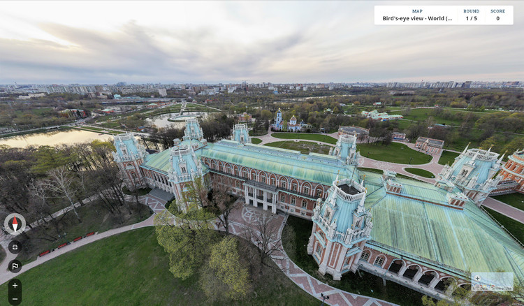
A geographic discovery game based on Google imagery, GeoGuessr requires players to guess various locations worldwide using only the clues provided by a Street view. Created in 2013, the game has taken on new relevance amidst the pandemic, as it provides a virtual travel experience. From desolate roads to famous sites, the game teases deductive reasoning, requiring players to make use of any clue, from signs, language, flags, landscape, to pinpoint their surroundings.

GeoGuessr Game Uses Street View to Create a Geographical Puzzle - Image 1 of 4GeoGuessr Game Uses Street View to Create a Geographical Puzzle - Image 2 of 4GeoGuessr Game Uses Street View to Create a Geographical Puzzle - Image 3 of 4GeoGuessr Game Uses Street View to Create a Geographical Puzzle - Image 4 of 4GeoGuessr Game Uses Street View to Create a Geographical Puzzle - More Images+ 5

New York Expands Outdoor Activities with Open Boulevards Initiative

Earlier this month, New York City Mayor Bill de Blasio announced the launch of the Open Boulevards program, an initiative that would temporarily close off car traffic on boulevard segments across several blocks, expanding the public space for dining, cultural activities and artistic performances. The project builds on the successful initiatives Open streets and Open Restaurants, which transformed the city’s streetscape to better serve diners, cyclists and pedestrians amidst the pandemic.

NACTO Releases Streets for Pandemic Response and Recovery in the Fight Against the COVID-19

The National Association of City Transportation Officials (NACTO) has released guidelines to provide cities with strategies “to redesign and adapt their streets for new uses both during the COVID-19 crisis and in the recovery”. Streets for Pandemic Response and Recovery highlights the most updated street design approaches cities are using, around the world.

7 Design Guidelines for a Safe Post COVID-19 Transition

In order to ensure a proper transition into post COVID-19, architects, public health experts, and engineers are generating design guidelines to provide people with new secure, and efficient resources. Finding a balance between optimizing operations and keeping people safe, the strategies tackle the built environment that surrounds us, from restaurants and outdoor dining, to streets, offices, and retail.

Addressed to city officials, owners, and employers, the tools developed help to reopen the world, while reducing the risk of COVID-19 transmission, promoting social distancing standards, and enhancing wellbeing. Discover in this article a roundup of design guidelines securing a safe post coronavirus transition.

London Introduces Car-Free Streets as Lockdown Eases

After Milan and Paris, London has announced its plans to transform large areas in the city, converting streets to car-free zones, as the coronavirus lockdown loosens up. Repurposing the city for people, London aims to emerge differently from the pandemic, supporting a low-carbon and sustainable recovery. Works have already started and are expected to be completed within six weeks.

Paris Plans to Maintain Anti-Pollution and Anti-Congestion Measures post Covid-19 Lockdown

Paris, just like Milan, is planning on keeping its streets car-free after the coronavirus lockdown. Mayor Anne Hidalgo announced plans to maintain the anti-pollution and anti-congestion measures introduced during the confinement period, as the city reopens.

New York Map Highlights Sidewalks with Social Distancing Possibilities

As social distancing becomes the new norm in the fight against COVID-19, people are finding it harder to keep up with the six-foot rule in dense cities. Urban Planner Meli Harvey developed a map of New York that shows the width of sidewalks in the city, aiming to highlight public areas where social distancing can be maintained.

New York Map Highlights Sidewalks with Social Distancing Possibilities - Image 1 of 4New York Map Highlights Sidewalks with Social Distancing Possibilities - Image 2 of 4New York Map Highlights Sidewalks with Social Distancing Possibilities - Image 3 of 4New York Map Highlights Sidewalks with Social Distancing Possibilities - Image 4 of 4New York Map Highlights Sidewalks with Social Distancing Possibilities - More Images+ 10

FMZD Transforms an Existing Concrete Structure in Tehran into a Contextual Shopping Mall

The Tehran Eye is a contextual shopping center that caters to the needs and the common living practices in the Iranian capital. The project, conceived by Farshad Mehdizadeh Design, consisted of redesigning a façade and reorganizing a large existing structure into an integrated entity in the city.

FMZD Transforms an Existing Concrete Structure in Tehran into a Contextual Shopping Mall - Image 1 of 4FMZD Transforms an Existing Concrete Structure in Tehran into a Contextual Shopping Mall - Image 2 of 4FMZD Transforms an Existing Concrete Structure in Tehran into a Contextual Shopping Mall - Image 3 of 4FMZD Transforms an Existing Concrete Structure in Tehran into a Contextual Shopping Mall - Image 4 of 4FMZD Transforms an Existing Concrete Structure in Tehran into a Contextual Shopping Mall - More Images+ 13

City of the Future Shares Thoughts on Retail and Vibrant Streets

City of the Future is a bi-weekly podcast from Sidewalk Labs that explores ideas and innovations that will transform cities.

In the second episode from season 2, hosts Eric Jaffe and Vanessa Quirk discuss the future of retail with author Mark Pilkington, social entrepreneur Sarah Filley, Sidewalk Labs’ Director of Development Carrie Jackson, and others.

What Makes a City Livable to You?

What Makes a City Livable to You? - Arch Daily Interviews
© Flickr user Hafitz Maulana licensed under CC BY-SA 2.0. ImageA music festival in Singapore

Mercer released their annual list of the Most Livable Cities in the World last month. The list ranks 231 cities based on factors such as crime rates, sanitation, education and health standards, with Vienna at #1 and Baghdad at #231. There’s always some furor over the results, as there ought to be when a city we love does not make the top 20, or when we see a city rank highly but remember that one time we visited and couldn’t wait to leave.

To be clear, Mercer is a global HR consultancy, and their rankings are meant to serve the multinational corporations that are their clients. The list helps with relocation packages and remuneration for their employees. But a company’s first choice on where to send their workers is not always the same place you’d choose to send yourself to.

And these rankings, calculated as they are, also vary depending on who’s calculating. Monocle publishes their own list, as does The Economist, so the editors at ArchDaily decided to throw our hat in as well. Here we discuss what we think makes cities livable, and what we’d hope to see more of in the future.

Call for Entries: LILA - Landezine International Landscape Award 2018

Landezine is calling all offices practicing landscape architecture to submit entries for the third edition of LILA – Landezine International Landscape Award by March 31st, 2018. This year, we have 4 categories and 7 awards.

Where Roofs and Streets Become One: Iran’s Historic Village of Masuleh

More than a thousand meters above sea level on the slopes of the Alborz mountain range in Gilan, northern Iran, a remarkable village dating back to 1006 AD bustles with life. The unique ochre-brown structures of Masuleh follow the slope of the mountain that the village nestles on—or rather, grows from—giving the village its most unusual quality: the roofs of many of the houses connect directly to, or even form a part of, the street serving the houses above.

Where Roofs and Streets Become One: Iran’s Historic Village of Masuleh - Image 1 of 4Where Roofs and Streets Become One: Iran’s Historic Village of Masuleh - Image 2 of 4Where Roofs and Streets Become One: Iran’s Historic Village of Masuleh - Image 3 of 4Where Roofs and Streets Become One: Iran’s Historic Village of Masuleh - Image 4 of 4Where Roofs and Streets Become One: Iran’s Historic Village of Masuleh - More Images+ 8