1. ArchDaily
  2. Cartography

Cartography: The Latest Architecture and News

A Brief History of Maps and Their Role in Urban Development

Cartography, or map making, has played a critical role in representing spatial concepts for thousands of years. While the earliest forms of maps displayed geographic information carved into clay tablets and etched onto cave walls, the maps we use today have significantly evolved to creatively show a range of different information. These visualizations draw conclusions about population sizes, historical events, cultural shifts, and weather patterns to help us understand more about our world and how we impact it.

The Different Cartographic Projections and What They Mean

Cartography consists of the flat, simplified and conventional geometric representation of the earth's surface, presented in the form of maps, charts or blueprints. Because it is a two-dimensional representation of something that is three-dimensional, all representations undergo some kind of deformation, so that the choice of a method takes into account not only technical aspects, but also political ones.

Shining Constellations: Maps Show the Population Distribution on Earth

Hungarian analyst and cartographer Robert Szucs shared with ArchDaily another of his series of maps, this time addressing the population distribution on Earth. A large blackboard, identifying only the geopolitical boundaries of countries and continents, reveals bright constellations, representing human agglomerations and the world's great voids.

Global Watersheds and Waterways Captured in Vibrant Colorized Maps

GIS analyst and Hungarian cartographer Robert Szucs has shared an impressive collection of maps that bring together all the drainage basins of the world in vibrant colors. Titled Grasshopper Geography, the maps showcase the rivers and watercourses of the world, featuring the basins of selected regions, countries and continents.

Global Watersheds and Waterways Captured in Vibrant Colorized Maps - Image 1 of 4Global Watersheds and Waterways Captured in Vibrant Colorized Maps - Image 2 of 4Global Watersheds and Waterways Captured in Vibrant Colorized Maps - Image 3 of 4Global Watersheds and Waterways Captured in Vibrant Colorized Maps - Image 4 of 4Global Watersheds and Waterways Captured in Vibrant Colorized Maps - More Images+ 9

A Series of Maps Reveals the Difference in How Cities are Perceived by Tourists and Locals

While visiting a city one has never been to before, it is common to go to touristic places, the 'must-see' spots advertised in the media. On the other hand, when establishing residency in a place, it is likely that one will start to attend some less popular locations, and will often spend a long time without passing by the city's most famous touristic sights. Artist Eric Fischer has developed a project that explores precisely the difference in perceiving - and photographing - a city from the point of view of tourists and locals. The work, which is entitled Locals and Tourists, gathers the maps of 136 of the largest - and most visited - cities in the world.

120 Ancient Maps Overlapped on Google Earth Reveal the Growth of Cities Across the World

More than 120 old maps from the David Rumsey Map Collection were inserted in Google Maps and Google Earth, allowing us to learn how several parts of the globe were in the past. The maps can be seen by activating the 'Rumsey Historical Maps' layer in Google Earth or through a version of Maps developed for the project.

These Maps Show Why It's a Bad Idea To Make Things Up

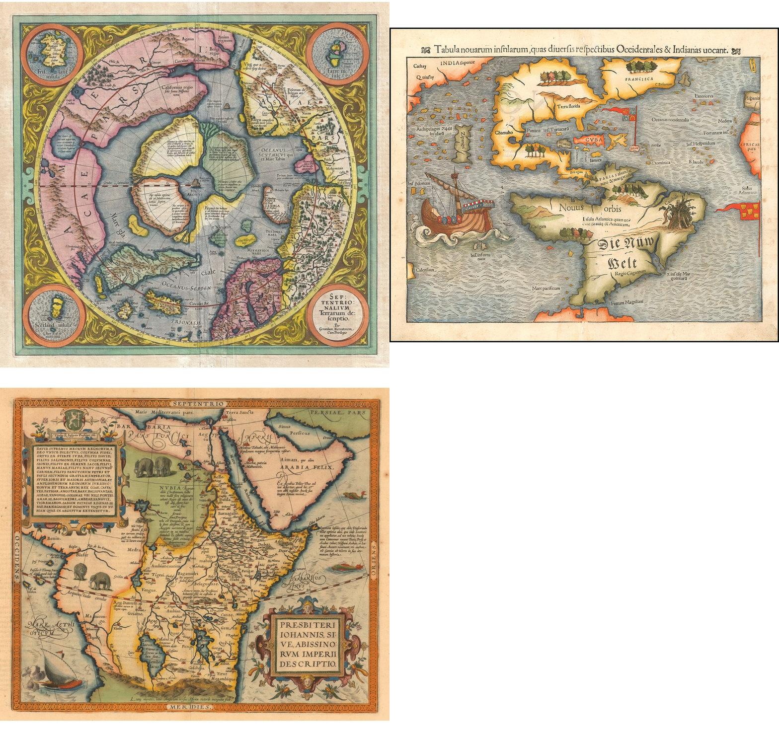
It's difficult to imagine an uncharted world. Today, GPS and satellite maps guide us around cities both familiar and new, while scanning and mapping techniques are gradually drawing the last air of mystery away our planet's remaining unexplored territories. At one time, however, cartography was based on little more than anecdotal evidence and a series of educated guesses. But map-making in the 16th and 17th Centuries was an art nonetheless, even if these examples testify to the fact that just because you're missing important facts, total fabrication may not be the best way forward.

Land Lines: Trace an Infinite Path Around the Planet Using Maps

Land Lines, a new Chrome Experiment exploiting the satellite image data collated by Google Maps, allows anyone—cartographic aficionado or otherwise—to marvel at the contours of the world through gestures. Intelligently designed to detect dominant visual lines from a dataset of thousands of images, cut down from over 50,000 by using a combination of OpenCV Structured Forests and ImageJ’s Ridge Detection, users can simply "draw" or "drag" on a mobile browser or on a desktop to "create an infinite line of connected rivers, highways and coastlines."

71 Thousand High-Res Historical Maps Available for Free Download

History and geography lovers rejoice! You can now see and even download incredible maps from the David Rumsey Map Collection database. The website contains more than 71 thousand maps and images that span the 16th to the 21st century and illustrate everything from the seven continents, to the entire world and even celestial bodies.

The maps and images serve as useful historical and artistic references, offering rare cartographic detail and insight into the visual organization of territories. The exceptionally high-resolution images can be filtered by place, author, and date of creation.